Connect Chesterfield with Slow Ways
We’re creating a network of walking routes that connect all of Britain’s towns, cities and national parks
more walks and reviews are needed to fully connect Chesterfield to the verified network. Can you give a hike and help?
Give a hike!Chesterfield
Derbyshire
Slow Ways linking Chesterfield and Bakewell, Bolsover, Clay Cross, Darley Dale, Dronfield, Matlock, North Wingfield, Staveley (Derbyshire)
England / Derbyshire / Chesterfield
Chesterfield’s eight Slow Ways are 84% checked
Help connect Chesterfield
Many Slow Ways have several route options. Some will be better than others, or good for different reasons.
Our goal is for each Slow Way to have at least one route that is verified and surveyed. To be verified – and get its snail badge – a route needs at least three positive reviews.
Give a hike and help get a for every one of Chesterfield’s Slow Ways.
Walk to Chesterfield from further afield
| Slow Way | Route | To do | ||||||||
|---|---|---|---|---|---|---|---|---|---|---|

Bakewell—Chesterfield
|
Bakche one |
|
4 X |
|
Enjoy me | Distance 20km/13mi | Ascent 432m | Descent 459m | ||

Bakewell—Chesterfield
|
Bakche two |
|
4 X |
|
Review me | Distance 25km/15mi | Ascent - | Descent - | ||

Bakewell—Chesterfield
|
Bakche three |
|
U U |
|
Pioneer me | Distance 25km/16mi | Ascent - | Descent - | ||

Chesterfield—Bolsover
|
Chebol two |
|
3 Y |
|
Enjoy me | Distance 12km/8mi | Ascent - | Descent - | ||
|
Chesterfield—Bolsover
|
Chebol three |
|
U U |
|
Pioneer me | Distance 13km/8mi | Ascent - | Descent - | ||

Chesterfield—Bolsover
|
Chebol four |
|
U U |
|
Verify me | Distance 10km/6mi | Ascent 255m | Descent 184m | ||

Chesterfield—Clay Cross
|
Checla one |
|
U U |
|
Survey me | Distance 11km/7mi | Ascent 129m | Descent 176m | ||

Chesterfield—North Wingfield
|
Chesnor one |
|
4 X |
|
Enjoy me | Distance 10km/6mi | Ascent 196m | Descent 162m | ||
|
Chesterfield—Staveley (Derbyshire)
|
Chesta one |
|
U U |
|
Pioneer me | Distance 8km/5mi | Ascent 126m | Descent 152m | ||
Chesterfield—Staveley (Derbyshire)
|
Chesta two |
|
U U |
|
Survey me | Distance 8km/5mi | Ascent 84m | Descent 110m | ||
|
Darley Dale—Chesterfield
|
Darche one |
|
U U |
|
Review me | Distance 18km/11mi | Ascent 368m | Descent 382m | ||

Dronfield—Chesterfield
|
Droche one |
|
|
U U |
|
Double check | Distance 11km/7mi | Ascent 219m | Descent 173m | |
|
Dronfield—Chesterfield
|
Droche two |
|
U U |
|
Pioneer me | Distance 13km/8mi | Ascent 184m | Descent 135m | ||

Dronfield—Chesterfield
|
Droche three |
|
4 X |
|
Enjoy me | Distance 12km/7mi | Ascent - | Descent - | ||

Dronfield—Chesterfield
|
Droche four |
|
U U |
|
Review me | Distance 12km/8mi | Ascent - | Descent - | ||

Matlock—Chesterfield
|
Matche one |
|
4 X |
|
Verify me | Distance 19km/12mi | Ascent 472m | Descent 472m | ||

Matlock—Chesterfield
|
Matche three |
|
U U |
|
Survey me | Distance 17km/11mi | Ascent - | Descent - | ||

Matlock—Chesterfield
|
Matche four |
|
U U |
|
Verify me | Distance 19km/12mi | Ascent - | Descent - |
Fancy stretching your legs a bit more?
If you’ve polished off all of the routes between Chesterfield and its neighbours, how about walking its whole web?
This includes the great ring of routes that join its neighbours to each other!
Collective progress
63% of Chesterfield’s eight route options are drawn, reviewed, surveyed and/or verified
18/18
14/18
6/18
7/18
13 people have contributed to Chesterfield’s Slow Ways
3 people have pledged to walk and review a route
6 people have surveyed a route in Chesterfield
206km out of 265km have been walked and reviewed
487km of reviews have been shared in Chesterfield
Latest Updates
Past this, a wooded area offers many possible routes, and it's not clear which is the "official" way, but heading in a broadly straight line will lead you to the corner of Foxholes lane, for a long (and very straight) tarmacked walk up past a caravan park and fish pond. Left onto Lant Lane (be aware of the single track road here) and then right further up takes you over the fields to another pond - follow the left edge of this and the adjoining farm to reach the hilltop road. From there, exposed fields take you across the top to the fork between Long Lane and Bath Lane, and then across Birkin Lane and down Highashes Lane past the High Ashes Rural Project farm site. A single lane road along the edge of this and then a path skirting the far side take you around the edge of Wingerworth, through the edge of Widdowson Spring Wood and then past Chesterfield Golf Club before entering the suburban fringes of Chesterfield proper....
Jonty Sewell
The route now rises more steeply on a quiet road to begin with and then a lane past wellspring farm. After dropping through Nab Plantation on a muddy path we join a wider trail (Hungerhill Lane) over the ridge to reach Dean Farm. Shortly, we join a quiet road to reach Peasunhurst Lane, this becomes a muddy field path to reach Hodge Lane....
StephenWalker
I enjoyed the way out of Chesterfield via residential streets and through Ashgate Park, Loundsley Green Park and Holmebrook Country Park....
StephenWalker
The western (Bakewell) side of East Moor can be boggy and so decent boots and gaiters are advised if you are walking after rain....
Lynn Jackson
I walked from Chesterfield via the Market Square, crossing into Queen's Park and walking up the road into a residential area. I came upon Stubbing Pond soon enough and from there walked up a farm track to get into fields which were still waterlogged from the previous week's rains. I continued to Spancar on the road until I found the footpath to continue the route through fields. But I got to the top and continued the route over increasingly muddy fields, cutting into my journey time....
Lynn Jackson
I began the walk from the church and through Market Square before walking alongside Holme brook along a quiet back lane footpath. I walked just a 100 metres or so to get to the quiet Barlow Grange Lane, which after a couple of km crossed and became what Barlow Grange Lane had originally been from time immemorial - a drover lane. A short walk along the covered pavement on the A621 (it was too boggy to use the footpath) and a short walk up Clodhall Lane and I was on the path to Baslow, passing Wellington’s Monument and going to the top of Bar Road. It was a straightforward walk into Edensor, past the church and up the lane that turned into a hollow way – a steady but gentle climb to the top of the hill where I came upon an inscribed 18th Century guidestone, showing the way to Bakewell, Chesterfield and Sheffield. The humpback road that I had to walk was a slight worry but no cars appeared on the lane and so I walked onward until I got to the woodland where the lane turned right....
Lynn Jackson
Lynn Jackson added Bakche three, a new walk from Bakewell to Chesterfield
Walk this routeOnce Harehill Road is reached, the route takes to the right of way that follows the golf course boundary and heads towards Widdowson Spring Wood and then on a fenced route through horse pastures to reach Swathwick Lane. Now the route follows a long leg southwards first on lanes then right of way across the fields to reach Hilltop Road on the edge of Ashover. After a right turn along the road, a steep footpath on the left takes us down to Hill Road and thence into the village centre on quiet streets. The route turns downhill along this quiet lane (Once again a wide verge to avoid cars, if required) to reach Foxholes Lane where it turns south-westward. After the end of the tarmac on Foxholes Lane (SK 31821 61150) there is a clear path into the wood but the exact route through the trees and to descend to SK 31580 61035 is not always obvious and could be very steep....
StephenWalker
StephenWalker added Matche four, a new walk from Matlock to Chesterfield
Walk this routeIt is testament to planners and conservationists that the route through the valley via Hasland is as green and peaceful as it is; not so long ago it was the scene of rail Sidings, coking plants and chemicals....
StephenWalker
Briefly, using the 1:25000 OS map helps to make sense of the plot on the website, and is invaluable....
StephenWalker
I followed this route from Staveley, the last leg of a Chesterfield - Bolsover- Staveley - Chesterfield circular walk. I enjoyed the route throughout, despite the unattractive entry to Chesterfield itself. There were refreshments and canal-related information available at Hollingwood Lock....
StephenWalker
Once clear of the town centre and under the railway, the route climbs steadily through woodland and across a golf course, to reach Calow - which is approached through the grounds of the hospital. There is a path through the woods to reach the 'Pillar of Rock' pub (more refreshments) and shortly after to reach the Market Place....
StephenWalker
The surfacing ends at the open field below the castle, where we follow the left edge down to a lane then take the road left through New Bolsover. We go straight on, then right down Charlesworth Street and left into Sutton Hall Road to find the path that starts between garden fences and leads down to the old railway (the diagonal line through the bottom field looks wet, and it is easier to follow the trodden path right, then follow the railway track left to rejoin the GPX line. At Carr Lane we cross the motorway bridge and follow the road around the bend to pick up the clear path (muddy in places) that leads towards the ruin of Sutton Scarsdale Hall but is forced right by a ha-ha. We go left at Bole Hill then right up Dark Lane, then use the field path and Dingle Lane to reach the A617, which we cross....
Hugh Hudson
There are a couple of awkward navigation moments as you follow the back streets through Chesterfield, crossing above the busy A61 and then crossing a number of smaller, but busy roads near Chesterfield train station but after that the navigation is easy. The only negative is the first, short stretch along the canal until you reach Tapton Lock is blighted by rubbish and hemmed in between housing developments - but it improves substantially after Tapton Lock....
paul.scholey
Rather than following the main road left, we take the path that emerges on Sycamore Drive, then follow Sycamore Drive right back to the A632. We follow quiet roads down through the housing estate and down Lea Road, then use paved paths and alleyways to continue past a small park to the old railway, where we turn left on an unsurfaced track. We follow the path off the old railway and down a few steps, then turn right under the railway bridge and take the lane (Dingle Lane) left beyond it that leads out to Calow Lane. We cross the bridge and follow the farm lane and turn left onto Mansfield Road, which has a good pavement on the left/north side. We cross and go left a short distance, then right onto Deincourt Crescent and through an alleyway right onto a good track. Eventually you should find a way onto the muddy field that takes you to the houses on Torrani Way, where we take the path left, then turn right onto Blacks Lane and left onto Draycott Lane to reach the North Wingfield meeting point.at The Green....
Hugh Hudson
A near-perfect Slow Way joining Chesterfield and Staveley, almost entirely along the Chesterfield Canal....
Andrew Sheldon
This route is well served by public transport(trains/buses Chesterfield and buses at Bolsover)However on route there is little in the way public transport or refreshment stops.Passing the covered reservoir prior to reaching the hospital grounds I would recommend using Chebol 4,Chebol 2 takes one rather a long way round.There are couple of busy roads to cross but Sutton Scarsdale hall soon appears followed by views across to Bolsover and it’s prominent castle .A good direct walk with no access issues however poorly way marked (some finger posts broken or nonextense.)...
J w ollid
The route then follows good quality paths that skirt through the housing estates to the West of Chesterfield with occassional stretches on roads before joining the dog walkers in Holmebrook Valley country park - where I was delighted to spot a group of Mergansers in the large lake. The good quality path then climbs out of the country park, before a short stretch of road walking through Cutthorpe and then cutting through farmland and a small wooded copse with a narrow bridge across a stream over to the village of Barlow....
paul.scholey
I created an alternative route Matche Three because it is more direct and avoids the big drop into Ashover and the climb back out. However this route has some good things going for it - the farms between Stubbing and Ashover and then Matlock feel more friendly, the farmland is prettier, and Ashover has coffee shops and pubs while the more direct Matche Three passes no shops or pubs. And there were great views back over Chesterfield, then over Ashover and finally Riber Castle and Matlock Dale....
SeaGreen
We go steeply down Castle Lane (the pavement has a handrail) then follow the path that goes right under the castle walls. We follow this lane round a bend, then take the field path right that leads to an underpass under the old railway track and continues across the field beyond - the trodden line is more direct than the right of way line. We follow the lane to the A632, and follow that a short distance before turning right through a pub car park and following the path into the fields. We turn left to find the lane onto Blacksmith Lane, which we cross to find the alleyway opposite, which crosses Rose Avenue and turns right then left to emerge on Church Lane, where we go right a short distance to find another alleyway left that leads into a car park on Central Drive, where we turn left, then cross North Road and follow the path straight on. The pavement on Crow Lane is on the north side, so we cross and follow it round to the junction opposite the station....
Hugh Hudson
Eventually you should see a little bridge down to the right, which we cross and go up the far side through muddy fields to reach Hackney Lane, which we follow through Barlow, where there is a pub, then straight on onto Furnace Lane, which takes a right turn and eventually leads us across Barlow Brook to the mill. We turn right onto Salisbury Road, part of which is now just a footpath, and follow it right along the bottom of the golf course then left down the hill. We use a shortcut path, with steps (avoidable by staying on Salisbury Road a little further) down to Hallowes Lane, where we go left down the hill....
Hugh Hudson
I hadn't walked this route before plotting so it was a pleasure to go take a look. The route gently climbs alongside the River Hipper which feed the ancient mill pond beside which the public footpath keeps the route off road. The real climb start here and is relentless but arriving in Bakewell I felt the east west route offered gentler climbs. The short cut west of the bridge is signed Rowsley then our route again climbs along a track towards Calton Pastures a very pleasant area to walk over....
Ken
This is a varied and challenging route through East Moor, up to Hartland Edge and along the edge of the Chatsworth House estate....
Slow Ways Darren
Ken added Droche four, a new walk from Dronfield to Chesterfield
Walk this routeA shop at New Whittington and an easy walk alongside the Chesterfield canal but leaving near the end to pass Chesterfield College. Crossing another road the path is fairly well waymarked for the Drone Valley Way and Chesterfield Round but follow the plot. A dog leg over another minor road and now it's to the north of Grasscroft Wood after which a view of Chesterfield can be studied from the field with horses. I should mention that walking from Chesterfield the exit path may be difficult to locate, see the picture....
Ken
Ken added Droche three, a new walk from Dronfield to Chesterfield
Walk this routeI walked Chesterfield to Dronfield on a hot day, the ground was dry but one section showed sign of flooding and had an uneven surface, otherwise the surface was good and excellent Chesterfield to Cutthorpe. The path runs along the edge of the park with back gardens to one side before turning to cross the brook to pass alongside a lake then steps up to the bridle path, the steps can be avoided but misses the lakeside path. Over the bridge there are multiple paths so care is needed but it's basically up hill on the bridleway to discover a golf course on the left....
Ken
From Staveley Market Place with it's statue / sculpture marking the history of the town it's a short walk to join the Chesterfield canal which is followed all the way....
Ken
Exiting the urban area it's achallenge to find the less used definitive line of the footpath, the other walked paths are well defined but wrong, so keep a close eye on the plot although it's not spot on here. The sheds of the large poultry farm were quiet and deserted on the outside and the path on this side was far better than the route around the back. The track after Hodge Lane Farm is fine but the footpath leaves this and gets rather complicated so again careful inspection of the plot is needed which is good at this location. It's possible to use the estate road and avoid the pavement alongside the main road before heading off towards The Bank. Once a San Francisco style cable car helped visitors ascend this steep road so it was good be be heading down, not up....
Ken
At the foot of the valley I took a ‘short cut’ from the Slow ways route taking a footpath south of Hodge Lane Farm rather than continuing on the metalled lane – the path involves a shallow ford and was becoming overgrown. It is sad to see a footpath disappearing, but I can understand why the northern route round the farm is preferable. Passing through a garden edge at Shooters-Lea Farm a tight woodland path takes you to the wide open pastureland of Rushley Lodge dairy farm. Skirting another golf course you reach the edge of Matlock where there is a very steep descent into the town centre past the HQ of Derbyshire County Council, housed in one of the former hydros built during the town’s hey day as a spa resort....
Alex Reeve
I liked this exit from Chesterfield along the shopping street, past the market and a safe bridge over the main road into Queens Park....
Ken
This route exits North Wingfield along the same paths as Clanor2 and hence has the same issue, the path is not easy to locate across the field and through the woodland. Turning north east along the old rail line things improve, then get even better along the Five Pits Trail to Grassmoor Country Park....
Ken
SeaGreen added Matche three, a new walk from Matlock to Chesterfield
Walk this routeWalked it at the end of January from Matlock to Chesterfield. It is quite a distance to get in, or out of both Matlock and Chesterfield but the X17 runs between both and can be picked up to do the final stretch in either direction....
SeaGreen
Now it's across a large field to reach Carr Lane which provides a bridge over the motorway then onto another footpath which brings into view the skeletal remains of Sutton Scarsdale Hall. Tracks offer easier walking from here leading through Sutton Springs Wood an interesting area perhaps land settlement smallholdings now with homes some simple but most tending to grand while the access road remains an unadopted dirt track. The plot here fails to show the track and the footpath to the road could be ignored, if you don't fancy sharing the field with ponies. On the road north from Cock Alley a blue brick wall was investigated and again old maps show this to have been the course of the Lancashire, Derbyshire and East Coast Railway which DCC have recorded as a proposed cycle route. This route offers a view of the Chesterfield and District Model Engineering Society which in translation means a railway round the garden, sadly not operating when I passed by. The route passes close to Chesterfield rail station then over the bypass road which splits the town, past the theatre and museum to the meeting point by that famous crooked spire....
Ken
David Sanderson added Chebol four, a new walk from Chesterfield to Bolsover
Walk this routePositive notes include: a lovely walk along the Chesterfield canal towpath, a short hike through some old birch and oak woods, followed by an up-and-over through a Scots pine plantation....
Oliver Boothroyd
Oliver Boothroyd added Droche two, a new walk from Dronfield to Chesterfield
Walk this routeKen added Chebol two, a new walk from Chesterfield to Bolsover
Walk this routeKen added Chebol three, a new walk from Chesterfield to Bolsover
Walk this routesimonredding added Bakche two, a new walk from Bakewell to Chesterfield
Walk this routeI used this route to walk from North Wingfield to Chesterfield on 9 May 2021. Unfortunately these sections are separated by an unattractive stretch alongside a busy road. Significant stretch on pavement alongside a busy road. After crossing a main road this meets The Five Pits Trail, another former railway and now a busy walking and cycle trail, with easy walking on an excellent surface. The route then joins the busy Mansfield Road, a monotonous stretch on a good pavement, before turning to cross a bridge over the A617 dual carriageway. This seemed the least used part of the route, but the paths were clear, waymarked, and mostly free of mud. The route eventually drops down to Calow Lane, where there is a very short section of road walking with no verge or refuge...
Jamie M
Route passes along the edge of a field where horses are exercised, though none were present. The route starts at the foot of Chesterfield’s crooked spire and detours via Queen’s Park to minimise roadside walking. After crossing the busy Derby Road at a pelican crossing the route avoids main roads. Eventually the route turns left to climb Hagg Hill, roadside walking on a good surfaced path. This is probably the most noticeable ascent in this direction, but the route soon turns off to the right. Soon the route reaches a footpath crossroads and turns right onto a long straight path After a brief section of roadside walking to cross the railway the route turns left and follows the rail line for the rest of the way into Clay Cross...
Jamie M
Starting in Chesterfield town centre, where there are plenty of refreshment options, the route crosses a footbridge into Queen’s Park then follows quiet urban roads through a former industrial area. After passing next to the disused Walton Mill the route emerges alongside a Morrisons supermarket before crossing Walton Road at a pelican crossing. The route then follows a well surfaced footpath and cycleway alongside a lake, through woodland and across Somersall Park before crossing Somersall Lane and leaving Chesterfield. From here the route climbs out of the village along Loads Road before branching off along farm tracks and across fields towards the small settlement of Upper Loads where it joins Claypit Lane, a minor road with little traffic. At the end of Claypit Lane the route briefly joins a busier road with fast moving traffic. After the stile the route turns downhill onto a track which is initially very uneven but becomes a surfaced road serving Beeley Hilltop Farm. From here the route follows a minor road which skirts the small village of Calton Lees before becoming a well surfaced track....
Jamie M
Cambo added Chesta two, a new walk from Chesterfield to Staveley (Derbyshire)
Walk this routeKen added Bakche one, a new walk from Bakewell to Chesterfield
Walk this routeTony Gordon added Darche one, a new walk from Darley Dale to Chesterfield
Walk this routeSlow Ways added Checla one, a new walk from Chesterfield to Clay Cross
Walk this routeSlow Ways added Chesnor one, a new walk from Chesterfield to North Wingfield
Walk this routeSlow Ways added Chesta one, a new walk from Chesterfield to Staveley (Derbyshire)
Walk this routeSlow Ways added Droche one, a new walk from Dronfield to Chesterfield
Walk this routeSlow Ways added Matche one, a new walk from Matlock to Chesterfield
Walk this route
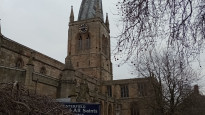
Chesterfield’s Slow Ways starting point
Grid ref
SK3850071140
Lat / Lon
53.23592° / -1.42464°
Easting / Northing
438,500E / 371,140N
what3words
Fancy stretching your legs a bit more?
If you’ve polished off all of the routes between Chesterfield and its neighbours, how about walking its whole web?
This includes the great ring of routes that join its neighbours to each other!
Facilities
Users have reported that the following facilities can be found within 1km of Chesterfield's meeting point
Public toilet
Wheelchair accessible toilet
Supermarket or convenience shop
Restaurant, cafe or pub
Accommodation
Accommodation for under £50 a night
Campsite
Bothy
Free wifi
Mobility scooter hire
Off-road wheelchair hire
Disabled Parking
Train station
Bus stop
Ferry
Official ‘Walkers are Welcome’ town
Help us improve this information by signing up or logging in and carrying out a quick survey of Chesterfield