Description
A desk top review of Chebol shows route one to be poorly plotted and has a lot of road walking along Carr Lane which has now been identified as a poor route. Chebol two by necessity uses a short section of Carr Lane / Palterton Lane to cross the motorway. I haven't walked it, see also Chebol three
A desk top review of Chebol shows route one to be poorly plotted and has a lot of road walking along Carr Lane which has now been identified as a poor route. Chebol two by necessity uses a short section of Carr Lane / Palterton Lane to cross the motorway. I haven't walked it, see also Chebol three
Status
This route has been reviewed by 3 people.
There are no issues flagged.
Photos for Chebol two

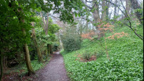

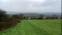
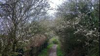
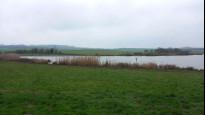
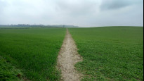
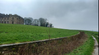
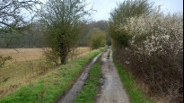

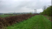


Photos of this route will appear when they are added to a review. You can review this route here.
Information
")
Route status - Live
Reviews - 3
Average rating -
Is this route good enough? - Yes (3)
There are currently no problems reported with this route.
Downloads - 3
Surveys
What is this route like?
Surveys are submitted by fellow users of this website and show what you might expect from this Slow Ways route. Scroll down the page to read more detailed surveys.
| Grade 3Y based on 1 surveys | Sign up or log in to survey this route. | ||
|---|---|---|---|
| Description | Note | ||
| Grade 3: Route includes rough surfaces that may include small boulders, potholes, shallow ruts, loose gravel, short muddy sections. Access grade Y: Stile, step and obstacle free. |
Grading is based on average scores by surveyors. This slow way has 1 surveys. | ||
| Full grading description | |||
Only people who have completed our training can become Slow Ways surveyors and submit a survey. We do not vet contributors, so we cannot guarantee the quality or completeness of the surveys they complete. If you are dependent on the information being correct we recommend reading and comparing surveys before setting off.
Survey Photos
Facilities
Facilities in the middle third of this route.
Challenges
Potential challenges reported on this route. Some challenges are seasonal.
Obstacles
Obstacles on this route.
Accessibility
Is this route step and stile free?
Measurements
Surveyors were asked to measure the narrowest and steepest parts of paths.
The narrowest part of the path is 75.0cm (1)
The steepest uphill gradient East: no data
The steepest uphill gradient West: no data
The steepest camber: no data
How clear is the waymarking on the route: Unclear in places (1)
Successfully completed
We asked route surveyors "Have you successfully completed this route with any of the following? If so, would you recommend it to someone with the same requirements?". Here is how they replied.
Recommended by an expert
We asked route surveyors "Are you a trained access professional, officer or expert? If so, is this route suitable for someone travelling with any of the following?" Here is how they replied.
Terrain
We asked route surveyors to estimate how much of the route goes through different kinds of terrain.
25.0% of the route is on roads (1)
10.0% of the route is lit at night (1)
40.0% of the route is paved (1)
15.0% of the route is muddy (1)
10.0% of the route is over rough ground (1)
5.0% of the route is through long grass (1)
Report a problem with this data
1 surveys
Information from verified surveys.
Geography information system (GIS) data
Total length
Maximum elevation
Minimum elevation
Start and end points
Chesterfield
Grid Ref
SK3850071140
Lat / Lon
53.23592° / -1.42464°
Easting / Northing
438,500E / 371,140N
What3Words
silly.shall.hook
Bolsover
Grid Ref
SK4738770498
Lat / Lon
53.22943° / -1.29160°
Easting / Northing
447,387E / 370,498N
What3Words
proclaims.warrior.loitering
| Chesterfield | |
|---|---|
| Grid Ref | SK3850071140 |
| Lat / Lon | 53.23592° / -1.42464° |
| Easting / Northing | 438,500E / 371,140N |
| What3Words | silly.shall.hook |
| Bolsover | |
|---|---|
| Grid Ref | SK4738770498 |
| Lat / Lon | 53.22943° / -1.29160° |
| Easting / Northing | 447,387E / 370,498N |
| What3Words | proclaims.warrior.loitering |
Sorry Land Cover data is not currently available for this route. Please check back later.
reviews
Hugh Hudson
05 Apr 2023 (edited 06 Apr 2023)Walked from Bolsover to Chesterfield. An interesting route, good in parts, but having walked CHEBOL4 last year I prefer that one for its directness, though this one has greater scenic variety and less road noise.
I also had a couple of minor issues - although there are supposed to be two bridleways through the north side of Sutton Springs Wood, the northern one is not well marked so I used the other one (the unsurfaced road) and failed to find the shortcut path at the junction. On balance I don't think a flag is necessary, so I'll give it a slightly reluctant snail.
I missed Ken's review comment about starting up Castle Street until after the walk, but would agree that the slight detour down the main road and up the alleyway is a little pointless. We follow Castle Street over and down the far side of the hill to find the surfaced path that heads right under the castle walls. The surfacing ends at the open field below the castle, where we follow the left edge down to a lane then take the road left through New Bolsover. We go straight on, then right down Charlesworth Street and left into Sutton Hall Road to find the path that starts between garden fences and leads down to the old railway (the diagonal line through the bottom field looks wet, and it is easier to follow the trodden path right, then follow the railway track left to rejoin the GPX line. I also wondererd whether staying on Water Lane might have been an easier line.
As Ken mentioned, the old right of way line crosses a small artificial lake, but there is no obstacle to walking in the field around it, and the paths across the arable fields beyond are well maintained and easy to follow, if a little muddy. At Carr Lane we cross the motorway bridge and follow the road around the bend to pick up the clear path (muddy in places) that leads towards the ruin of Sutton Scarsdale Hall but is forced right by a ha-ha. We follow the track past farm buildings and up the hill to the road, which we cross and continue onto Rock Lane.
The bridleway leads easily into Sutton Springs Wood. As mentioned earlier, the bridleway splits where the road turns left, and the route appears to continue through the garden of a new house. OpenStreetMap rather suggests that this bridleway is no longer clear, so I stayed on the road (also a bridleway) to reach the B6425. OpenStreetMap also suggests that the corner-cutting path goes straight on from the corner where the road turns right, which might explain why I couldn't see any evidence of it where the right of way should be, where there is a high hedge. Staying on the road has the additional advantage when wet of passing a bus shelter with a bench.
We cross the B6425 and continue down the quiet lane to find the permissive bridleway down to Bole Hill (initially a wide grassy path, but narrower and muddy at the far end). We go left at Bole Hill then right up Dark Lane, then use the field path and Dingle Lane to reach the A617, which we cross. Beyond the Co-Op (the first facility since Carr Vale) we take the path right then cross the green space and the hospital car park (the signs disappear, but there are no real obstacles) to reach the hospital access road, which we cross and go through another green space to Sycamore Drive. We take the path straight on, then take the right turn past the covered reservoir onto the golf course (I agree with Ken and John that the BOLSHI4 route is easier).
Either way we find our way down through the golf course to the steep and muddy path that emerges on Piccadilly Road. The rest of the route across the small park, past the railway station and over the footbridge is as per BOLSHI 4, and I have to admit that I missed out the walk from the railway station to the meeting point by the church, having done it twice on other SlowWays in recent months.
J w ollid
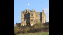
12 Feb 2023This route is well served by public transport(trains/buses Chesterfield and buses at Bolsover)However on route there is little in the way public transport or refreshment stops.Passing the covered reservoir prior to reaching the hospital grounds I would recommend using Chebol 4,Chebol 2 takes one rather a long way round.There are couple of busy roads to cross but Sutton Scarsdale hall soon appears followed by views across to Bolsover and it’s prominent castle .A good direct walk with no access issues however poorly way marked (some finger posts broken or nonextense.).
-
Share your thoughts
Ken
19 Jan 2022I walked this route twice to Chesterfield, first after a fair bit of rain. Two large arable fields with cross paths which can be claggy, no cattle seen. No services half way, a seat, with snail, at Sutton Scarsdale where the Hall offers interest along with New Bolsover Model Village. This Slow Way serves Chesterfield Hospital. Posting the route before the walk I would now offer some minor changes, see below.
Leave the Market Place along Castle Street, ignore the plot. Bolsover castle may have protected the area in years gone by but it fails to dominate the town today. Approaching from the west offers the best view so turn around as you leave down the hill to New Bolsover. Not a minature village this model but well worth a minor detour from the route to take a look while the paint is still fresh.
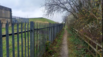
Carr Vale was perhaps the poor neighbour but most houses here are now in private ownership with that personal touch applied. The path twisting out of the urban area is ignored by locals who often know a better unrecorded path. A fenced in section is also not on the correct line which then requires an offset crossing of the cycle track.
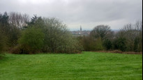
Another deviation from the recorded line, unless you can walk on water. I hear the county council have it on their, long list, of issues to sort out. Now it's across a large field to reach Carr Lane which provides a bridge over the motorway then onto another footpath which brings into view the skeletal remains of Sutton Scarsdale Hall. When I passed fencing surrounded the building but I still made a detour to get a closer look by backtracking along the drive from the village road. On a visit some years back before the fence was erected I was able to wander through the ruin, let's hope the planned renovation will allow this again soon.
Tracks offer easier walking from here leading through Sutton Springs Wood an interesting area perhaps land settlement smallholdings now with homes some simple but most tending to grand while the access road remains an unadopted dirt track. Fortunately the pot holes act as a speed deterrent the only protection for walkers as there are no pavements. The plot here fails to show the track and the footpath to the road could be ignored, if you don't fancy sharing the field with ponies.
A section of quiet road leads to a permissive path along a well maintained track, only old maps offer evidence it was once a railway. On the road north from Cock Alley a blue brick wall was investigated and again old maps show this to have been the course of the Lancashire, Derbyshire and East Coast Railway which DCC have recorded as a proposed cycle route. Looks like a good bit of work will be required as there is no sign through the fields it was once a railway.
Hitting the main road a former Inn now serves as a Co-op store. Our path enters the hospital grounds and the recorded footpath crosses the car park but stay on the provided paths before entering a green corridor. I made a mistake and would now recommend taking Chebol4 around the covered reservoir. This route offers a view of the Chesterfield and District Model Engineering Society which in translation means a railway round the garden, sadly not operating when I passed by.
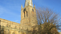
Onto the golf course and down into Chesterfield the enclosed path is quite steep and was muddy but a fall was avoided. Across the recreation ground with a welcome for Slow Ways, they must have known we planned a route this way. The route passes close to Chesterfield rail station then over the bypass road which splits the town, past the theatre and museum to the meeting point by that famous crooked spire.
-
Share your thoughts
Share your views about this route, give it a star rating, indicate whether it should be verified or not.
Include information that will be useful to others considering to walk or wheel it.
You can add up to 15 photos.
Other Routes for Chesterfield—Bolsover See all Slow Ways
Review this better route and help establish a trusted network of walking routes.
Suggest a better route if it better meets our methodology.
Share your thoughts