Description
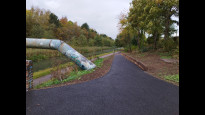
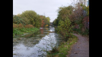
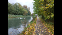
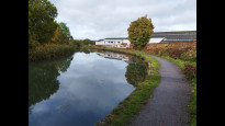
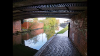
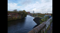
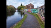
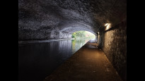
Follows the towpath of the Birmingham Canal. Fixes the error in Wolcos one which failed to indicate the route from the Railway Station to the canal in Wolverhampton
Follows the towpath of the Birmingham Canal. Fixes the error in Wolcos one which failed to indicate the route from the Railway Station to the canal in Wolverhampton
Status
This route has been reviewed by 5 people.
There are no issues flagged.
Photos for Wolcos two

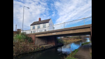

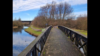


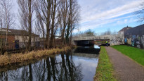


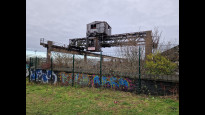


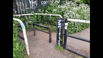


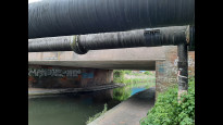


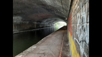

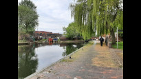
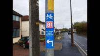


Photos of this route will appear when they are added to a review. You can review this route here.
Information
")
Route status - Live
Reviews - 5
Average rating -
Is this route good enough? - Yes (5)
There are currently no problems reported with this route.
Downloads - 1
Surveys
What is this route like?
Surveys are submitted by fellow users of this website and show what you might expect from this Slow Ways route. Scroll down the page to read more detailed surveys.
| Grade 1X based on 1 surveys | Sign up or log in to survey this route. | ||
|---|---|---|---|
| Description | Note | ||
| Grade 1: Entirely smooth and compacted surfaces. Access grade X: At least one stile, flight of steps or other obstacle that is highly likely to block access for wheelchair and scooter users. |
Grading is based on average scores by surveyors. This slow way has 1 surveys. | ||
| Full grading description | |||
Only people who have completed our training can become Slow Ways surveyors and submit a survey. We do not vet contributors, so we cannot guarantee the quality or completeness of the surveys they complete. If you are dependent on the information being correct we recommend reading and comparing surveys before setting off.
Survey Photos
Facilities
Facilities in the middle third of this route.
Challenges
Potential challenges reported on this route. Some challenges are seasonal.
Obstacles
Obstacles on this route.
Accessibility
Is this route step and stile free?
Measurements
Surveyors were asked to measure the narrowest and steepest parts of paths.
The narrowest part of the path is 80.0cm (1)
The steepest uphill gradient East: no data
The steepest uphill gradient West: no data
The steepest camber: no data
How clear is the waymarking on the route: Clear (1)
Successfully completed
We asked route surveyors "Have you successfully completed this route with any of the following? If so, would you recommend it to someone with the same requirements?". Here is how they replied.
Recommended by an expert
We asked route surveyors "Are you a trained access professional, officer or expert? If so, is this route suitable for someone travelling with any of the following?" Here is how they replied.
Terrain
We asked route surveyors to estimate how much of the route goes through different kinds of terrain.
There is no data on how much of this route is on roads
There is no data on how much of this route is lit at night
Thereis no data on amount of route paved
There is no data on muddiness
There is no data on rough ground
There is no data on long grass
Report a problem with this data
1 surveys
Information from verified surveys.
Geography information system (GIS) data
Total length
Maximum elevation
Minimum elevation
Start and end points
Wolverhampton
Grid Ref
SO9193598870
Lat / Lon
52.58759° / -2.12047°
Easting / Northing
391,935E / 298,870N
What3Words
tested.counts.feed
Coseley
Grid Ref
SO9426794081
Lat / Lon
52.54457° / -2.08596°
Easting / Northing
394,267E / 294,081N
What3Words
atomic.rapid.lowest
| Wolverhampton | |
|---|---|
| Grid Ref | SO9193598870 |
| Lat / Lon | 52.58759° / -2.12047° |
| Easting / Northing | 391,935E / 298,870N |
| What3Words | tested.counts.feed |
| Coseley | |
|---|---|
| Grid Ref | SO9426794081 |
| Lat / Lon | 52.54457° / -2.08596° |
| Easting / Northing | 394,267E / 294,081N |
| What3Words | atomic.rapid.lowest |
Sorry Land Cover data is not currently available for this route. Please check back later.
Other Routes for Wolverhampton—Coseley See all Slow Ways
Review this better route and help establish a trusted network of walking routes.
Suggest a better route if it better meets our methodology.