Description
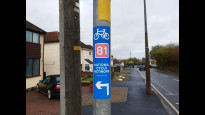
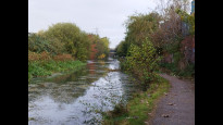
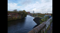
Follows the towpath of the Birmingham Canal. Fixes the error in Wolcos one which failed to indicate the route from the Railway Station to the canal in Wolverhampton
Follows the towpath of the Birmingham Canal. Fixes the error in Wolcos one which failed to indicate the route from the Railway Station to the canal in Wolverhampton
Status
This route has been reviewed by 5 people.
There are no issues flagged.
Photos for Wolcos two


Photos of this route will appear when they are added to a review. You can review this route here.
Information
")
Route status - Live
Reviews - 5
Average rating -
Is this route good enough? - Yes (5)
There are currently no problems reported with this route.
Downloads - 1
Surveys
What is this route like?
Surveys are submitted by fellow users of this website and show what you might expect from this Slow Ways route. Scroll down the page to read more detailed surveys.
| Grade 1X based on 1 surveys | Sign up or log in to survey this route. | ||
|---|---|---|---|
| Description | Note | ||
| Grade 1: Entirely smooth and compacted surfaces. Access grade X: At least one stile, flight of steps or other obstacle that is highly likely to block access for wheelchair and scooter users. |
Grading is based on average scores by surveyors. This slow way has 1 surveys. | ||
| Full grading description | |||
Only people who have completed our training can become Slow Ways surveyors and submit a survey. We do not vet contributors, so we cannot guarantee the quality or completeness of the surveys they complete. If you are dependent on the information being correct we recommend reading and comparing surveys before setting off.
Survey Photos
Facilities
Facilities in the middle third of this route.
Challenges
Potential challenges reported on this route. Some challenges are seasonal.
Obstacles
Obstacles on this route.
Accessibility
Is this route step and stile free?
Measurements
Surveyors were asked to measure the narrowest and steepest parts of paths.
The narrowest part of the path is 80.0cm (1)
The steepest uphill gradient East: no data
The steepest uphill gradient West: no data
The steepest camber: no data
How clear is the waymarking on the route: Clear (1)
Successfully completed
We asked route surveyors "Have you successfully completed this route with any of the following? If so, would you recommend it to someone with the same requirements?". Here is how they replied.
Recommended by an expert
We asked route surveyors "Are you a trained access professional, officer or expert? If so, is this route suitable for someone travelling with any of the following?" Here is how they replied.
Terrain
We asked route surveyors to estimate how much of the route goes through different kinds of terrain.
There is no data on how much of this route is on roads
There is no data on how much of this route is lit at night
Thereis no data on amount of route paved
There is no data on muddiness
There is no data on rough ground
There is no data on long grass
Report a problem with this data
1 surveys
Information from verified surveys.
Geography information system (GIS) data
Total length
Maximum elevation
Minimum elevation
Start and end points
Wolverhampton
Grid Ref
SO9193598870
Lat / Lon
52.58759° / -2.12047°
Easting / Northing
391,935E / 298,870N
What3Words
tested.counts.feed
Coseley
Grid Ref
SO9426794081
Lat / Lon
52.54457° / -2.08596°
Easting / Northing
394,267E / 294,081N
What3Words
atomic.rapid.lowest
| Wolverhampton | |
|---|---|
| Grid Ref | SO9193598870 |
| Lat / Lon | 52.58759° / -2.12047° |
| Easting / Northing | 391,935E / 298,870N |
| What3Words | tested.counts.feed |
| Coseley | |
|---|---|
| Grid Ref | SO9426794081 |
| Lat / Lon | 52.54457° / -2.08596° |
| Easting / Northing | 394,267E / 294,081N |
| What3Words | atomic.rapid.lowest |
Sorry Land Cover data is not currently available for this route. Please check back later.
reviews
Steve Litchfield
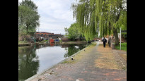
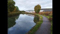
02 Jan 2024 (edited 12 Jan 2024)I completed this walk yesterday travelling northwards from Coseley. I really enjoyed the walk. After having read the other reviews, I don't have any other detail to add other than it's an interesting journey mainly along the canal and has historic industrial interest. Without any locks on the canal throughout the walk, it is also therefore very level and could easily be wheeled.
Marion Frankland
02 Jul 2023As below with the route description. Walked (ran) in the summer, and was a little overgrown in places, but not impassable.
-
Share your thoughts
Saira
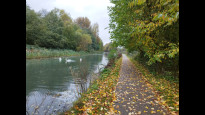
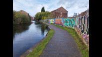
22 May 2023I don't have very much to add to the below reviews! This was a brilliant Slow Way - direct, offroad, easy to follow and very enjoyable. I walked with this route Mary - we spotted a lot of wildfowl along the way, as well as colourful grafetti and interesting buildings. Would defo recommend!.
-
Share your thoughts
Mary Oz
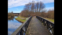
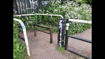
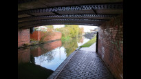
18 May 2023From the Coseley Station side road, an alleyway led down to the canal towpath which the route stuck to all the way to Wolverhampton. It was well-surfaced but there was at least one cycle barrier, and there some brick-paved bridges over side branches of the canal.
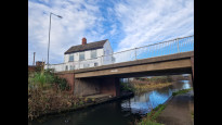
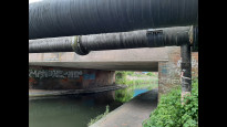
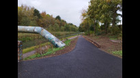
The A463 was a high flyover, and after passing below the railway there was an intriguing aluminium sculpture of interlocking cylinders.
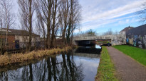
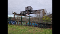
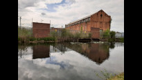
There were factories, graffiti, and lots of pipe bridges, but it still felt pleasantly quiet and almost rural. The surroundings became more industrial as we neared Wolverhampton Station, but still with lots of waterfowl around. We saw herons, mallards, Canada geese, swans, moorhens and coots; many of them with cute fluffy babies!
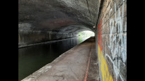
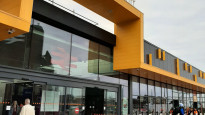
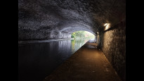
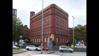
Wolverhampton Tunnel, beneath a muti-storey car park, was surprisingly bright and airy, before we zigzagged past a couple of canal basins and back to the station. There was plenty of heritage around from the canal age and the railway age. We also found a nice tiled and railway themed pub, The Great Western, just beyond the railway to round off an excellent day’s Slow Waying!.
-
Share your thoughts
David Sanderson
23 Oct 2022Very direct, very offroad, very easy to follow. I walked this from Coseley to Wolverhampton. It comprises of a peaceful stroll along the Birmingham Canal with a residential walk at the Coseley end and a walk along the pavement of the main road in central Wolverhampton at the other. The only concern from a Slow Ways point of view is the lack of facilities on the way. You pass no shops until you get to the Wolverhampton end and those are the ones in the station. At only 7km that's not going to lose it a star. I wore boots but, despite the rain, I could have happily worn shoes. This route is safe, accessible and seems to take no time to walk. There was no end of wildfowl on the canal which made the walk even better. There are links to trains and buses at either end. A really good Slow Way.
-
Share your thoughts
Share your views about this route, give it a star rating, indicate whether it should be verified or not.
Include information that will be useful to others considering to walk or wheel it.
You can add up to 15 photos.
Other Routes for Wolverhampton—Coseley See all Slow Ways
Review this better route and help establish a trusted network of walking routes.
Suggest a better route if it better meets our methodology.
Share your thoughts