Description
Improved route from Hooley to Netherne using Star Lane and traffic light crossing of A23. Footpath (street lights) along Forge Bridge Lane to Netherne avoiding narrow single track road
Improved route from Hooley to Netherne using Star Lane and traffic light crossing of A23. Footpath (street lights) along Forge Bridge Lane to Netherne avoiding narrow single track road
Status
This route has been reviewed by 3 people.
There are no issues flagged.
Photos for Bannet two


Photos of this route will appear when they are added to a review. You can review this route here.
Information
")
Route status - Live
Reviews - 3
Average rating -
Is this route good enough? - Yes (3)
There are currently no problems reported with this route.
Downloads - 6
Surveys
We are working to build-up a picture of what routes look like. To do that we are asking volunteers to survey routes so that we can communicate features, obstacles and challenges that may make a route desirable or not.
Slow Ways surveyors are asked to complete some basic online training, but they are not vetted. If you are dependent on the survey information being correct in order to complete a route, we recommend that you think critically about the information provided. You may also wish to wait until more than one survey has been completed.
Help people know more about this route by volunteering to submit a survey.
- Complete the survey training.
- Submit a survey for this route.
Geography information system (GIS) data
Total length
Maximum elevation
Minimum elevation
Start and end points
Banstead
Grid Ref
TQ2523059643
Lat / Lon
51.32211° / -0.20420°
Easting / Northing
525,230E / 159,643N
What3Words
minute.cracks.scare
Netherne On-The-Hill
Grid Ref
TQ2953856298
Lat / Lon
51.29109° / -0.14362°
Easting / Northing
529,538E / 156,298N
What3Words
guides.fantastic.boil
| Banstead | |
|---|---|
| Grid Ref | TQ2523059643 |
| Lat / Lon | 51.32211° / -0.20420° |
| Easting / Northing | 525,230E / 159,643N |
| What3Words | minute.cracks.scare |
| Netherne On-The-Hill | |
|---|---|
| Grid Ref | TQ2953856298 |
| Lat / Lon | 51.29109° / -0.14362° |
| Easting / Northing | 529,538E / 156,298N |
| What3Words | guides.fantastic.boil |
Sorry Land Cover data is not currently available for this route. Please check back later.
reviews
Derick Rethans
20 Aug 2023I walked this on a warm sunny afternoon, from Netherne On-the-Hill to Banstead. It had rained a little overnight.
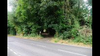
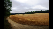
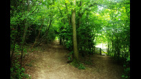
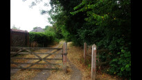
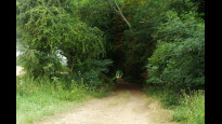
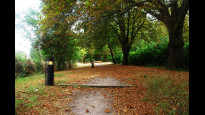
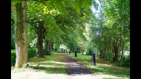
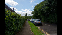
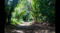
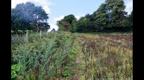
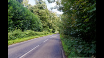
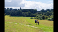
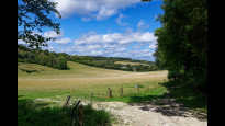
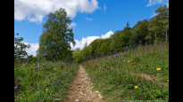
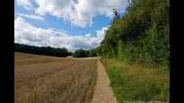
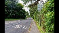
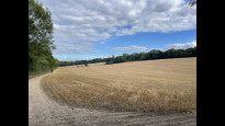
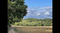
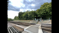
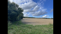
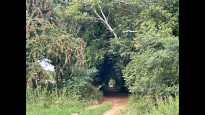
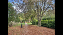
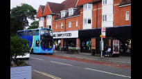
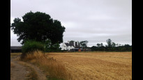
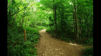
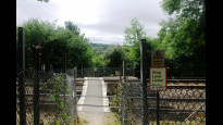
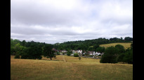
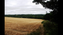
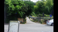
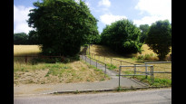
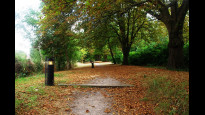
From Netherne the route starts along a lit path (photo #1) and then heads down to cross the railway at Hooley where there is some pavement walking along quiet residential streets (photo #2). Soon it then encounters farmland and up a hill along the side of fields (photo #4). After a nice section through woodland (photo #5), there is a little stretch along a street with no pavement. But also few cars (photo #6). Soon the route goes up again along fields, open space chalk land (photo #7, #8, #9), and down the hill to cross a level crossing. On the other side, you then walk up, in some place steeply, through "meadows" with loads of wild flowers. I took a little rest here on a bench (photo #10). After the top of the hill, the route follows the edges of fields (photo #11) to end up on Holly Lane (photo #12) which leads into Banstead's village.
Jane Taylor
05 Sep 2022Good route connecting Banstead to Netherne.
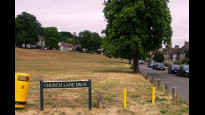
This routes corrects the problems with Bannet one, and provides safe passage across the A23 at Hooley and up the hill to Netherne (last two photos).
Most of the walk is through lovely North Downs chalk farmland and woods, some ups and downs of course!
Good paths and easy to follow. There’s a railway crossing (photo) and few short stretches along lanes with no pavement (photo), but nothing dangerous.
There aren’t any intermediate refreshments, so take something along for a traditional fieldside picnic.
-

JohnMyerson
05 Sep 2022Thanks Jane. I enjoyed this walk too.
-
Share your thoughts
JohnMyerson
04 Aug 2022Good countryside walk. Some steep sections and vegetation. Only suitable for walkers. Shops at Banstead, at Hooley (BP garage at A23 traffic lights, Star Lane) and convenience store in Netherne. Cross A23 at traffic lights. Footpath up the hill to Netherne.
-
Share your thoughts
Share your views about this route, give it a star rating, indicate whether it should be verified or not.
Include information that will be useful to others considering to walk or wheel it.
You can add up to 15 photos.
There are no other routes for Banstead — Netherne On-The-Hill
If you know a better way, then please let us know.
Review this better route and help establish a trusted network of walking routes.
Suggest a better route if it better meets our methodology.
Share your thoughts