Umberleigh — South Molton
Umbsou two

Verified Slow Way
Verified by 100.00% of reviewers
Verified Slow Way
Verified by 100.00% of reviewers
By Helen Gough on 08 May 2022
Description
Safer and shorter route connecting Umberleigh and South Molton. Mostly walking on lanes, but crossing the B3226 twice
Safer and shorter route connecting Umberleigh and South Molton. Mostly walking on lanes, but crossing the B3226 twice
Status
This route has been reviewed by 4 people.
There are no issues flagged.
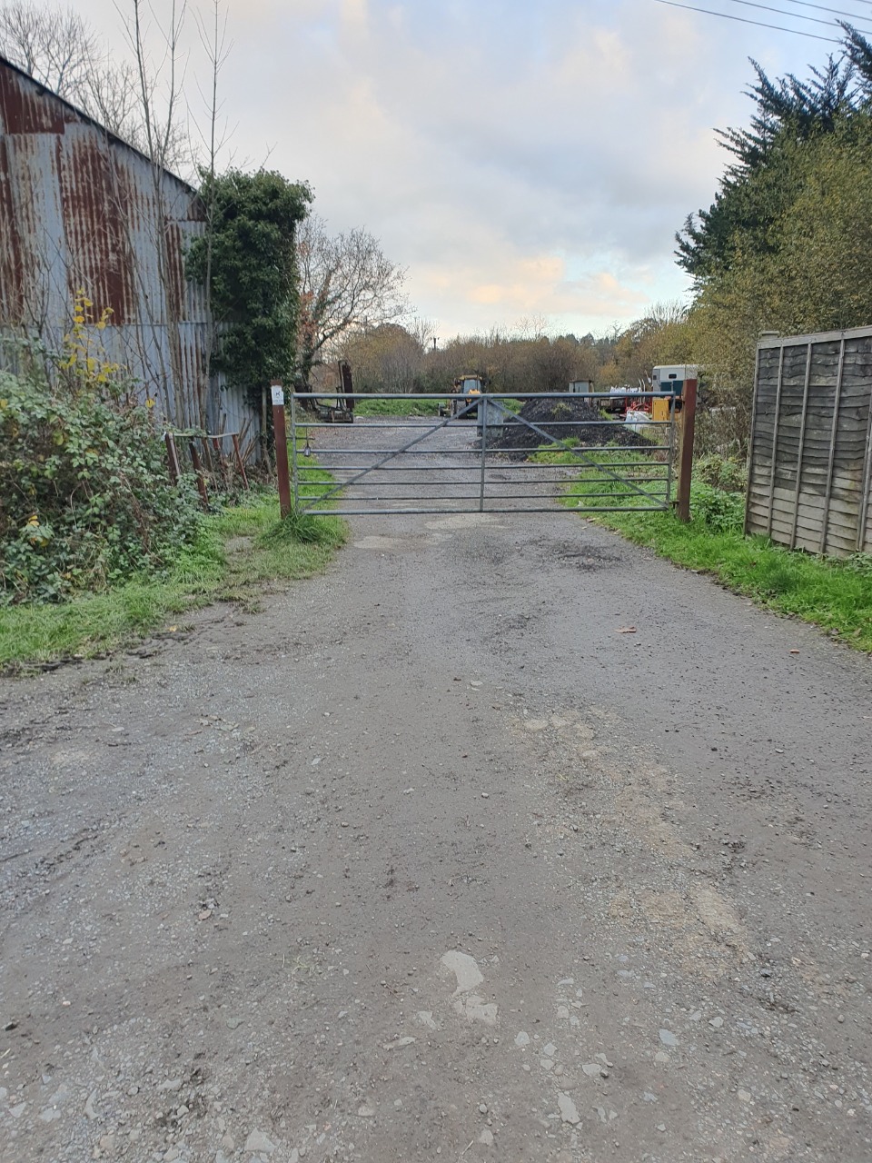
Photos for Umbsou two


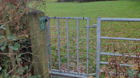
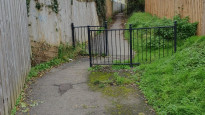
Photos of this route will appear when they are added to a review. You can review this route here.
Information
Route status - Live
Reviews - 4
Average rating -
Is this route good enough? - Yes (4)
There are currently no problems reported with this route.
Downloads - 3
Surveys
What is this route like?
Surveys are submitted by fellow users of this website and show what you might expect from this Slow Ways route. Scroll down the page to read more detailed surveys.
| Grade 3X based on 1 surveys | Sign up or log in to survey this route. | ||
|---|---|---|---|
| Description | Note | ||
| Grade 3: Route includes rough surfaces that may include small boulders, potholes, shallow ruts, loose gravel, short muddy sections. Access grade X: At least one stile, flight of steps or other obstacle that is highly likely to block access for wheelchair and scooter users. |
Grading is based on average scores by surveyors. This slow way has 1 surveys. | ||
| Full grading description | |||
Only people who have completed our training can become Slow Ways surveyors and submit a survey. We do not vet contributors, so we cannot guarantee the quality or completeness of the surveys they complete. If you are dependent on the information being correct we recommend reading and comparing surveys before setting off.
Survey Photos
Facilities
Facilities in the middle third of this route.
Challenges
Potential challenges reported on this route. Some challenges are seasonal.
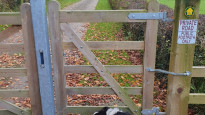
Obstacles
Obstacles on this route.
Accessibility
Is this route step and stile free?
Measurements
Surveyors were asked to measure the narrowest and steepest parts of paths.
Narrowest part of path: no data
The steepest uphill gradient East: no data
The steepest uphill gradient West: no data
The steepest camber: no data
How clear is the waymarking on the route: Clear (1)
Successfully completed
We asked route surveyors "Have you successfully completed this route with any of the following? If so, would you recommend it to someone with the same requirements?". Here is how they replied.
Recommended by an expert
We asked route surveyors "Are you a trained access professional, officer or expert? If so, is this route suitable for someone travelling with any of the following?" Here is how they replied.
Terrain
We asked route surveyors to estimate how much of the route goes through different kinds of terrain.
There is no data on how much of this route is on roads
There is no data on how much of this route is lit at night
Thereis no data on amount of route paved
There is no data on muddiness
There is no data on rough ground
There is no data on long grass
Report a problem with this data
1 surveys
Information from verified surveys.
Geography information system (GIS) data
Total length
Maximum elevation
Minimum elevation
Start and end points
Umberleigh
Grid Ref
SS6094823783
Lat / Lon
50.99659° / -3.98293°
Easting / Northing
260,948E / 123,783N
What3Words
watching.overcomes.lighters
South Molton
Grid Ref
SS7142225863
Lat / Lon
51.01772° / -3.83449°
Easting / Northing
271,422E / 125,863N
What3Words
toads.reward.stuffy
| Umberleigh | |
|---|---|
| Grid Ref | SS6094823783 |
| Lat / Lon | 50.99659° / -3.98293° |
| Easting / Northing | 260,948E / 123,783N |
| What3Words | watching.overcomes.lighters |
| South Molton | |
|---|---|
| Grid Ref | SS7142225863 |
| Lat / Lon | 51.01772° / -3.83449° |
| Easting / Northing | 271,422E / 125,863N |
| What3Words | toads.reward.stuffy |
Sorry Land Cover data is not currently available for this route. Please check back later.
reviews
Paul Coverdale
10 Apr 2024I walked the first third of this slow way in the company of my dog, Rosie, on a grey, drizzly April afternoon. The ground was very wet following weeks of rainfall.
I took the shortcut from Umberleigh station over the railway bridge on the B3277, which was busy without a pavement. I recommend using the longer footpath over the viaduct as per the slow way route.
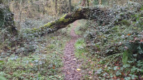
Once past the school, the easterly track was very muddy with a lot of surface water until we ascended and entered the woodland. For this part alone, it is not accessible for bikes or wheelchairs. The minor country roads were very quiet, but also had a lot of surface water in places. At the crossroads I took a right to head back to Chittlehamholt where I was staying.
Helen Gough
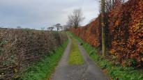
03 Dec 2022I walked from Umberleigh to South Molton and really enjoyed it. I walked on a cold winters day, after a very wet November and this was a perfect choice. Most of it is along very quiet country lanes, with just a few footpaths at either end, so underfoot was easy going. The footpaths on the Umberleigh end were a bit mucky, but considering the rain we've had were in good condition.
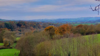
Most of the walk is high up, so the views are fantastic when they appear, but watch out for the wind!
If you want a winter walk with views where you don't have to wade through slippery nasty mud, this is it.
-
Share your thoughts
Jane Gough
03 Dec 2022An excellent route for bad weather walking. Only one muddy path which, considering the rain we have had lately, was not as muddy as expected. Mostly quiet lanes. Elevation not uncomfortable to walk. Nice wood walk. Definitely acceptable to be part of the network.
-
Share your thoughts
Tim Ryan
24 Oct 2022An excellent alternative route. Very good paths in and out of South Molton and Umberleigh. Unfortunately, because of the lack of footpaths in this area. Most of the route is on roads. These country lanes however are very quiet, I felt safe throughout the walk. There are two sections on a busier road, the B3226 at Honiton Cross, and again at Meethe. These are short lengths, no more than 100 metres, and are wide enough. I felt safe. This is a well-designed route, given the lack of footpaths.
-
Share your thoughts
Share your views about this route, give it a star rating, indicate whether it should be verified or not.
Include information that will be useful to others considering to walk or wheel it.
You can add up to 15 photos.
Other Routes for Umberleigh—South Molton See all Slow Ways
Review this better route and help establish a trusted network of walking routes.
Suggest a better route if it better meets our methodology.
Share your thoughts