Robertsbridge — Battle
Robbat two

Slow Way not verified yet. Verify Robbat here.
Slow Way not verified yet. Verify Robbat here.
By Victoria on 24 Mar 2024
Description
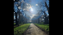
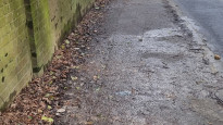
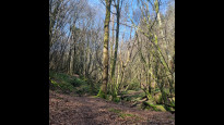
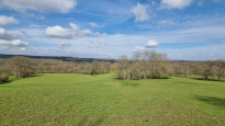
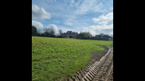
The route takes you out of Battle via the A21 for a short distance and then takes you away from the busy road. The footpath takes you through some beautiful woodlands between the Netherfield Road and Mountfield. Once you've been through Mountfield village, the route takes you through fields and along the drive to stunning Mountfield Court. Once passed the listed building, you find yourself walking through the fields of the estate towards the train line. After that, you follow the trainline to Robertsbridge through scenic woodland and fields
The route takes you out of Battle via the A21 for a short distance and then takes you away from the busy road. The footpath takes you through some beautiful woodlands between the Netherfield Road and Mountfield. Once you've been through Mountfield village, the route takes you through fields and along the drive to stunning Mountfield Court. Once passed the listed building, you find yourself walking through the fields of the estate towards the train line. After that, you follow the trainline to Robertsbridge through scenic woodland and fields
Status
This route is yet to be reviewed and verified. Please walk this route and leave a review.
Photos for Robbat two

Photos of this route will appear when they are added to a review. You can review this route here.
Information
Route status - Live
Reviews - 0
Average rating -
Is this route good enough? - Not verified yet
There are currently no problems reported with this route.
Downloads - 0
Surveys
We are working to build-up a picture of what routes look like. To do that we are asking volunteers to survey routes so that we can communicate features, obstacles and challenges that may make a route desirable or not.
Slow Ways surveyors are asked to complete some basic online training, but they are not vetted. If you are dependent on the survey information being correct in order to complete a route, we recommend that you think critically about the information provided. You may also wish to wait until more than one survey has been completed.
Help people know more about this route by volunteering to submit a survey.
- Complete the survey training.
- Submit a survey for this route.
Geography information system (GIS) data
Total length
Maximum elevation
Minimum elevation
Start and end points
Robertsbridge
Grid Ref
TQ7338623505
Lat / Lon
50.98484° / 0.46889°
Easting / Northing
573,386E / 123,505N
What3Words
backswing.shower.automate
Battle
Grid Ref
TQ7483015809
Lat / Lon
50.91526° / 0.48575°
Easting / Northing
574,830E / 115,809N
What3Words
billiard.thrashing.flocking
| Robertsbridge | |
|---|---|
| Grid Ref | TQ7338623505 |
| Lat / Lon | 50.98484° / 0.46889° |
| Easting / Northing | 573,386E / 123,505N |
| What3Words | backswing.shower.automate |
| Battle | |
|---|---|
| Grid Ref | TQ7483015809 |
| Lat / Lon | 50.91526° / 0.48575° |
| Easting / Northing | 574,830E / 115,809N |
| What3Words | billiard.thrashing.flocking |
Sorry Land Cover data is not currently available for this route. Please check back later.
reviews
This Slow Ways route hasn’t yet been reviewed.
Share your views about it, give it a star rating, indicate whether it should be verified or not. Include information that will be useful to others considering to walk or wheel it.
You can add up to 15 photos.
Other Routes for Robertsbridge—Battle See all Slow Ways
Review this better route and help establish a trusted network of walking routes.
Suggest a better route if it better meets our methodology.