Description
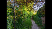
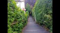
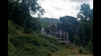
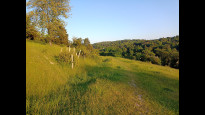
Fairly quiet suburban route which rises up the side of a steep sided valley in order to keep away from the busy A22 / Godstone Road that links Purley and Kenley stations. Mostly on very quiet residential roads, some footpath/alleyways and, near Kenley, across a nature reserve being grazed by cows.
Downs Court Road has a bit more traffic, do make sure to cross near the junction with Cliff End not further up the hill as there is a blind bend close to the footpath entrance there.
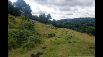
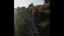
The grazing cows are fairly used to humans but dogs definitely need to be on leads.
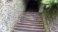
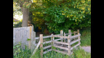
Unlike PurKen 1 it has only one *very* steep section and is otherwise under 10% gradient. That steep bit is the long flight of stairs between Friends Rd and Cliff End and it is also in PurKen 1. You could avoid it by heading straight to the bottom of Downs Court Road from Purley Station. There's a couple of kissing gates around the cows but no stiles
Fairly quiet suburban route which rises up the side of a steep sided valley in order to keep away from the busy A22 / Godstone Road that links Purley and Kenley stations. Mostly on very quiet residential roads, some footpath/alleyways and, near Kenley, across a nature reserve being grazed by cows.
Downs Court Road has a bit more traffic, do make sure to cross near the junction with Cliff End not further up the hill as there is a blind bend close to the footpath entrance there.
The grazing cows are fairly used to humans but dogs definitely need to be on leads.
Unlike PurKen 1 it has only one *very* steep section and is otherwise under 10% gradient. That steep bit is the long flight of stairs between Friends Rd and Cliff End and it is also in PurKen 1. You could avoid it by heading straight to the bottom of Downs Court Road from Purley Station. There's a couple of kissing gates around the cows but no stiles
Status
This route has been reviewed by 2 people.
There are no issues flagged.
Photos for Purken two


Photos of this route will appear when they are added to a review. You can review this route here.
Information

Route status - Live
Reviews - 2
Average rating -
Is this route good enough? - Yes (2)
There are currently no problems reported with this route.
Downloads - 2
Surveys
We are working to build-up a picture of what routes look like. To do that we are asking volunteers to survey routes so that we can communicate features, obstacles and challenges that may make a route desirable or not.
Slow Ways surveyors are asked to complete some basic online training, but they are not vetted. If you are dependent on the survey information being correct in order to complete a route, we recommend that you think critically about the information provided. You may also wish to wait until more than one survey has been completed.
Help people know more about this route by volunteering to submit a survey.
- Complete the survey training.
- Submit a survey for this route.
Geography information system (GIS) data
Total length
Maximum elevation
Minimum elevation
Start and end points
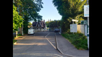
Purley
Grid Ref
TQ3144261536
Lat / Lon
51.33773° / -0.11441°
Easting / Northing
531,442E / 161,536N
What3Words
fired.oils.degree
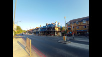
Kenley
Grid Ref
TQ3241160111
Lat / Lon
51.32470° / -0.10103°
Easting / Northing
532,411E / 160,111N
What3Words
caked.vines.raves
| Purley | |
|---|---|
| Grid Ref | TQ3144261536 |
| Lat / Lon | 51.33773° / -0.11441° |
| Easting / Northing | 531,442E / 161,536N |
| What3Words | fired.oils.degree |
| Kenley | |
|---|---|
| Grid Ref | TQ3241160111 |
| Lat / Lon | 51.32470° / -0.10103° |
| Easting / Northing | 532,411E / 160,111N |
| What3Words | caked.vines.raves |
Sorry Land Cover data is not currently available for this route. Please check back later.
Other Routes for Purley—Kenley See all Slow Ways
Review this better route and help establish a trusted network of walking routes.
Suggest a better route if it better meets our methodology.