Description
Fairly quiet suburban route which rises up the side of a steep sided valley in order to keep away from the busy A22 / Godstone Road that links Purley and Kenley stations. Mostly on very quiet residential roads, some footpath/alleyways and, near Kenley, across a nature reserve being grazed by cows.
Downs Court Road has a bit more traffic, do make sure to cross near the junction with Cliff End not further up the hill as there is a blind bend close to the footpath entrance there.
The grazing cows are fairly used to humans but dogs definitely need to be on leads.
Unlike PurKen 1 it has only one *very* steep section and is otherwise under 10% gradient. That steep bit is the long flight of stairs between Friends Rd and Cliff End and it is also in PurKen 1. You could avoid it by heading straight to the bottom of Downs Court Road from Purley Station. There's a couple of kissing gates around the cows but no stiles
Status
This route has been reviewed by 2 people.
There are no issues flagged.
Photos for Purken two


Photos of this route will appear when they are added to a review. You can review this route here.
Information

Route status - Live
Reviews - 2
Average rating -
Is this route good enough? - Yes (2)
There are currently no problems reported with this route.
Downloads - 2
Surveys
We are working to build-up a picture of what routes look like. To do that we are asking volunteers to survey routes so that we can communicate features, obstacles and challenges that may make a route desirable or not.
Slow Ways surveyors are asked to complete some basic online training, but they are not vetted. If you are dependent on the survey information being correct in order to complete a route, we recommend that you think critically about the information provided. You may also wish to wait until more than one survey has been completed.
Help people know more about this route by volunteering to submit a survey.
- Complete the survey training.
- Submit a survey for this route.
Geography information system (GIS) data
Total length
Maximum elevation
Minimum elevation
Start and end points
Purley
Grid Ref
TQ3144261536
Lat / Lon
51.33773° / -0.11441°
Easting / Northing
531,442E / 161,536N
What3Words
fired.oils.degree
Kenley
Grid Ref
TQ3241160111
Lat / Lon
51.32470° / -0.10103°
Easting / Northing
532,411E / 160,111N
What3Words
caked.vines.raves
| Purley | |
|---|---|
| Grid Ref | TQ3144261536 |
| Lat / Lon | 51.33773° / -0.11441° |
| Easting / Northing | 531,442E / 161,536N |
| What3Words | fired.oils.degree |
| Kenley | |
|---|---|
| Grid Ref | TQ3241160111 |
| Lat / Lon | 51.32470° / -0.10103° |
| Easting / Northing | 532,411E / 160,111N |
| What3Words | caked.vines.raves |
Sorry Land Cover data is not currently available for this route. Please check back later.
reviews
Derick Rethans
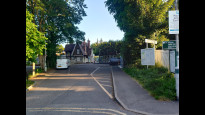
16 Jul 2023I walked this on a rainy and stormy morning, from Purley to Kenley.
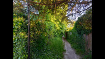
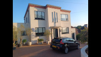
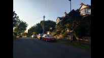
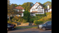
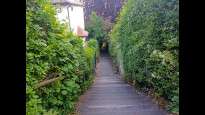
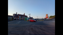
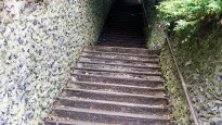
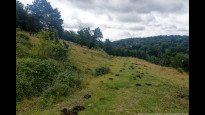
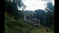
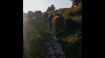
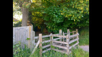
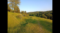
I first got out on the wrong side of the station, and as there were barriers in operation, I had to convince staff to let me go back through (which they kindly did). If you're not starting from this station, you might struggle with that though. Soon after leaving the station (photo #1), there was a 100+ flight of stairs straight up to Cliff End (photo #2). This was the only *steep* bit up, but after walking along Cliff End (photo #3) and then down towards Downs Court Road, there is another uphillish section to where you then follow the public foot path (photo #4, #5) to the end of the nature reserve. From here on it is down a grassy path, with lots of sheep and cow poo (photo #6), towards a gate at the bottom. You get a good loop at the shops in Kenley from here (photo #8). I had some goats (photo #7) and cows in the way, but they were the most docile ones I've encountered for a long time. A short section then brings you towards the station. It is short, and fairly direct, but also very hilly.
Daisy C
04 Jun 2023 (edited 07 Jun 2023)Arrived at Kenley after walking from Oxted at the far edge of the North Downs via Warlingham (thumbs up for both). Quickest way home included a walk to Purley Station so I decided to make it a triple Slow Way day.
About halfway along PurKen 1 I saw a 12% gradient sign for the road ahead and, checking the map more carefully now, saw I was about to go all the way back to the bottom of the valley only to then climb even further back up the hill. My tired legs objected and this was my ad-hoc solution.
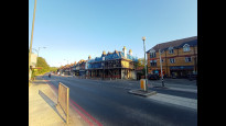
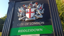
There's a couple of eat/shop options near Kenley Station, and a pub "The Kenley Hotel" with "Rooms available from £20". Over the road is Riddlesdown, City of London open land. A dozen or so cows were, worryingly, clustered around the gate as I approached. Fully blocking it and the narrow track beyond. I tentatively advanced and tried to carefully encourage them out of my way. When the land flattened a bit most moved off the track but a few just moved to one side of the track and stopped dead. As if to say 'We're done, you should overtake now'. Who was really herding who?
I was intrigued by the smaller residential streets up the hill, felt a bit 'Reggie Perrin' but with better views and sometimes vertigo. Near the brow of the hill is a striking but rather incongruous art deco house, with a blue plaque for Peter Cushing.
If I'd planned this new route or had time to scout around more I might have cut out the very long, very steep stairway to/from Cliff End. Downs Court Road is not as quiet or perhaps as nice but surely is gentler on the legs if coming from Purley.
There are two kissing gates and compacted but non flattened surfaces in the cow section (aka Riddles down).
The route is along a steep sided valley, some slopes are inevitable, but this route is relatively gentle, considering, except those long steps. It seemed better than PurKen 1 in that direction and is far quieter than the main road joining Kenley and Purley stations.
-
Share your thoughts
Share your views about this route, give it a star rating, indicate whether it should be verified or not.
Include information that will be useful to others considering to walk or wheel it.
You can add up to 15 photos.
Other Routes for Purley—Kenley See all Slow Ways
Review this better route and help establish a trusted network of walking routes.
Suggest a better route if it better meets our methodology.
Share your thoughts