Perth — Coupar Angus
Percou two

Slow Way not verified yet. Verify Percou here.
Slow Way not verified yet. Verify Percou here.
By F Berry on 21 Apr 2024
Description
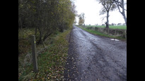
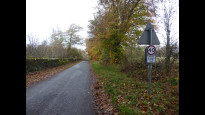
This cross country route follows minor roads, farm tracks and core paths. Refreshments and bus stops would be available in Scone and Burrelton, both off route and near the ends of Percou two. Should a short cut to Coupar Angus be required there is a footway from Burrelton/Woodside to Coupar Angus, beside the A94, but this would not be pleasant walking beside the busy main road. There are no shops or refreshments in Wolfhill which is in the central third of the route.
It should be noted that there is a cafe at East Redstone, the Three Witches Tearoom (currently closed on Tuesdays and Wednesdays), which is in the middle third of this long route. Additional road walking would be required to visit the tearoom, but no additional distance if the minor roads NW and SW of Milton of Collace are used. (Note that the path shown on OS mapping from the disused quarry at Dunsinnan directly to Redstone does not appear to exist, although it could be possible to use field edges to cut this corner).
This route gives good views northwards to the Central Highlands and southwards to the Sidlaws. It passes through open countryside, the only wood encountered is Muirward.
From Perth, the route follows Milkboys Walk and a farm track through Pickstonhill. It crosses the A94 (a crossing with traffic lights lies nearby) and takes a direct route through Scone, up Abbey Road, passing a Spar shop en route.
Near Spoutwells there are major roadworks for the Cross Tay road link, but the route should always remain open as it is a well used core path, although local diversions may be in place. The route continues through Muirward Wood on wide forest tracks then turns northwards at Newlands. South of Kingswells, at a waymarker in the verge, the route leaves the north-south track (the old turnpike road), and follows farm tracks into, then out of, Wolfhill.
After crossing the busy A94 (take care) a very short bit of verge leads to the next section. Here the paths are initially very indistinct. A core path heads directly across the field to the strip of woodland, then a track (shown on maps, but which no longer exists) running next to the woodland strip is gained for a few yards. A sign 'To Millstead 1400m' indicates a route through the woodland strip, after which the route is clear. (On reaching the minor road, turn left to visit the tea room). Across this minor road a signposted path through a 'wildlife area' leads between fields towards houses at Damside.
A lengthy stint of walking on tarmac is now required, but the roads are quiet and the views, to the Sidlaws and to the mountains to the north, are splendid. The route takes you past Kinnochtry before using a signposted farm track to pass to the west of Lintrose House. From its northern end a left turn along the road leads down to Coupar Angus, this road is a 'Walking and Cycling friendly road' with a speed limit of 40mph. It recrosses the A94 at traffic lights within the town
Status
This route has been reviewed by 1 person.
There are no issues flagged.
Photos for Percou two


Photos of this route will appear when they are added to a review. You can review this route here.
Information
Route status - Live
Reviews - 1
Average rating -
Is this route good enough? - Yes (1)
There are currently no problems reported with this route.
Downloads - 0
Surveys
We are working to build-up a picture of what routes look like. To do that we are asking volunteers to survey routes so that we can communicate features, obstacles and challenges that may make a route desirable or not.
Slow Ways surveyors are asked to complete some basic online training, but they are not vetted. If you are dependent on the survey information being correct in order to complete a route, we recommend that you think critically about the information provided. You may also wish to wait until more than one survey has been completed.
Help people know more about this route by volunteering to submit a survey.
- Complete the survey training.
- Submit a survey for this route.
Geography information system (GIS) data
Total length
Maximum elevation
Minimum elevation
Start and end points
Perth
Grid Ref
NO1164323744
Lat / Lon
56.39765° / -3.43305°
Easting / Northing
311,643E / 723,744N
What3Words
grew.acting.solved
Coupar Angus
Grid Ref
NO2212539969
Lat / Lon
56.54522° / -3.26814°
Easting / Northing
322,125E / 739,969N
What3Words
quilt.whoever.defrost
| Perth | |
|---|---|
| Grid Ref | NO1164323744 |
| Lat / Lon | 56.39765° / -3.43305° |
| Easting / Northing | 311,643E / 723,744N |
| What3Words | grew.acting.solved |
| Coupar Angus | |
|---|---|
| Grid Ref | NO2212539969 |
| Lat / Lon | 56.54522° / -3.26814° |
| Easting / Northing | 322,125E / 739,969N |
| What3Words | quilt.whoever.defrost |
Sorry Land Cover data is not currently available for this route. Please check back later.
There are no other routes for Perth — Coupar Angus
If you know a better way, then please let us know.
Review this better route and help establish a trusted network of walking routes.
Suggest a better route if it better meets our methodology.