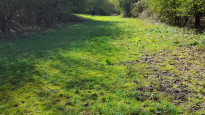
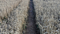
Leominster — Hereford
Leoher four

Slow Way not verified yet. Verify Leoher here.

Slow Way not verified yet. Verify Leoher here.
By nichowes on 04 Sep 2023
Description
This is Leoher four, the place from which to download the revised, safe, accurate route .gpx for unpassable Leoher three, on which footpath closures took place place in summer 2022, with safe diversions now in place on Leoher four..
Photo one shows footbridge at GR SO 49455 56493 amid S&A Farms, onto closed, dangerous footpath; do not cross this footbridge but follow the safe, revised route as shown by the dashed line on the map in photo two (in which the footbridge is located at point B). The former stile/gate near point A on the map was completely overgrown and invisible from the dashed line route when Nic Howes visited in August 2023.
Leoher four was trialled in two sections in January 2022. The section from Wellington to Hereford was trialled by me and Dan Cox and the section from Leominster to Wellington was trialled by me alone. Local bus transport was used in both trial walks to enable point to point walking.
Leoher four includes a different route from Leominster to Upper Hill, avoiding Leoher two's long section of walking out of Leominster on country roads with no footway. Leoher four includes S&A's farm at Brierley, a large man-made lake with interesting wildfowl and a steep woodland bank crowned by a large hill fort with intact ramparts.
Leoher four also includes a more interesting - and quieter - route than Leoher two into Hereford from the latter's outskirts. From Holmer village the route avoids the busy, noisy A49 and follows quiet lanes, a footpath through Hereford's northern industrial quarter and paths around Widemarsh Common to finish at Hereford Town Hall.
Issues became increasingly obvious with northern sections of Leoher three. These issues have now been addressed by Leominster Parish Council, PROW team, Nic Howes and Neil Summerskill, and are now avoided with a detour that is mapped by the .gpx downloadable from Leoher four, here.
There is an unmarked, untrodden public footpath route across arable fields between the pond south of Westhope Hill and Brickyard Cottage. It is much easier to stick on the roughly parallel tractor way which leads through an uninhabited yard and barns near The Cotts Farm before rejoining a public right of way
Status
This route has been reviewed by 5 people.
This route has been flagged (3 times) for reasons relating to access.
Photos for Leoher four
Photos of this route will appear when they are added to a review. You can review this route here.
Information

Route status - Live
Reviews - 5
Average rating -
Is this route good enough? - Yes (2) Maybe (3)
Problems reported - Access (3)
Downloads - 1
Surveys
We are working to build-up a picture of what routes look like. To do that we are asking volunteers to survey routes so that we can communicate features, obstacles and challenges that may make a route desirable or not.
Slow Ways surveyors are asked to complete some basic online training, but they are not vetted. If you are dependent on the survey information being correct in order to complete a route, we recommend that you think critically about the information provided. You may also wish to wait until more than one survey has been completed.
Help people know more about this route by volunteering to submit a survey.
- Complete the survey training.
- Submit a survey for this route.
Geography information system (GIS) data
Total length
Maximum elevation
Minimum elevation
Start and end points
Leominster
Grid Ref
SO4969059026
Lat / Lon
52.22714° / -2.73798°
Easting / Northing
349,690E / 259,026N
What3Words
relishing.sports.truth
Hereford
Grid Ref
SO5119339982
Lat / Lon
52.05607° / -2.71324°
Easting / Northing
351,193E / 239,982N
What3Words
froze.prop.skinny
| Leominster | |
|---|---|
| Grid Ref | SO4969059026 |
| Lat / Lon | 52.22714° / -2.73798° |
| Easting / Northing | 349,690E / 259,026N |
| What3Words | relishing.sports.truth |
| Hereford | |
|---|---|
| Grid Ref | SO5119339982 |
| Lat / Lon | 52.05607° / -2.71324° |
| Easting / Northing | 351,193E / 239,982N |
| What3Words | froze.prop.skinny |
Sorry Land Cover data is not currently available for this route. Please check back later.
Other Routes for Leominster—Hereford See all Slow Ways
Review this better route and help establish a trusted network of walking routes.
Suggest a better route if it better meets our methodology.


