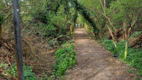
Description
While the bridge over the canal is being replaced in 2022 (which both options one and two utilise), this route provides an alternative way across the canal and into Iver that I know works!
While the bridge over the canal is being replaced in 2022 (which both options one and two utilise), this route provides an alternative way across the canal and into Iver that I know works!
Status
This route has been reviewed by 5 people.
There are no issues flagged.
Photos for Ivehay three


Photos of this route will appear when they are added to a review. You can review this route here.
Information
")
Route status - Live
Reviews - 5
Average rating -
Is this route good enough? - Yes (5)
There are currently no problems reported with this route.
Downloads - 3
Surveys
What is this route like?
Surveys are submitted by fellow users of this website and show what you might expect from this Slow Ways route. Scroll down the page to read more detailed surveys.
| Grade 3X based on 1 surveys | Sign up or log in to survey this route. | ||
|---|---|---|---|
| Description | Note | ||
| Grade 3: Route includes rough surfaces that may include small boulders, potholes, shallow ruts, loose gravel, short muddy sections. Access grade X: At least one stile, flight of steps or other obstacle that is highly likely to block access for wheelchair and scooter users. |
Grading is based on average scores by surveyors. This slow way has 1 surveys. | ||
| Full grading description | |||
Only people who have completed our training can become Slow Ways surveyors and submit a survey. We do not vet contributors, so we cannot guarantee the quality or completeness of the surveys they complete. If you are dependent on the information being correct we recommend reading and comparing surveys before setting off.
Survey Photos
Facilities
Facilities in the middle third of this route.
Challenges
Potential challenges reported on this route. Some challenges are seasonal.
Obstacles
Obstacles on this route.
Accessibility
Is this route step and stile free?
Measurements
Surveyors were asked to measure the narrowest and steepest parts of paths.
The narrowest part of the path is 70.0cm (1)
The steepest uphill gradient walking East 9.0% (1)
The steepest uphill gradient walking West 9.0% (1)
The steepest camber gradient across the path 3.0% (1)
How clear is the waymarking on the route: Unsigned (1)
Successfully completed
We asked route surveyors "Have you successfully completed this route with any of the following? If so, would you recommend it to someone with the same requirements?". Here is how they replied.
Recommended by an expert
We asked route surveyors "Are you a trained access professional, officer or expert? If so, is this route suitable for someone travelling with any of the following?" Here is how they replied.
Terrain
We asked route surveyors to estimate how much of the route goes through different kinds of terrain.
15.0% of the route is on roads (1)
20.0% of the route is lit at night (1)
60.0% of the route is paved (1)
10.0% of the route is muddy (1)
5.0% of the route is over rough ground (1)
There is no data on long grass
Report a problem with this data
1 surveys
Information from verified surveys.
Geography information system (GIS) data
Total length
Maximum elevation
Minimum elevation
Start and end points
Iver
Grid Ref
TQ0385081192
Lat / Lon
51.52011° / -0.50461°
Easting / Northing
503,850E / 181,192N
What3Words
drums.sage.noon
Hayes
Grid Ref
TQ0985779860
Lat / Lon
51.50700° / -0.41847°
Easting / Northing
509,857E / 179,860N
What3Words
music.spaces.flame
| Iver | |
|---|---|
| Grid Ref | TQ0385081192 |
| Lat / Lon | 51.52011° / -0.50461° |
| Easting / Northing | 503,850E / 181,192N |
| What3Words | drums.sage.noon |
| Hayes | |
|---|---|
| Grid Ref | TQ0985779860 |
| Lat / Lon | 51.50700° / -0.41847° |
| Easting / Northing | 509,857E / 179,860N |
| What3Words | music.spaces.flame |
Sorry Land Cover data is not currently available for this route. Please check back later.
reviews
Aamwalk
20 May 2022This is a nice walk and have regularly walked sections of this route. The slough spur of the grand union canel is much more rural than the main canel and is an interesting contrast. Various bits of interesting canel industrial heritage along the way.
Strider
18 Apr 2022I walked from Hayes to Iver.
Hayes has typical urban shops (coffee!), there are steps down to the canal and a new path along a strip of nature through urban/industrial areas. More steps to a bridge leading to a short road section before a shady path between woods and lakes with barriers for wheeled transport. Turn right before a bridge, down an embankment to the Grand Union Canal and over an aqueduct, love the idea of a bridge for a river. The next bridge after passing under the M25 has steps (really not a walk for wheels) up to a road leading North to Iver village (go South for the rail station). The slow ways Node is outside a Co-op which has food (and coffee!).
-
Share your thoughts
Slow Ways Darren
07 Apr 2022A really pleasant combination of the Slough Arm of the Grand Union Canal and the Grand Union itself linked up by the Colne Valley Trail. There has been a lot of investment improving the tow path and it's now very nice and feels quite safe. The Slough Arm of the GU is a nice little find with lots of viaducts over waterways too.
We walked this backwards and it worked just as well.
The final stretch around Iver does have a busy road to walk along.
Beware though the start and end points aren't the railway stations and the Iver station is quite a way out of the village center.
-
Share your thoughts
Alison Moore
07 Apr 2022We walked this slow way from Hayes to Iver. Super walk along the canal which is well kept and mostly free from any rubbish. Also included a stretch along the Colne valley trail which was stunning. The slow way doesn’t stop at the station in Iver so after exploring Iver and the beautiful church we had to walk a little further out of the town to get to the station.
-
Share your thoughts
Mtormey
03 Feb 2022I walked this route from Hayes to Iver. There’s a lot about this route that I like a lot. The canal walking is great, but there’s also some really fine woodland walking and you even go over a canal aqueduct, which is pretty cool! I wasn’t super charmed by Iver, but there’s a couple cafés and such to recover in. I met the leader of the church on the corner and he was very lovely, so I certainly felt welcomed! For a route that’s largely canal walking, there’s still a good diversity that makes it an interesting walk. Only gets dinged a star because the last approach into Iver is along fairly narrow pavements. Thankfully, it’s only about a half mile from the canal to town.
-
Share your thoughts
Share your views about this route, give it a star rating, indicate whether it should be verified or not.
Include information that will be useful to others considering to walk or wheel it.
You can add up to 15 photos.
Other Routes for Iver—Hayes See all Slow Ways
Review this better route and help establish a trusted network of walking routes.
Suggest a better route if it better meets our methodology.
Share your thoughts