Hoyland — Wath upon Dearne
Hoywat two

Slow Way not verified yet. Verify Hoywat here.
Slow Way not verified yet. Verify Hoywat here.
By a Slow Ways Volunteer on 07 Apr 2021
Description
This is a Slow Ways route connecting Hoyland and Wath upon Dearne.
Know of a better route? Share it here.
This is a Slow Ways route connecting Hoyland and Wath upon Dearne.
Know of a better route? Share it here.
Status
This route has been reviewed by 2 people.
There are no issues flagged.
Photos for Hoywat two


Photos of this route will appear when they are added to a review. You can review this route here.
Information
Route status - Live
Reviews - 2
Average rating -
Is this route good enough? - Yes (2)
There are currently no problems reported with this route.
Downloads - 4
Surveys
We are working to build-up a picture of what routes look like. To do that we are asking volunteers to survey routes so that we can communicate features, obstacles and challenges that may make a route desirable or not.
Slow Ways surveyors are asked to complete some basic online training, but they are not vetted. If you are dependent on the survey information being correct in order to complete a route, we recommend that you think critically about the information provided. You may also wish to wait until more than one survey has been completed.
Help people know more about this route by volunteering to submit a survey.
- Complete the survey training.
- Submit a survey for this route.
Geography information system (GIS) data
Total length
Maximum elevation
Minimum elevation
Start and end points
Hoyland
Grid Ref
SE3737000589
Lat / Lon
53.50070° / -1.43810°
Easting / Northing
437,370E / 400,589N
What3Words
gained.spoke.laptop
Wath upon Dearne
Grid Ref
SE4350300890
Lat / Lon
53.50293° / -1.34561°
Easting / Northing
443,503E / 400,890N
What3Words
reason.gossiping.listening
Hoywat Two's land is
| Hoyland | |
|---|---|
| Grid Ref | SE3737000589 |
| Lat / Lon | 53.50070° / -1.43810° |
| Easting / Northing | 437,370E / 400,589N |
| What3Words | gained.spoke.laptop |
| Wath upon Dearne | |
|---|---|
| Grid Ref | SE4350300890 |
| Lat / Lon | 53.50293° / -1.34561° |
| Easting / Northing | 443,503E / 400,890N |
| What3Words | reason.gossiping.listening |
| Arable | 21.5% |
| Pasture | 4.5% |
| Urban | 56.2% |
| Woods | 17.8% |
Data: Corine Land Cover (CLC) 2018
reviews
Hugh Hudson
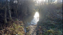
04 Jan 2024 (edited 09 Jan 2024)Walked from Hoyland to Wath. Mostly pretty good, but the path east of Pontefract Road had one section under water which was almost knee deep in places. I enjoyed most of it.
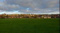
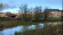
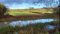
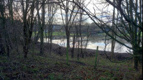
From Hoyland we take the paved area past the market, then follow residential streets down the hill. The route across the playing field is neither signposted nor clearly marked, but as long as no sport is in progress there is no obstacle to heading straight for the railway bridge. Beyond the bridge a good path, a little muddy in places, continues down the hill. Beyond Fitzwilliam Street the path is wetter and less clear, but passes through open fields and parkland so the exact line is not critical.
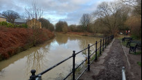
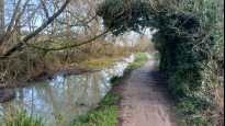
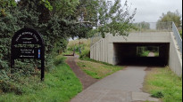
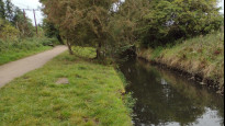
Beyond Wath Road a lane leads us to the canal basin, where we join a branch of the TransPennine Trail, which is a well surfaced path that follows the line of the old canal. There are steps the far side of Tingle Bridge Lane, where there is also a pub. Beyond Smithy Bridge Lane we leave the canal and follow the main path half right, still on the TransPennine Trail. A couple of the road crossings require a little care, as traffic leaves the roundabouts quite fast. Eventually we join the wider Barnsley branch of the TPT, and at the next junction we leave the Trail and turn right (there is pavement on the right hand side).
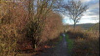
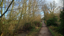
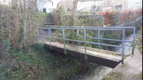
The path left is just beyond the bridge over Knoll Beck and is unsignposted. I had no problems following the path other than the aforementioned flooded section, and beyond Dearne Lane the path is better used and less confined by undergrowth. The path leads into a more open area, where we bear right and cross a bridge and go up more steps to reach West Street, where we turn left to find the meeting point by the bus stops to the right.
Ken
18 Sep 2023My third walk of the day and a choice of two routes to pioneer so I go for the shortest. This is a walk through the fascinating industrial heritage of South Yorkshire along former railways and canals. Mostly easy walking along traffic free paths but it could perhaps benefit from a plot change from Wath. Potential services about half way at Cortonwood Retail Park and an inn at Tingle Bridge Lane
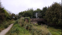
I started from Wath upon Dearne and unbeknown I had already encountered the lost Dearne and Dove canal on the last walk. This route starts well with a stone bridge offering evidence of the infilled canal and a good stone surfaced path. Unfortunately this slowly deteriorates as can be seen from the picture with the pylon.
I would hope there is a better well used alternative link to the Trans Pennine Trail from Wath because once on that trail it was very easy going on a green and occasionally blue traffic free path. In places it was noisy from a busy road and there was one busy crossing at Cortonwood access road but otherwise a most enjoyable walk.
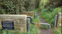
The Elsecar Greenway departs from the Dove Valley Trail and the start of this is alongside that busy and noisy road on a disused railway line which was used elsewhere as a heritage line from Elsecar. By the time this becomes evident our path has moved to the towpath of the old canal and in places evidence remains. Locks and bridges constructed of solid stone blocks explain why an attempt was made to bring back the boats.
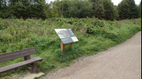
There's no sign of Hemingford Halt or the preserved colliery that the information boards records. It adds that volunteers work hard on the restoration of buildings, but their efforts are lost beyond the belt of trees that now divide us. It must have been very different when all the pits and works were in production as further boards try to show what it was like before the trees took over.
I made a detour off the route to look around the Elsecar Heritage Centre before rejoining the route. Well I thought I had rejoined the route. I locked onto an excellent wide surfaced path, that was until I checked the plot and found the Slow Way takes a faint walked path across the grass. So care is needed here.
Thanks to the sign at the foot of the straight climbing path I discover it was an incline that carried goods from Milton Ironworks to the canal basin information I had missed when walking down the include a week or so earlier.
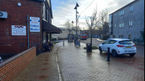
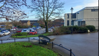
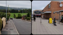
The recorded path across the recreation ground can be used to avoid any organised sporting event but at other times a direct path can be taken. Hoyland stands on a hill and that becomes very evident on this approach. We pass through the modern marketplace to a good and distinctive meeting place although a better place for buses, with a shelter is just short of the route end.
-
Share your thoughts
Share your views about this route, give it a star rating, indicate whether it should be verified or not.
Include information that will be useful to others considering to walk or wheel it.
You can add up to 15 photos.
Other Routes for Hoyland—Wath upon Dearne See all Slow Ways
Review this better route and help establish a trusted network of walking routes.
Suggest a better route if it better meets our methodology.
Share your thoughts