Description
From Fairmilehead cross roads turn right into Comiston Road and shortly afterwards turn right into a pedestrian lane. This leads into Bellrock Park which should be followed round to the left. Waterfield Road on the right leads into the Waterboard Field (Brough Park). This whole area used to be a large waterworks that supplied Edinburgh. Follow the path across the park and turn into Buckstone Howe. Turn left for a short distance and go through Buckstone Park. At the end turn right onto a track through the woods. This emerges from an avenue of yew trees into open paddocks and should be followed till it branches left. Follow the track through a little wood and after a cottage turn left. Keep going past Meadowhead Farm till Braid Hills Drive is reached. Just before the road, turn left to follow a bridle way through a wood on the edge of the golf course. When it reaches the road, cross the road. The bridle way is well used by horses and cyclists and so can be muddy. However, there is a pavement on the north side of Braid Hills Drive as an alternative. Either follow the Howe Dean Path (steps) or an informal path to its west (steep and possibly muddy) to meet the main track that goes through the Hermitage of Braid. Cross this track and take a path up some steps. This leads to a track through a community woodland on the site of an old quarry. This should be followed to the top (there are several possible paths) from where a path leads to the Royal Observatory on Blackford Hill. Follow a path on its east side. Turn right down the steep Observatory Road and take the first left into Blackford Hill Rise which snakes down to Ladysmith Road. Turn left and you arrive at a major cross roads. Cross over into Blackford Avenue which passes over a railway line then take the second right into West Relugas Road. Take the first left then cross over and keep going to a T-junction. On the far side a gate post surmounted by a griffon marks the start of Lover's Loan, which can be followed all the way to Sciennes Road. Turn left and right and cross over to Middle Meadow Walk. Faiedi1 can be followed all the way to Waverley station from here. However, as an alternative turn right at a junction and then left into George Square. This can be followed on either side or, if the gates are open, through the garden in the centre. Diagonally opposite where you come into the square, turn left towards Bristo Square. George Square is a mix of Georgian houses and more modern university buildings. Watch out for the rhinoceros! Go through the underpass under Potterrow and turn into West College Street . On the right is a door into the University of Edinburgh Old Quad, which is worth a look. Continue across Chambers Street then down steps into the Cowgate. Turn left and right into old Fishmarket Close, which is steep and is cobbled. This leads to the High Street. Turn left past St Giles and descend Advocates Close (more steps). This leads to Cockburn Street, which is a short distance from Waverley Station
From Fairmilehead cross roads turn right into Comiston Road and shortly afterwards turn right into a pedestrian lane. This leads into Bellrock Park which should be followed round to the left. Waterfield Road on the right leads into the Waterboard Field (Brough Park). This whole area used to be a large waterworks that supplied Edinburgh. Follow the path across the park and turn into Buckstone Howe. Turn left for a short distance and go through Buckstone Park. At the end turn right onto a track through the woods. This emerges from an avenue of yew trees into open paddocks and should be followed till it branches left. Follow the track through a little wood and after a cottage turn left. Keep going past Meadowhead Farm till Braid Hills Drive is reached. Just before the road, turn left to follow a bridle way through a wood on the edge of the golf course. When it reaches the road, cross the road. The bridle way is well used by horses and cyclists and so can be muddy. However, there is a pavement on the north side of Braid Hills Drive as an alternative. Either follow the Howe Dean Path (steps) or an informal path to its west (steep and possibly muddy) to meet the main track that goes through the Hermitage of Braid. Cross this track and take a path up some steps. This leads to a track through a community woodland on the site of an old quarry. This should be followed to the top (there are several possible paths) from where a path leads to the Royal Observatory on Blackford Hill. Follow a path on its east side. Turn right down the steep Observatory Road and take the first left into Blackford Hill Rise which snakes down to Ladysmith Road. Turn left and you arrive at a major cross roads. Cross over into Blackford Avenue which passes over a railway line then take the second right into West Relugas Road. Take the first left then cross over and keep going to a T-junction. On the far side a gate post surmounted by a griffon marks the start of Lover's Loan, which can be followed all the way to Sciennes Road. Turn left and right and cross over to Middle Meadow Walk. Faiedi1 can be followed all the way to Waverley station from here. However, as an alternative turn right at a junction and then left into George Square. This can be followed on either side or, if the gates are open, through the garden in the centre. Diagonally opposite where you come into the square, turn left towards Bristo Square. George Square is a mix of Georgian houses and more modern university buildings. Watch out for the rhinoceros! Go through the underpass under Potterrow and turn into West College Street . On the right is a door into the University of Edinburgh Old Quad, which is worth a look. Continue across Chambers Street then down steps into the Cowgate. Turn left and right into old Fishmarket Close, which is steep and is cobbled. This leads to the High Street. Turn left past St Giles and descend Advocates Close (more steps). This leads to Cockburn Street, which is a short distance from Waverley Station
Status
This route has been reviewed by 4 people.
There are no issues flagged.
Photos for Faiedi two

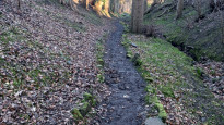
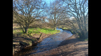

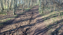

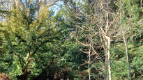
Photos of this route will appear when they are added to a review. You can review this route here.
Information
")
Route status - Live
Reviews - 4
Average rating -
Is this route good enough? - Yes (4)
There are currently no problems reported with this route.
Downloads - 2
Surveys
We are working to build-up a picture of what routes look like. To do that we are asking volunteers to survey routes so that we can communicate features, obstacles and challenges that may make a route desirable or not.
Slow Ways surveyors are asked to complete some basic online training, but they are not vetted. If you are dependent on the survey information being correct in order to complete a route, we recommend that you think critically about the information provided. You may also wish to wait until more than one survey has been completed.
Help people know more about this route by volunteering to submit a survey.
- Complete the survey training.
- Submit a survey for this route.
Geography information system (GIS) data
Total length
Maximum elevation
Minimum elevation
Start and end points
Fairmilehead
Grid Ref
NT2483568230
Lat / Lon
55.90129° / -3.20370°
Easting / Northing
324,835E / 668,230N
What3Words
truck.mimic.smoke
Edinburgh
Grid Ref
NT2569673813
Lat / Lon
55.95157° / -3.19147°
Easting / Northing
325,696E / 673,813N
What3Words
shape.pads.choice
| Fairmilehead | |
|---|---|
| Grid Ref | NT2483568230 |
| Lat / Lon | 55.90129° / -3.20370° |
| Easting / Northing | 324,835E / 668,230N |
| What3Words | truck.mimic.smoke |
| Edinburgh | |
|---|---|
| Grid Ref | NT2569673813 |
| Lat / Lon | 55.95157° / -3.19147° |
| Easting / Northing | 325,696E / 673,813N |
| What3Words | shape.pads.choice |
Sorry Land Cover data is not currently available for this route. Please check back later.
Other Routes for Fairmilehead—Edinburgh See all Slow Ways
Review this better route and help establish a trusted network of walking routes.
Suggest a better route if it better meets our methodology.