Description
I redrew this route because of the access problem at Gailey Wharf, leaving/joining the canal. I also avoided walking alongside the busy A449 by staying on the towpath for longer
I redrew this route because of the access problem at Gailey Wharf, leaving/joining the canal. I also avoided walking alongside the busy A449 by staying on the towpath for longer
Status
This route has been reviewed by 3 people.
There are no issues flagged.
Photos for Codpen two

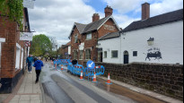
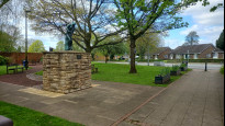
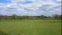
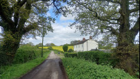


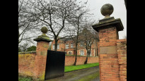


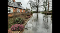
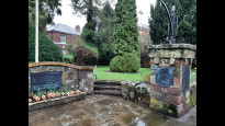
Photos of this route will appear when they are added to a review. You can review this route here.
Information
")
Route status - Live
Reviews - 3
Average rating -
Is this route good enough? - Yes (3)
There are currently no problems reported with this route.
Downloads - 1
Surveys
What is this route like?
Surveys are submitted by fellow users of this website and show what you might expect from this Slow Ways route. Scroll down the page to read more detailed surveys.
| Grade 3X based on 1 surveys | Sign up or log in to survey this route. | ||
|---|---|---|---|
| Description | Note | ||
| Grade 3: Route includes rough surfaces that may include small boulders, potholes, shallow ruts, loose gravel, short muddy sections. Access grade X: At least one stile, flight of steps or other obstacle that is highly likely to block access for wheelchair and scooter users. |
Grading is based on average scores by surveyors. This slow way has 1 surveys. | ||
| Full grading description | |||
Only people who have completed our training can become Slow Ways surveyors and submit a survey. We do not vet contributors, so we cannot guarantee the quality or completeness of the surveys they complete. If you are dependent on the information being correct we recommend reading and comparing surveys before setting off.
Survey Photos
Facilities
Facilities in the middle third of this route.
Challenges
Potential challenges reported on this route. Some challenges are seasonal.
Obstacles
Obstacles on this route.
Accessibility
Is this route step and stile free?
Measurements
Surveyors were asked to measure the narrowest and steepest parts of paths.
Narrowest part of path: no data
The steepest uphill gradient East: no data
The steepest uphill gradient West: no data
The steepest camber: no data
How clear is the waymarking on the route: Unclear in places (1)
Successfully completed
We asked route surveyors "Have you successfully completed this route with any of the following? If so, would you recommend it to someone with the same requirements?". Here is how they replied.
Recommended by an expert
We asked route surveyors "Are you a trained access professional, officer or expert? If so, is this route suitable for someone travelling with any of the following?" Here is how they replied.
Terrain
We asked route surveyors to estimate how much of the route goes through different kinds of terrain.
There is no data on how much of this route is on roads
There is no data on how much of this route is lit at night
Thereis no data on amount of route paved
There is no data on muddiness
There is no data on rough ground
There is no data on long grass
Report a problem with this data
1 surveys
Information from verified surveys.
Geography information system (GIS) data
Total length
Maximum elevation
Minimum elevation
Start and end points
Codsall
Grid Ref
SJ8643203296
Lat / Lon
52.62727° / -2.20188°
Easting / Northing
386,432E / 303,296N
What3Words
august.guess.remind
Penkridge
Grid Ref
SJ9224514196
Lat / Lon
52.72537° / -2.11626°
Easting / Northing
392,245E / 314,196N
What3Words
commended.mend.paths
| Codsall | |
|---|---|
| Grid Ref | SJ8643203296 |
| Lat / Lon | 52.62727° / -2.20188° |
| Easting / Northing | 386,432E / 303,296N |
| What3Words | august.guess.remind |
| Penkridge | |
|---|---|
| Grid Ref | SJ9224514196 |
| Lat / Lon | 52.72537° / -2.11626° |
| Easting / Northing | 392,245E / 314,196N |
| What3Words | commended.mend.paths |
Sorry Land Cover data is not currently available for this route. Please check back later.
reviews
Hugh Hudson
24 Apr 2024 (edited 25 Apr 2024)Walked from Codsall to Penkridge. An interesting and varied route. The Staffordshire Way section is 5* - I have walked it before but not recently. From Brewood eastwards the paths are less well used and maintained. I took a look at the horse pasture David mentions but retreated and chose to use the farm drive instead. Some field paths without clear marked lines. From CratefordRoad onwards going is easy, so overall I think 4 stars and a snail is fair.
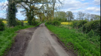
From Codsall to the canal at Brewood the route is entirely on the Staffordshire Way, which is easy to follow but has a few steps and stiles. Beyond Codsall all of the road sections are quiet apart from Port Lane which has a walkable verge. There was one gate that I had to climb because the sheep farmer had tied a temporary looking electric fence securely around the gate mechanism, probably to stop the young lambs escaping.
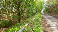
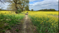
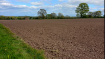
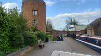
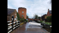
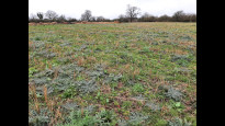
The Staffordshire Way leaves us to head north along the Shropshire Union canal, and we stay on the lane and follow streets out to the east side of Brewood. The first field path crosses a pasture, and the arable field beyond was ploughed, with no obvious sign of the path. Fortunately the stile at the far side was clearly visible. The lane beyond (Tinkers Lane) is surprisingly busy, the worst bit of road walking on the route.
From the junction of Somerford Lane and Tinkers Lane, a dilapidated stile takes us into a field subdivided into horse pastures, where there was no sign of any path infrastructure or any sign of a gap, stile or hurdle in the fences, so I retreated and used the farm drive slightly further north instead, passing a group of locals who ignored me rather than questioning what I was doing, so I suspect that most local walkers now use the drive. The drive leads into a yard, where the path continues to the left of the house over a couple of bridges.
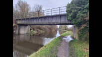
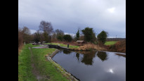
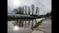
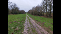
The path across to Crateford Lane is visible enough to follow, and the lane itself is quiet . There are pelican crossings over the busy A449, and we go straight on along the pavement on what is now the access road to an industrial estate beyond the railway and mostly beyond the canal. We head left onto the Staffs & Worcs canal, which takes us most of the way into Penkridge. This towpath is unsurfaced and a little muddy in places, but the wetter mud was entirely avoidable. Just beyond a footbridge we turn left up to Francis Green Lane, and follow pavements to the meeting point.
David Sanderson
29 Feb 2024A nice variety of towpath, lane and field. Safe, and thanks to it running along the Staffordshire Way mostly well signposted. There was a small section in Somerford where the local landowner keeps you guessing which route to take around their horses but that was an exception. The only section I might have changed would be in Brewood, where it stops following the Staffordshire Way. Had it continued it might have picked up some stops and shops, which this route lacks. Overall reasonably safe, direct and easy to follow.
-
Share your thoughts
Mary Oz
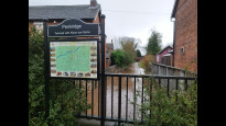
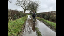
25 Feb 2024We walked from Penkridge after a lot of rain which introduced an element of “fun” to this walk! The first four miles were nice and easy along the towpath of the Staffs & Worcs Canal, although the path was very muddy! There had been a bridge strike just as we reached the section alongside the motorway (Bridge 81 Otherton Lane) but this will no doubt be repaired shortly.
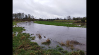
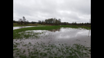
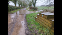
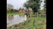
We had some problems between the A449 and Brewood. The road at OS Grid Ref: SJ 90391 09312 was completely flooded, but we managed to edge along the embankment and stay dry. (The rain put paid to that a bit later!!) Crossing the very full River Penk was dramatic but safe, but after passing the farm buildings we had to negotiate several small fields enclosed by electric fencing, with horses in them (OS Grid Ref: SJ 89510 08919). It was also poorly signposted here. We managed to get through safely but it wasn’t easy, and if I’d been on my own, I would have used the roads over Somerford Bridge, just to the north.
From Brewood, the going became a lot easier, with good field paths and lanes. There was a very short stretch of road at OS Grid Ref: SJ 87709 05948 where the traffic was very fast, but we had a wide verge.
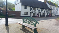
Codsall had a good number of shops, pubs and cafés, as did Penkridge. Both had railway stations, although on different lines. Brewood, not far from the middle, also had facilities.
In dry weather, I think this would be a very pleasant walk, but the electric fence section really knocked off a star or two for me.
-
Share your thoughts
Share your views about this route, give it a star rating, indicate whether it should be verified or not.
Include information that will be useful to others considering to walk or wheel it.
You can add up to 15 photos.
Other Routes for Codsall—Penkridge See all Slow Ways
Review this better route and help establish a trusted network of walking routes.
Suggest a better route if it better meets our methodology.
Share your thoughts