Connect Penkridge with Slow Ways
We’re creating a network of walking routes that connect all of Britain’s towns, cities and national parks
more walks and reviews are needed to fully connect Penkridge to the verified network. Can you give a hike and help?
Give a hike!Penkridge
Staffordshire
Slow Ways linking Penkridge and Cannock, Codsall, Great Wyrley, Newport (Telford and Wrekin), Rugeley, Stafford, Wheaton Aston
England / Staffordshire / Penkridge
Penkridge’s seven Slow Ways are 61% checked
Help connect Penkridge
Many Slow Ways have several route options. Some will be better than others, or good for different reasons.
Our goal is for each Slow Way to have at least one route that is verified and surveyed. To be verified – and get its snail badge – a route needs at least three positive reviews.
Give a hike and help get a for every one of Penkridge’s Slow Ways.
Walk to Penkridge from further afield
| Slow Way | Route | To do | ||||||||
|---|---|---|---|---|---|---|---|---|---|---|

Codsall—Penkridge
|
Codpen one |
|
|
U U |
|
Review me | Distance 16km/10mi | Ascent 98m | Descent 134m | |
Codsall—Penkridge
|
Codpen two |
|
3 X |
|
Enjoy me | Distance 16km/10mi | Ascent - | Descent - | ||

Newport (Telford and Wrekin)—Penkridge
|
Newppen one |
|
U U |
|
Pioneer me | Distance 24km/15mi | Ascent 138m | Descent 131m | ||
|
Penkridge—Cannock
|
Pencan one |
|
|
U U |
|
Double check | Distance 13km/8mi | Ascent 66m | Descent 116m | |

Penkridge—Cannock
|
Pencan two |
|
U U |
|
Review me | Distance 10km/6mi | Ascent - | Descent - | ||

Penkridge—Cannock
|
Pencan three |
|
U U |
|
Review me | Distance 10km/6mi | Ascent - | Descent - | ||
|
Penkridge—Great Wyrley
|
Pengre one |
|
U U |
|
Pioneer me | Distance 13km/8mi | Ascent 114m | Descent 54m | ||
|
Penkridge—Great Wyrley
|
Pengre two |
|
U U |
|
Pioneer me | Distance 13km/8mi | Ascent 55m | Descent 114m | ||

Penkridge—Great Wyrley
|
Pengre three |
|
U U |
|
Review me | Distance 12km/8mi | Ascent - | Descent - | ||
|
Penkridge—Rugeley
|
Penrug one |
|
|
U U |
|
Double check | Distance 14km/9mi | Ascent - | Descent - | |
|
Penkridge—Rugeley
|
Penrug two |
|
|
U U |
|
Double check | Distance 14km/9mi | Ascent 175m | Descent 180m | |

Penkridge—Rugeley
|
Penrug three |
|
U U |
|
Verify me | Distance 18km/11mi | Ascent - | Descent - | ||

Penkridge—Rugeley
|
Penrug four |
|
3 X |
|
Enjoy me | Distance 19km/12mi | Ascent - | Descent - | ||

Penkridge—Rugeley
|
Penrug five |
|
U U |
|
Review me | Distance 19km/12mi | Ascent - | Descent - | ||
|
Stafford—Penkridge
|
Stapen one |
|
U U |
|
Pioneer me | Distance 13km/8mi | Ascent 103m | Descent 97m | ||
|
Stafford—Penkridge
|
Stapen two |
|
U U |
|
Pioneer me | Distance 14km/9mi | Ascent 118m | Descent 113m | ||

Stafford—Penkridge
|
Stapen three |
|
2 X |
|
Enjoy me | Distance 12km/8mi | Ascent - | Descent - | ||

Wheaton Aston—Penkridge
|
Whepen one |
|
U U |
|
Review me | Distance 9km/6mi | Ascent 40m | Descent 70m |
Fancy stretching your legs a bit more?
If you’ve polished off all of the routes between Penkridge and its neighbours, how about walking its whole web?
This includes the great ring of routes that join its neighbours to each other!
Collective progress
51% of Penkridge’s seven route options are drawn, reviewed, surveyed and/or verified
18/18
13/18
3/18
3/18
11 people have contributed to Penkridge’s Slow Ways
1 people have pledged to walk and review a route
3 people have surveyed a route in Penkridge
184km out of 260km have been walked and reviewed
399km of reviews have been shared in Penkridge
Latest Updates
I took a look at the horse pasture David mentions but retreated and chose to use the farm drive instead....
Hugh Hudson
The only section I might have changed would be in Brewood, where it stops following the Staffordshire Way....
David Sanderson
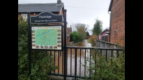
There had been a bridge strike just as we reached the section alongside the motorway (Bridge 81 Otherton Lane) but this will no doubt be repaired shortly. The road at OS Grid Ref: SJ 90391 09312 was completely flooded, but we managed to edge along the embankment and stay dry....
Mary Oz
I’ve corrected this on CodPen Two, by staying on the canal longer anyway and also not having to walk alongside the busy A449....
Mary Oz
The route follows the cycle path on the towpath, rather than the Staffordshire Way, which runs parallel on the other side of a fence. The route requires you rejoin the Staffordshire Way where there is no join....
David Sanderson
From The centre of Rugeley this was a good varied route with field, woodland, towpaths and moor paths to take you to Penkridge. The only small issue (as others have mentioned) is the section running parallel to the Camp Road. it was very brambly and I’m not sure how clear the path will be in summer....
Lynn Jackson
Paths on the ground do not always align with OS and some paths used are through access land so again no path on the map, follow the plotted route and all will be well. The path has a good surface all the way to meet the road south of Slitting Mill where our route makes a safe direct crossing into the access land of Cannock Chase onto another well surfaced signed track. From here our route has a short challenging section through the access land of Bednall Belt Plantation to the west of the road. You may choose Penrug-4 to avoid the stiles and field paths to enter Bednall by road....
Ken
The initial route out of Rugeley to Cannock chase was slightly confusing in places as it had been moved from the original OS marked route, but it was pretty obvious on the ground. Then there was a nice path and quiet roads into the very pretty, sleepy village of Bednall....
Mary Oz
Originally failed for photo below. But since fixed. Flag removed...
David Sanderson
Mainly footpath and some towpath using The Heart of England Way and Staffordshire Way in sections....
David Sanderson
Walked from Rugeley to Penkridge as a group.This is a good reasonably direct route,using bridleways footpaths and a section of canal towpath(staffs and worcs canal) Some sections were muddy,but generally the route was good underfoot,However one small section of path running parallel to Camp road was difficult to follow and in the summer could present a problem (when the bracken brambles etc start to grow)Plenty of interesting places to look at on route and two refreshment stops if needed(Cannock chase)No obstructions or issues and fairly well served by public transport at either end of the route....
J w ollid
Shortly beyond we come to a T junction where we turn right, following the wide track past more small lakes before tending left and uphill to reach the road (Marquis's Drive). This is forced right a couple of times by fire breaks but takes a fairly straight path onto the open higher part of the Chase, passing the Katyn memorial to reach Camp Road, which we cross and pass or stop at the Springslade Cafe. We follow the road down past the cafe then take a smaller track right uphill to a junction where we go sharp left to reach another forest road, where we go right a short distance to find a path left that goes through an open gate into an area of grassland, brambles and sparse trees. The clear wide path goes further north than the right of way line, and skirts round the far right (north west) corner of the field, then crosses another field on a well marked line to reach the bridge over the Staffordshire & Worcestershire canal....
Hugh Hudson
David Sanderson added Penrug four, a new walk from Penkridge to Rugeley
Walk this routeWe were planning to walk this route yesterday from Rugeley to Penkridge, and followed most of it, but we found an issue that currently blocks it, and as a result we explored other alternatives and found a different route into the Cannock Chase access land (see PENRUG 4)....
Hugh Hudson
Walk along the canal in Penkridge is a nice start if a bit of road noise from the M6....
Eddie Jones
Route seemed to mainly follow the road from here towards Penkridge so followed a different route via Fairoak Pools and Brindley Heath for a more scenic option....
Eddie Jones
David Sanderson added Penrug three, a new walk from Penkridge to Rugeley
Walk this routeSafe, easy to follow and deceptively direct. Pavement, towpath, country lane, and a brief section of field. Stiles and steps....
David Sanderson
Crossing the A5 can be tricky and there's also a road crossing at Hatherton which requires caution....
David Sanderson
This would probably be a four star route were it not for the road walking on the B5012 Cannock Road near Pillaton, which I would not fail as a dangerous, but would certainly describe as requiring caution. The first section of the walk along Stafford Road is safe, but not very interesting....
David Sanderson
David Sanderson added Pencan three, a new walk from Penkridge to Cannock
Walk this routeDavid Sanderson added Pengre three, a new walk from Penkridge to Great Wyrley
Walk this routeDavid Sanderson added Pencan two, a new walk from Penkridge to Cannock
Walk this routeHaving walked sections of it I can confirm that the Church Lane is a horrendous section of road to have to try and walk. It's a main road with no pavement and a blind corner. Too dangerous...
David Sanderson
It's a gorgeous route; it's safe, direct, and off-road; it's extremely pleasant; and it was surprisingly joyful (for someone who doesn't love canal walking). Full marks....
mtormey
There are pavements passing shops and pubs throughout Penkridge and the route joins the canal at the earliest possible occasion. The towpath of the Staffordshire and Worcestershire Canal takes you most of the route....
David Sanderson
The last section of the walk, alongside the river, past some shops and pub, and through Victoria Park was pleasant and interesting and mostly car-free....
Mary Oz
David Sanderson added Stapen three, a new walk from Stafford to Penkridge
Walk this routeI personally prefer quiet walks, so didn’t enjoy sections walking along main roads, and there is also a short section that follows a very busy but narrow country road that I did not feel safe to walk on....
Sarah Roberts
FP through Bickford Grange Farm is obstructed at both ends with dumped rubble and soil, passable with some care....
Margaret
The road from Pottal Pool to the junction with Cannock Rd is heavily trafficked with frequent large lorries. There is no verge to walk on and a Slow Wayer has indicated that this road is dangerous for pedestrians....
Slow Ways Cristie
The road from Pottal Pool to the junction with Cannock Rd is heavily trafficked with frequent large lorries. There is no verge to walk on and I think this road is dangerous for pedestrians...
Margaret
Tony Parsons added Penrug two, a new walk from Penkridge to Rugeley
Walk this routeTony Parsons added Penrug one, a new walk from Penkridge to Rugeley
Walk this routeSlow Ways added Newppen one, a new walk from Newport (Telford and Wrekin) to Penkridge
Walk this routeSlow Ways added Pengre one, a new walk from Penkridge to Great Wyrley
Walk this routeSlow Ways added Pengre two, a new walk from Penkridge to Great Wyrley
Walk this routeSlow Ways added Stapen one, a new walk from Stafford to Penkridge
Walk this routeSlow Ways added Stapen two, a new walk from Stafford to Penkridge
Walk this routeSlow Ways added Whepen one, a new walk from Wheaton Aston to Penkridge
Walk this route
Penkridge’s Slow Ways starting point
Grid ref
SJ9224514196
Lat / Lon
52.72537° / -2.11626°
Easting / Northing
392,245E / 314,196N
what3words
Fancy stretching your legs a bit more?
If you’ve polished off all of the routes between Penkridge and its neighbours, how about walking its whole web?
This includes the great ring of routes that join its neighbours to each other!
Facilities
Users have reported that the following facilities can be found within 1km of Penkridge's meeting point
Public toilet
Wheelchair accessible toilet
Supermarket or convenience shop
Restaurant, cafe or pub
Accommodation
Accommodation for under £50 a night
Campsite
Bothy
Free wifi
Mobility scooter hire
Off-road wheelchair hire
Disabled Parking
Train station
Bus stop
Ferry
Official ‘Walkers are Welcome’ town
Help us improve this information by signing up or logging in and carrying out a quick survey of Penkridge