Barrowford — Foulridge
Barrfou one

Slow Way not verified yet. Verify Barrfou here.
Slow Way not verified yet. Verify Barrfou here.
By a Slow Ways Volunteer on 07 Apr 2021
Description
This is a Slow Ways route connecting Barrowford and Foulridge.
Know of a better route? Share it here.
This is a Slow Ways route connecting Barrowford and Foulridge.
Know of a better route? Share it here.
Status
This route has been reviewed by 1 person.
There are no issues flagged.
Photos for Barrfou one


Photos of this route will appear when they are added to a review. You can review this route here.
Information
Route status - Live
Reviews - 1
Average rating -
Is this route good enough? - Yes (1)
There are currently no problems reported with this route.
Downloads - 5
Surveys
We are working to build-up a picture of what routes look like. To do that we are asking volunteers to survey routes so that we can communicate features, obstacles and challenges that may make a route desirable or not.
Slow Ways surveyors are asked to complete some basic online training, but they are not vetted. If you are dependent on the survey information being correct in order to complete a route, we recommend that you think critically about the information provided. You may also wish to wait until more than one survey has been completed.
Help people know more about this route by volunteering to submit a survey.
- Complete the survey training.
- Submit a survey for this route.
Geography information system (GIS) data
Total length
Maximum elevation
Minimum elevation
Start and end points
Barrowford
Grid Ref
SD8590039619
Lat / Lon
53.85262° / -2.21583°
Easting / Northing
385,900E / 439,619N
What3Words
baguette.bench.zealous
Foulridge
Grid Ref
SD8903042120
Lat / Lon
53.87518° / -2.16834°
Easting / Northing
389,030E / 442,120N
What3Words
testy.toasted.scorched
Barrfou One's land is
| Barrowford | |
|---|---|
| Grid Ref | SD8590039619 |
| Lat / Lon | 53.85262° / -2.21583° |
| Easting / Northing | 385,900E / 439,619N |
| What3Words | baguette.bench.zealous |
| Foulridge | |
|---|---|
| Grid Ref | SD8903042120 |
| Lat / Lon | 53.87518° / -2.16834° |
| Easting / Northing | 389,030E / 442,120N |
| What3Words | testy.toasted.scorched |
| Pasture | 61.9% |
| Urban | 32.0% |
| Water | 6.1% |
Data: Corine Land Cover (CLC) 2018
review
Mary Oz
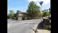
08 May 2024I walked from Barrowford to Foulridge on a pleasant spring day. Previously (when walking BarCol Two) I had crossed the footbridge into the park at Barrowford, a short way northeast of the start point. This was a more pleasing start than walking along the road, and the exit from the park is next to the Pendle Heritage Centre, opposite the entrance to the riverside path. At least by following the road I noticed the Tollhouse at Barrowford Bridge. The riverside path was full of bluebells and wild garlic.
The route continued with a section of the Leeds and Liverpool Canal, including a visit to the southwestern portal of Foulridge Tunnel. (Famously, a cow swam right through this mile-long tunnel in 1912!) The engineering and industrial heritage around here was fascinating, including an air shaft for the tunnel, and remnants of a former railway line. There was even a stream (for water from the reservoirs to top up the summit pound of the canal) which crossed above the canal tunnel! There was a bench with a view, above the tunnel portal.
The route then skirted the edge of Lower Foulridge Reservoir, where there were more bluebells, to reach the village of Foulridge. The northeastern portal of Foulridge Tunnel is only a short walk from the end point of this route. This was a really lovely walk!.
Share your views about this route, give it a star rating, indicate whether it should be verified or not.
Include information that will be useful to others considering to walk or wheel it.
You can add up to 15 photos.
There are no other routes for Barrowford — Foulridge
If you know a better way, then please let us know.
Review this better route and help establish a trusted network of walking routes.
Suggest a better route if it better meets our methodology.
Share your thoughts