Description
Route between Yeovil and Sherborne which avoids dangerous road walking
Route between Yeovil and Sherborne which avoids dangerous road walking
Status
This route has been reviewed by 2 people.
There are no issues flagged.
Photos for Yeoshe two


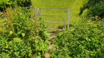


Photos of this route will appear when they are added to a review. You can review this route here.
Information

Route status - Live
Reviews - 2
Average rating -
Is this route good enough? - Yes (2)
There are currently no problems reported with this route.
Downloads - 9
Surveys
What is this route like?
Surveys are submitted by fellow users of this website and show what you might expect from this Slow Ways route. Scroll down the page to read more detailed surveys.
| Grade 2X based on 1 surveys | Sign up or log in to survey this route. | ||
|---|---|---|---|
| Description | Note | ||
| Grade 2: Mostly smooth and compacted surfaces, but there may be some loose gravel, muddy patches or cobbles. Access grade X: At least one stile, flight of steps or other obstacle that is highly likely to block access for wheelchair and scooter users. |
Grading is based on average scores by surveyors. This slow way has 1 surveys. | ||
| Full grading description | |||
Only people who have completed our training can become Slow Ways surveyors and submit a survey. We do not vet contributors, so we cannot guarantee the quality or completeness of the surveys they complete. If you are dependent on the information being correct we recommend reading and comparing surveys before setting off.
Survey Photos

Facilities
Facilities in the middle third of this route.
Challenges
Potential challenges reported on this route. Some challenges are seasonal.
Obstacles
Obstacles on this route.
Accessibility
Is this route step and stile free?
Measurements
Surveyors were asked to measure the narrowest and steepest parts of paths.
Narrowest part of path: no data
The steepest uphill gradient East: no data
The steepest uphill gradient West: no data
The steepest camber: no data
How clear is the waymarking on the route: Unclear in places (1)
Successfully completed
We asked route surveyors "Have you successfully completed this route with any of the following? If so, would you recommend it to someone with the same requirements?". Here is how they replied.
Recommended by an expert
We asked route surveyors "Are you a trained access professional, officer or expert? If so, is this route suitable for someone travelling with any of the following?" Here is how they replied.
Terrain
We asked route surveyors to estimate how much of the route goes through different kinds of terrain.
There is no data on how much of this route is on roads
There is no data on how much of this route is lit at night
Thereis no data on amount of route paved
There is no data on muddiness
There is no data on rough ground
There is no data on long grass
Report a problem with this data
1 surveys
Information from verified surveys.
Geography information system (GIS) data
Total length
Maximum elevation
Minimum elevation
Start and end points
Yeovil
Grid Ref
ST5567115976
Lat / Lon
50.94150° / -2.63230°
Easting / Northing
355,671E / 115,976N
What3Words
violin.cars.burn
Sherborne
Grid Ref
ST6380516470
Lat / Lon
50.94652° / -2.51659°
Easting / Northing
363,805E / 116,470N
What3Words
happier.rewriting.rainy
| Yeovil | |
|---|---|
| Grid Ref | ST5567115976 |
| Lat / Lon | 50.94150° / -2.63230° |
| Easting / Northing | 355,671E / 115,976N |
| What3Words | violin.cars.burn |
| Sherborne | |
|---|---|
| Grid Ref | ST6380516470 |
| Lat / Lon | 50.94652° / -2.51659° |
| Easting / Northing | 363,805E / 116,470N |
| What3Words | happier.rewriting.rainy |
Sorry Land Cover data is not currently available for this route. Please check back later.
reviews
Panifex
16 Jul 2023This is a fantastic walk across the South Somerset countryside.
The walk from Sherborne to Bradford Abbas is along well used footpaths, and is really simple to follow. As the previous review noted, there were some cows on Lenthay Common, but they were completely uniterested in me, or the many people walking dogs (and even letting them loose among the cattle...). The road into Bradford Abbas was surprisingly busy, so this took some care and attention.
The paths after Bradford Abbas are less well used, and in places quite overgrown. I enountered cattle in exactly the same place as the previous reviewer, around the railway bridge, but while they came over to check me out, they were not that excited by me (perhaps as I had no dog?). If you are very nervous around cows, then walking along the road to the south would probably be an acceptable alternative.
I struggled a bit to find the footpath to Rexe's Hollow just after Yeovil Junction station, but actually the plotting is good and I should have just paid more attention and followed exactly what it shows!
From here the walk into Yeovil is really pretty, along some interesting lanes (remember to pop off the lane and have a look at Jack the Treacle Eater, the fantastic folly on the Barwick estate. It's bonkers.) The walk through the woods is especially nice, though I suspect it might be a bit slippery in the winter - and you wouldn't want to slide down the steep slope into the road below. But still, much more pleasant than the road suggested in Yeoshe one.
All in all, a great walk that I would happily do again.
Helen Gough
28 May 2022I walked this route from Yeovil to Sherborne, and found that the paths are better maintained from Bradford Abbas to Sherborne. Between Yeovil and Clifton Maybank the paths were becoming overgrown in places, especially around field boundaries and I had to hack away at nettles several times.
I walked as always with my dog and we (well, mostly him) were chased by bullocks near the Bradford Viaduct. If I didn't love cheese so much, I would be happy to see the end of cows in the countryside.
From Bradford Abbas the land was mostly arable and the paths were wide and well maintained. There were plenty of people using them too. There were a few placid cows on Lenthay Common, obviously they are used to people and dogs as they didn't bat an eyelid as we passed.
There are plenty of places to eat and drink in Yeovil and Sherborne, and there is a pub in Bradford Abbas, roughly half way along the route.
-
Share your thoughts
Share your views about this route, give it a star rating, indicate whether it should be verified or not.
Include information that will be useful to others considering to walk or wheel it.
You can add up to 15 photos.
Other Routes for Yeovil—Sherborne See all Slow Ways
Review this better route and help establish a trusted network of walking routes.
Suggest a better route if it better meets our methodology.
Share your thoughts