Description
This is a Slow Ways route connecting Woodingdean and Saltdean.
Know of a better route? Share it here.
This is a Slow Ways route connecting Woodingdean and Saltdean.
Know of a better route? Share it here.
Status
This route has been reviewed by 4 people.
There are no issues flagged.
Photos for Woosal one


Photos of this route will appear when they are added to a review. You can review this route here.
Information
")
Route status - Live
Reviews - 4
Average rating -
Is this route good enough? - Yes (4)
There are currently no problems reported with this route.
Downloads - 2
Surveys
What is this route like?
Surveys are submitted by fellow users of this website and show what you might expect from this Slow Ways route. Scroll down the page to read more detailed surveys.
| Grade 3X based on 1 surveys | Sign up or log in to survey this route. | ||
|---|---|---|---|
| Description | Note | ||
| Grade 3: Route includes rough surfaces that may include small boulders, potholes, shallow ruts, loose gravel, short muddy sections. Access grade X: At least one stile, flight of steps or other obstacle that is highly likely to block access for wheelchair and scooter users. |
Grading is based on average scores by surveyors. This slow way has 1 surveys. | ||
| Full grading description | |||
Only people who have completed our training can become Slow Ways surveyors and submit a survey. We do not vet contributors, so we cannot guarantee the quality or completeness of the surveys they complete. If you are dependent on the information being correct we recommend reading and comparing surveys before setting off.
Survey Photos
Facilities
Facilities in the middle third of this route.
Challenges
Potential challenges reported on this route. Some challenges are seasonal.
Obstacles
Obstacles on this route.
Accessibility
Is this route step and stile free?
Measurements
Surveyors were asked to measure the narrowest and steepest parts of paths.
Narrowest part of path: no data
The steepest uphill gradient East: no data
The steepest uphill gradient West: no data
The steepest camber: no data
How clear is the waymarking on the route: Unclear in places (1)
Successfully completed
We asked route surveyors "Have you successfully completed this route with any of the following? If so, would you recommend it to someone with the same requirements?". Here is how they replied.
Recommended by an expert
We asked route surveyors "Are you a trained access professional, officer or expert? If so, is this route suitable for someone travelling with any of the following?" Here is how they replied.
Terrain
We asked route surveyors to estimate how much of the route goes through different kinds of terrain.
20.0% of the route is on roads (1)
18.0% of the route is lit at night (1)
20.0% of the route is paved (1)
30.0% of the route is muddy (1)
10.0% of the route is over rough ground (1)
There is no data on long grass
Report a problem with this data
1 surveys
Information from verified surveys.
Geography information system (GIS) data
Total length
Maximum elevation
Minimum elevation
Start and end points
Woodingdean
Grid Ref
TQ3551405849
Lat / Lon
50.83631° / -0.07685°
Easting / Northing
535,514E / 105,849N
What3Words
arena.hairspray.jingles
Saltdean
Grid Ref
TQ3809902054
Lat / Lon
50.80159° / -0.04159°
Easting / Northing
538,099E / 102,054N
What3Words
zinc.discount.camera
Woosal One's land is
| Woodingdean | |
|---|---|
| Grid Ref | TQ3551405849 |
| Lat / Lon | 50.83631° / -0.07685° |
| Easting / Northing | 535,514E / 105,849N |
| What3Words | arena.hairspray.jingles |
| Saltdean | |
|---|---|
| Grid Ref | TQ3809902054 |
| Lat / Lon | 50.80159° / -0.04159° |
| Easting / Northing | 538,099E / 102,054N |
| What3Words | zinc.discount.camera |
| Arable | 31.5% |
| Intertidal flats | 5.8% |
| Pasture | 23.8% |
| Urban | 38.8% |
Data: Corine Land Cover (CLC) 2018
reviews
Kelly Smith
29 Jul 2023Great walk out with some lovely ladies and the black tri tribe great route and it was buggy/beginner friendly. Also good transport links into town.
Catherine
29 Jul 2023Shoutout to Kelly for an amazing hike/walk, I really enjoyed enjoyed. It was also a great opportunity for me to network and meet new friends.
Thank you Kelly.
-
Share your thoughts
Martine
29 Jul 2023The route was great; lots of flat, easy land, a few hills but nothing taxing. The website & its navigation could be better, not terribly intuitive and a little clunky at times.
-
Demi
29 Jul 2023A beautiful, peaceful & most enjoyable walk - Thank you to our walk leader Kelly Smith!
-
Martine
29 Jul 2023Yes Kelly was incredible! Very experienced hiker and walk leader. Always feel safe and reassured when she is leading a hike. Definitely looking forward to more with her in future.
-
Share your thoughts
Bostal Boy
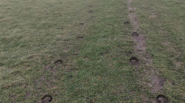
02 Mar 2022Walked from Woodingdean to Saltdean in the fog on 1st March. The walk is through residential streets at both ends with a surprisingly quiet section over the Downs in between.
The Downland paths were quite well defined, though there was a short section where I was following hoof prints in the grass due to the fog.
The chalky paths were quite slippery after overnight rain and there were some muddy sections, visibility was low in the fog, but Sat Nav kept me on the right track. Only one gate along the route, no stiles. The whole route is 6.5 km, there are no facilities along the way other than at the start and finish.
-
Share your thoughts
Share your views about this route, give it a star rating, indicate whether it should be verified or not.
Include information that will be useful to others considering to walk or wheel it.
You can add up to 15 photos.
There are no other routes for Woodingdean — Saltdean
If you know a better way, then please let us know.
Review this better route and help establish a trusted network of walking routes.
Suggest a better route if it better meets our methodology.
Share your thoughts