Winchester — Bishop's Waltham
Winbis one

Verified Slow Way
Verified by 100.00% of reviewers
Verified Slow Way
Verified by 100.00% of reviewers
By a Slow Ways Volunteer on 07 Apr 2021
Description
This is a Slow Ways route connecting Winchester and Bishop's Waltham.
Know of a better route? Share it here.
This is a Slow Ways route connecting Winchester and Bishop's Waltham.
Know of a better route? Share it here.
Status
This route has been reviewed by 3 people.
There are no issues flagged.
Photos for Winbis one


Photos of this route will appear when they are added to a review. You can review this route here.
Information
Route status - Live
Reviews - 3
Average rating -
Is this route good enough? - Yes (3)
There are currently no problems reported with this route.
Downloads - 17
Surveys
What is this route like?
Surveys are submitted by fellow users of this website and show what you might expect from this Slow Ways route. Scroll down the page to read more detailed surveys.
| Grade 0U based on 0 surveys | Sign up or log in to survey this route. | ||
|---|---|---|---|
| Description | Note | ||
| Currently ungraded. Access grade U: Currently ungraded. |
Grading is based on average scores by surveyors. This slow way has 0 surveys. | ||
| Full grading description | |||
Only people who have completed our training can become Slow Ways surveyors and submit a survey. We do not vet contributors, so we cannot guarantee the quality or completeness of the surveys they complete. If you are dependent on the information being correct we recommend reading and comparing surveys before setting off.
Survey Photos

We are working to build-up a picture of what routes look like. To do that we are asking volunteers to survey routes so that we can communicate features, obstacles and challenges that may make a route desirable or not.
Slow Ways surveyors are asked to complete some basic online training, but they are not vetted. If you are dependent on the survey information being correct in order to complete a route, we recommend that you think critically about the information provided. You may also wish to wait until more than one survey has been completed.
Help people know more about this route by volunteering to submit a survey.
- Complete the survey training.
- Submit a survey for this route.
Geography information system (GIS) data
Total length
Maximum elevation
Minimum elevation
Start and end points
Winchester
Grid Ref
SU4841629351
Lat / Lon
51.06146° / -1.31048°
Easting / Northing
448,416E / 129,351N
What3Words
gained.grips.pleasing
Bishop's Waltham
Grid Ref
SU5532417410
Lat / Lon
50.95347° / -1.21373°
Easting / Northing
455,324E / 117,410N
What3Words
scope.bookings.pops
Winbis One's land is
| Winchester | |
|---|---|
| Grid Ref | SU4841629351 |
| Lat / Lon | 51.06146° / -1.31048° |
| Easting / Northing | 448,416E / 129,351N |
| What3Words | gained.grips.pleasing |
| Bishop's Waltham | |
|---|---|
| Grid Ref | SU5532417410 |
| Lat / Lon | 50.95347° / -1.21373° |
| Easting / Northing | 455,324E / 117,410N |
| What3Words | scope.bookings.pops |
| Arable | 35.9% |
| Pasture | 46.0% |
| Urban | 14.4% |
| Woods | 3.7% |
Data: Corine Land Cover (CLC) 2018
reviews
Tom
23 Nov 2022A great walk that takes you through some beautiful Hampshire countryside. Covers country villages and hamlets, fields, woods, and lanes. The highlight for me was crossing an actual airfield as part of the route! The route passes a couple of pubs (in Upham and Owslebury) but as I walked early in the day, neither were open. It is a long walk, so bring supplies!
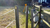
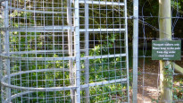
The route crosses a number of stiles, and parts of the route include uneven ground. The route also crossed a field of cows, and while they won't be there all the time, not everyone will like this. The route crosses a churchyard in Bishop's Waltham and the gates will likely be locked during night hours, requiring a small re-route.
When I walked this route at the end of August 2022, energy lines were being installed on part of the route between Bishop's Waltham and Upham, so I followed the roads to divert around it, then followed the trail back to the obstruction. The works were temporary so I assume access is now fully restored.
I navigated using GPS using the .gpx file listed for this route. It seemed off at points (by 50m or so), but this could well be due to how I set the file up on my GPS device. It would be useful to know whether anyone else had similar issues.
All in all, a really good, varied route that I'd recommend.
Thiswormjim
08 Sep 2022I walked this route in July. It was a very enjoyable route to walk, although it's pretty long. I found the road walking sections to be safe and I would walk it again.
Some parts of the route were not well written, like going through a field where no path exists. It's easy to get around these elements, though.
There are many stiles and gates.
-
Share your thoughts
Jonathan Bramley
09 Jun 2021This is a relatively straightforward route to walk. There are several stiles and so it is not accessible for those with restricted mobility. There are also a couple of sections on roadways but these are not busy roads. It also crosses a grass airstrip at one point but again this is not busy and it's easy to see at hear whether it's in use at the particular moment.
-
Share your thoughts
Share your views about this route, give it a star rating, indicate whether it should be verified or not.
Include information that will be useful to others considering to walk or wheel it.
You can add up to 15 photos.
There are no other routes for Winchester — Bishop's Waltham
If you know a better way, then please let us know.
Review this better route and help establish a trusted network of walking routes.
Suggest a better route if it better meets our methodology.
Share your thoughts