Description
Because of the concerns raised over the road section in Wilsal1, I have compiled and walked this route. I recorded it at 6.43 mi, so about a mile further. It follows the same start from Wilton up to Home Farm Rd, where it virtually immediately turns right through a metal kissing gate, and then travels upwards across Warren Down, and Hare Warren, on clear paths and tracks. It emerges at the Salisbury Racecourse. The route then follows the Old Shaftsbury Drove track, all the way to Harnham Slope. Having crossed the Harnham Rd, it follows the same route into Salisbury as Wilsal1. This route has 1 kissing gate, and 3 stiles.This route cuts out the questionable road section between Home Farm Rd, and the A3094
Because of the concerns raised over the road section in Wilsal1, I have compiled and walked this route. I recorded it at 6.43 mi, so about a mile further. It follows the same start from Wilton up to Home Farm Rd, where it virtually immediately turns right through a metal kissing gate, and then travels upwards across Warren Down, and Hare Warren, on clear paths and tracks. It emerges at the Salisbury Racecourse. The route then follows the Old Shaftsbury Drove track, all the way to Harnham Slope. Having crossed the Harnham Rd, it follows the same route into Salisbury as Wilsal1. This route has 1 kissing gate, and 3 stiles.This route cuts out the questionable road section between Home Farm Rd, and the A3094
Status
This route has been reviewed by 1 person.
There are no issues flagged.
Photos for Wilsal four
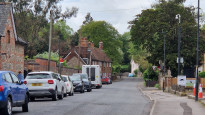


Photos of this route will appear when they are added to a review. You can review this route here.
Information

Route status - Live
Reviews - 1
Average rating -
Is this route good enough? - Yes (1)
There are currently no problems reported with this route.
Downloads - 0
Surveys
What is this route like?
Surveys are submitted by fellow users of this website and show what you might expect from this Slow Ways route. Scroll down the page to read more detailed surveys.
| Grade 3X based on 1 surveys | Sign up or log in to survey this route. | ||
|---|---|---|---|
| Description | Note | ||
| Grade 3: Route includes rough surfaces that may include small boulders, potholes, shallow ruts, loose gravel, short muddy sections. Access grade X: At least one stile, flight of steps or other obstacle that is highly likely to block access for wheelchair and scooter users. |
Grading is based on average scores by surveyors. This slow way has 1 surveys. | ||
| Full grading description | |||
Only people who have completed our training can become Slow Ways surveyors and submit a survey. We do not vet contributors, so we cannot guarantee the quality or completeness of the surveys they complete. If you are dependent on the information being correct we recommend reading and comparing surveys before setting off.
Survey Photos

Facilities
Facilities in the middle third of this route.
Challenges
Potential challenges reported on this route. Some challenges are seasonal.
Obstacles
Obstacles on this route.
Accessibility
Is this route step and stile free?
Measurements
Surveyors were asked to measure the narrowest and steepest parts of paths.
The narrowest part of the path is 45.0cm (1)
The steepest uphill gradient walking East 30.0% (1)
The steepest uphill gradient walking West 35.0% (1)
The steepest camber gradient across the path 5.0% (1)
How clear is the waymarking on the route: Clear (1)
Successfully completed
We asked route surveyors "Have you successfully completed this route with any of the following? If so, would you recommend it to someone with the same requirements?". Here is how they replied.
Recommended by an expert
We asked route surveyors "Are you a trained access professional, officer or expert? If so, is this route suitable for someone travelling with any of the following?" Here is how they replied.
Terrain
We asked route surveyors to estimate how much of the route goes through different kinds of terrain.
16.0% of the route is on roads (1)
32.0% of the route is lit at night (1)
54.0% of the route is paved (1)
8.0% of the route is muddy (1)
28.0% of the route is over rough ground (1)
0.0% of the route is through long grass (1)
Report a problem with this data
1 surveys
Information from verified surveys.
Geography information system (GIS) data
Total length
Maximum elevation
Minimum elevation
Start and end points
Wilton
Grid Ref
SU0951031320
Lat / Lon
51.08112° / -1.86561°
Easting / Northing
409,510E / 131,320N
What3Words
songbird.topples.relies
Salisbury
Grid Ref
SU1449029970
Lat / Lon
51.06888° / -1.79457°
Easting / Northing
414,490E / 129,970N
What3Words
firm.ankle.often
| Wilton | |
|---|---|
| Grid Ref | SU0951031320 |
| Lat / Lon | 51.08112° / -1.86561° |
| Easting / Northing | 409,510E / 131,320N |
| What3Words | songbird.topples.relies |
| Salisbury | |
|---|---|
| Grid Ref | SU1449029970 |
| Lat / Lon | 51.06888° / -1.79457° |
| Easting / Northing | 414,490E / 129,970N |
| What3Words | firm.ankle.often |
Sorry Land Cover data is not currently available for this route. Please check back later.
review
Brian
14 May 2023I walked this route yesterday, and it is about a mile longer than Wilsal1, but avoids the questionable road section from Home FarmRd to the A3094. There are fine views down into Salisbury. There are alternative routes into Salisbury from the Old Shaftsbury Drove, one which drops down through the S Wilts Golf Club and rejoins Wilsal1 at SU 114 294, but this crosses the racecourse, so is probably closed on race days. Whilst there is a footpath shown on maps down the Harnham Slope, you may require the services of a Tenzing Norgay to get you either up or down this slope.....not for the faint hearted. At the tee junction this route turns left, then hard right down a well used and shallower gradient track.
Share your views about this route, give it a star rating, indicate whether it should be verified or not.
Include information that will be useful to others considering to walk or wheel it.
You can add up to 15 photos.
Other Routes for Wilton—Salisbury See all Slow Ways
Review this better route and help establish a trusted network of walking routes.
Suggest a better route if it better meets our methodology.
Share your thoughts