Description
The route starts by following the route of the old railway out of Kimberley before heading north to join the Robin Hood Way at Bulwell Wood. Continues on Robin Hood Way through Bulwell Hall Park, and Bestwood Country Park (including Mill Lakes) before leaving it at Violet Hill to take small paths into Arnold
The route starts by following the route of the old railway out of Kimberley before heading north to join the Robin Hood Way at Bulwell Wood. Continues on Robin Hood Way through Bulwell Hall Park, and Bestwood Country Park (including Mill Lakes) before leaving it at Violet Hill to take small paths into Arnold
Status
This route has been reviewed by 1 person.
There are no issues flagged.
Photos for Kimarn one

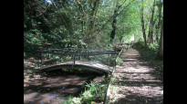
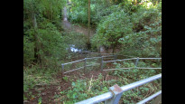


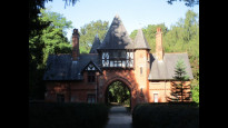
Photos of this route will appear when they are added to a review. You can review this route here.
Information

Route status - Live
Reviews - 1
Average rating -
Is this route good enough? - Yes (1)
There are currently no problems reported with this route.
Downloads - 2
Surveys
We are working to build-up a picture of what routes look like. To do that we are asking volunteers to survey routes so that we can communicate features, obstacles and challenges that may make a route desirable or not.
Slow Ways surveyors are asked to complete some basic online training, but they are not vetted. If you are dependent on the survey information being correct in order to complete a route, we recommend that you think critically about the information provided. You may also wish to wait until more than one survey has been completed.
Help people know more about this route by volunteering to submit a survey.
- Complete the survey training.
- Submit a survey for this route.
Geography information system (GIS) data
Total length
Maximum elevation
Minimum elevation
Start and end points
Kimberley
Grid Ref
SK4994944748
Lat / Lon
52.99775° / -1.25722°
Easting / Northing
449,949E / 344,748N
What3Words
rotate.began.audit
Arnold
Grid Ref
SK5859745370
Lat / Lon
53.00247° / -1.12827°
Easting / Northing
458,597E / 345,370N
What3Words
broad.taker.under
| Kimberley | |
|---|---|
| Grid Ref | SK4994944748 |
| Lat / Lon | 52.99775° / -1.25722° |
| Easting / Northing | 449,949E / 344,748N |
| What3Words | rotate.began.audit |
| Arnold | |
|---|---|
| Grid Ref | SK5859745370 |
| Lat / Lon | 53.00247° / -1.12827° |
| Easting / Northing | 458,597E / 345,370N |
| What3Words | broad.taker.under |
Sorry Land Cover data is not currently available for this route. Please check back later.
Other Routes for Kimberley—Arnold See all Slow Ways
Review this better route and help establish a trusted network of walking routes.
Suggest a better route if it better meets our methodology.