Description
ElmBro 1 is a bit uninspired, along fast busy roads. This is quieter and the same distance. It breaks away from ElmBro 1 after nearly a mile and uses quieter roads and three green spaces, the Harvington Estate (aka Harvington Woods or Playing Fields), Queensmead Recreation Ground and Glassmill Ponds.
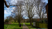
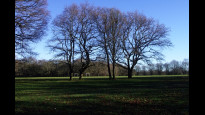
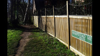
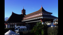
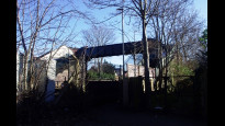
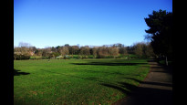
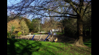
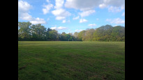
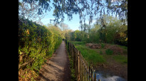
The entrances and paths through Harvington aren't shown clearly on maps. The western edge is basically unfenced so you just walk across the grass, towards the northern edge and keep roughly beside it through the woods on the most obvious 'straight through' path. The eastern end is a bit weird, easy enough to leave by but from the other way it just looks like a shadowy space behind a tree. If you see some new-ish houses labelled "Hampstead Mews Private" you're in the right place. Next is the "Chinese Garage", formerly a quirky pagoda styled 1950's petrol station but now a Grade II listed Tesco Express. There's a few shops there on Wickham Rd, and the entrance to Kelsey Park is just beyond has public toilets. There are a few short sections along busier roads, but it's basically along quiet, leafy and expensive roads until the railway footbridge, including a short steep bit down Kingswood Road with a view across to the parks and the back of the high street. Over the railway footbridge next - several dozen steps - then along the edge of Queensfield Rec (until you hit the River Beck if you cross the road and walk along the park edge). Then right down Glassmill Lane and into Glassmill Ponds (a ribbon park/path along the River Beck). At the other end of the park this route goes uphill on Ethelbert Rd to Bromley High Street opposite the Glades shopping centre (more public loos) then downhill to the station. But if you go straight on along Ravensbourne Rd you could avoid the busy high street
ElmBro 1 is a bit uninspired, along fast busy roads. This is quieter and the same distance. It breaks away from ElmBro 1 after nearly a mile and uses quieter roads and three green spaces, the Harvington Estate (aka Harvington Woods or Playing Fields), Queensmead Recreation Ground and Glassmill Ponds.
The entrances and paths through Harvington aren't shown clearly on maps. The western edge is basically unfenced so you just walk across the grass, towards the northern edge and keep roughly beside it through the woods on the most obvious 'straight through' path. The eastern end is a bit weird, easy enough to leave by but from the other way it just looks like a shadowy space behind a tree. If you see some new-ish houses labelled "Hampstead Mews Private" you're in the right place. Next is the "Chinese Garage", formerly a quirky pagoda styled 1950's petrol station but now a Grade II listed Tesco Express. There's a few shops there on Wickham Rd, and the entrance to Kelsey Park is just beyond has public toilets. There are a few short sections along busier roads, but it's basically along quiet, leafy and expensive roads until the railway footbridge, including a short steep bit down Kingswood Road with a view across to the parks and the back of the high street. Over the railway footbridge next - several dozen steps - then along the edge of Queensfield Rec (until you hit the River Beck if you cross the road and walk along the park edge). Then right down Glassmill Lane and into Glassmill Ponds (a ribbon park/path along the River Beck). At the other end of the park this route goes uphill on Ethelbert Rd to Bromley High Street opposite the Glades shopping centre (more public loos) then downhill to the station. But if you go straight on along Ravensbourne Rd you could avoid the busy high street
Status
This route has been reviewed by 3 people.
There are no issues flagged.
Photos for Elmbro two















Photos of this route will appear when they are added to a review. You can review this route here.
Information

Route status - Live
Reviews - 3
Average rating -
Is this route good enough? - Yes (3)
There are currently no problems reported with this route.
Downloads - 2
Surveys
We are working to build-up a picture of what routes look like. To do that we are asking volunteers to survey routes so that we can communicate features, obstacles and challenges that may make a route desirable or not.
Slow Ways surveyors are asked to complete some basic online training, but they are not vetted. If you are dependent on the survey information being correct in order to complete a route, we recommend that you think critically about the information provided. You may also wish to wait until more than one survey has been completed.
Help people know more about this route by volunteering to submit a survey.
- Complete the survey training.
- Submit a survey for this route.
Geography information system (GIS) data
Total length
Maximum elevation
Minimum elevation
Start and end points
Elmers End
Grid Ref
TQ3580068436
Lat / Lon
51.39871° / -0.04925°
Easting / Northing
535,800E / 168,436N
What3Words
haven.ticket.rooms
Bromley
Grid Ref
TQ4041968709
Lat / Lon
51.40004° / 0.01721°
Easting / Northing
540,419E / 168,709N
What3Words
face.newly.stages
| Elmers End | |
|---|---|
| Grid Ref | TQ3580068436 |
| Lat / Lon | 51.39871° / -0.04925° |
| Easting / Northing | 535,800E / 168,436N |
| What3Words | haven.ticket.rooms |
| Bromley | |
|---|---|
| Grid Ref | TQ4041968709 |
| Lat / Lon | 51.40004° / 0.01721° |
| Easting / Northing | 540,419E / 168,709N |
| What3Words | face.newly.stages |
Sorry Land Cover data is not currently available for this route. Please check back later.
reviews
Derick Rethans
17 Mar 2024I walked this on a warm early afternoon, from Elmers End to Bromley. It had rained significantly in the morning.
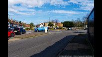
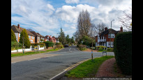
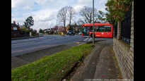
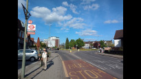
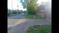
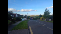
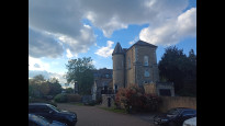
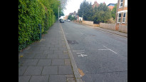
The first stretch was fairly residential (photo #1), along not-so-busy roads (photo #2). The woods and stream (photo #3, #4, #5) at Harvington Estate were lovely, but the walk along Hayes Way (photo #6), was less so, nor crossing Hayes Lane or Shortland Road (photo #7, #8). On Kingswood Road, the route goes down (photo #9), and you can see Bromley on the hill across the valley. After crossing the railway, you go up slowly but steadily through Queensmead Recreation Ground, leaving it soon enough to continue along some ponds which are being redone (photo #10), and then steeply up the hill to finish at Bromley proper.
A fairly good route, with lots of green, but also fairly residential.
JohnMyerson
20 Jan 2024Four stars because of the less interesting road walks, but Eden Park, Harvington Woods and Queensmead Recreation Ground are pleasant. I diverted after the larger pond up the steep paths through Church House Gardens to the Churchill Theatre in the High Street. Toilets in the Glades shopping centre are on the first floor above Waterstones.
-
Share your thoughts
Daisy C
09 May 2023 (edited 13 May 2023)I walked this on the same day as ElmBro 1 and it's definitely quieter traffic, with more off-road, and even greener along the roads. Where it doesn't overlap with ElmBro 1 the roads were actually incredibly quiet but perhaps that was a bit exaggerated by the Bank Holiday weekend. The two routes are the same length.
Some busy roads at the Elmers End end. Then a restful break in Harvington Woods along a gently winding path between freshly greened trees, cow parsley and bluebells. Some signs it had been a bit muddy but it was fine for me.
The 'Chinese Garage' was a quirky pagoda styled petrol station and is now a Grade II listed Tesco Express. There's a short row of shops on Wickham Road, and just beyond is the entrance to Kelsey Park where there are public toilets.
There were Coronation picnic parties with bunting and gazebos in Queensmead Rec. Glassmill Pond is almost adjoining. I expected an alley from maps but it's a nice ribbon park along a stream with ducks, small reed beds, and tree-lined grassy paths. Then up a small hill up to Bromley High Street which is a big shopping destination and generally heaving with crowds.
You could jump on a 367, 167 or 352 bus at various points on the route. There's a railway footbridge and steepish bits of road shortly before and after it (nice views though).
-
Share your thoughts
Share your views about this route, give it a star rating, indicate whether it should be verified or not.
Include information that will be useful to others considering to walk or wheel it.
You can add up to 15 photos.
Other Routes for Elmers End—Bromley See all Slow Ways
Review this better route and help establish a trusted network of walking routes.
Suggest a better route if it better meets our methodology.
Share your thoughts