Description
This is a Slow Ways route connecting Chapel-en-le-Frith and Edale.
Know of a better route? Share it here.
This is a Slow Ways route connecting Chapel-en-le-Frith and Edale.
Know of a better route? Share it here.
Status
This route has been reviewed by 6 people.
There are no issues flagged.
Photos for Chaeda one
Photos of this route will appear when they are added to a review. You can review this route here.
Information

Route status - Live
Reviews - 6
Average rating -
Is this route good enough? - Yes (6)
There are currently no problems reported with this route.
Downloads - 34
Surveys
What is this route like?
Surveys are submitted by fellow users of this website and show what you might expect from this Slow Ways route. Scroll down the page to read more detailed surveys.
| Grade 4X based on 1 surveys | Sign up or log in to survey this route. | ||
|---|---|---|---|
| Description | Note | ||
| Grade 4: Route includes very rough surfaces including deep ruts, steep loose gravel, unmade paths and deep muddy sections. Wheelchairs may experience traction/wheel spin issues. Access grade X: At least one stile, flight of steps or other obstacle that is highly likely to block access for wheelchair and scooter users. |
Grading is based on average scores by surveyors. This slow way has 1 surveys. | ||
| Full grading description | |||
Only people who have completed our training can become Slow Ways surveyors and submit a survey. We do not vet contributors, so we cannot guarantee the quality or completeness of the surveys they complete. If you are dependent on the information being correct we recommend reading and comparing surveys before setting off.
Survey Photos
Facilities
Facilities in the middle third of this route.
Challenges
Potential challenges reported on this route. Some challenges are seasonal.
Obstacles
Obstacles on this route.
Accessibility
Is this route step and stile free?
Measurements
Surveyors were asked to measure the narrowest and steepest parts of paths.
The narrowest part of the path is 20.0cm (1)
The steepest uphill gradient walking East 42.0% (1)
The steepest uphill gradient walking West 42.0% (1)
The steepest camber gradient across the path 10.0% (1)
How clear is the waymarking on the route: Unclear in places (1)
Successfully completed
We asked route surveyors "Have you successfully completed this route with any of the following? If so, would you recommend it to someone with the same requirements?". Here is how they replied.
Recommended by an expert
We asked route surveyors "Are you a trained access professional, officer or expert? If so, is this route suitable for someone travelling with any of the following?" Here is how they replied.
Terrain
We asked route surveyors to estimate how much of the route goes through different kinds of terrain.
There is no data on how much of this route is on roads
There is no data on how much of this route is lit at night
Thereis no data on amount of route paved
There is no data on muddiness
There is no data on rough ground
There is no data on long grass
Report a problem with this data
1 surveys
Information from verified surveys.
Geography information system (GIS) data
Total length
Maximum elevation
Minimum elevation
Start and end points
Chapel-en-le-Frith
Grid Ref
SK0588280770
Lat / Lon
53.32384° / -1.91315°
Easting / Northing
405,882E / 380,770N
What3Words
dreamers.cutback.footpath
Edale
Grid Ref
SK1225185321
Lat / Lon
53.36464° / -1.81736°
Easting / Northing
412,251E / 385,321N
What3Words
opened.licks.beaks
Chaeda One's land is
| Chapel-en-le-Frith | |
|---|---|
| Grid Ref | SK0588280770 |
| Lat / Lon | 53.32384° / -1.91315° |
| Easting / Northing | 405,882E / 380,770N |
| What3Words | dreamers.cutback.footpath |
| Edale | |
|---|---|
| Grid Ref | SK1225185321 |
| Lat / Lon | 53.36464° / -1.81736° |
| Easting / Northing | 412,251E / 385,321N |
| What3Words | opened.licks.beaks |
| Moors | 7.4% |
| Natural grass | 2.1% |
| Pasture | 69.0% |
| Peat bogs | 9.0% |
| Urban | 12.4% |
Data: Corine Land Cover (CLC) 2018
reviews
Hugh Hudson
25 Feb 2026 (edited 26 Feb 2026)Walked from Chapel to Edale. Mostly fine - the eastern part is entirely on good (if stony) paths but the climb out of Chapel needs care and is not always straightforward to navigate.
From Chapel we head east along Market Street then half left onto Sheffield Road, which takes us under the A6 bypass. Just beyond the junction we descend steps to a muddy path that follows the main road down to a footbridge over a brook. The path across the first field is not always clear, if in doubt bear left and follow the stream. Once at the stream level the path is easy to follow if a little wet in places, and eventually leads us to a farm lane through Bagshaw Hall. Our path left is signposted but could do with a few more waymarks - I assumed that the first stone step stile was on the path but there is an easier route past the house. Further up the path crosses into a wood, where the path climbs steeply - I suspect this section would require care in descent. Above the trees we are on a good old lane which leads to a boggy area outside Maglow Farm, whose track we use to get into the upper pasture where there is no clear path. The exit from this field has choices - there is an awkward step stile but the gate to the right is not locked, so I chose that easier option.
From here we are on a well made old road which eventually joins the old Sheffield Road. Take care on the short road section - there are narrow verges on both sides, and beyond Rushup Lane an avoiding path is available on the north side. The old road up the hill is an eroded and very stony holloway - there is a softer alternative along the right/south bank. We eventually reach the flatter hill top, taking the left branch and following Chapel Gate over the edge, where it slants down the hillside (fairly steeply and roughly in places). Lower down the old road heads right, but we take the obvious path straight on through some wet and muddy fields to reach the road below Barber Booth. The permissive path to Edale station is a vast improvement on the old route along the road.
Overall this is a good route, which could probably be made a little easier by using the Stonyford path up from Bagshaw, though I have not walked that so can't be sure.
Mary Oz
31 Jan 2025We walked this from Chapel to Edale on a freezing but sunny day in January, with a noticeable wind-chill as we got higher up!
There were two road crossings with fast cars, although with reasonable gaps and sightlines, so they were manageable. There were many stiles (traditional wood, stone steps through the walls, ladder stiles, stone squeeze stiles), narrow footbridges, gates large and tiny, steep slopes, muddy sections (including stepping stones at one point), and a few stairs.
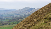
Most of these were on the way up to Mag Low. Once we reached the bridlepath it became much easier going, and easier navigation too. We had already had good views behind us, looking back down into Chapel, but now they really started to open out, and were spectacular in the low sunlight. We could see a ventilation shaft for the railway tunnel across to the north. After a bit we reached a road that we had to walk along, but there were reasonable verges. Where the Pennine Way crosses, there is a bus stop (infrequent bus 62, I think) and a side road to some accommodation.
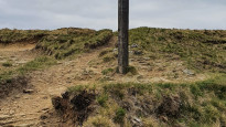
It’s not clear from the plot, but we actually left the road where the Pennine Way crosses, the track runs next to the road, behind a wall, before veering away to the north east. Here, there was a very sunken stony track (which looked ancient) and multiple trodden paths through the grass on the bank above. It was necessary to pay attention to which bits were badly eroded though.
Eventually we were at the summit, and crossing a well-worn path through the moorland. We saw buzzards and a kestrel, but I imagine lots of other wildlife lives here too.
The shallow gradient, fields and footpaths towards Barber Booth and Edale felt tamer, but were still pleasant and the setting sun provided lovely views.
The walk had its challenges, but was very rewarding.
-
Share your thoughts
Susan
31 Jan 2025I found this route pretty tough, but then I am a pensioner! It was a long uphill haul from Chapel-en-le-Frith to the highest point, and then a pretty steep descent down a stony path towards Edale. As we did this walk in January, the route involved a lot of mud. There were several stiles and some tight squeezes here and there, and there’s nowhere particular you can stop for a break, i.e. nowhere you can sit. Also, the start of the route is not near a railway station. On the plus side, the route is almost all off-road and the views are lovely.
Many SW routes are perfectly feasible wearing decent walking shoes, but this route definitely needs good walking boots. I’m really glad I did this route, but I’d have to gird my loins to do it a second time!.
-
Share your thoughts
Ecgbarrett
28 May 2022Walked from Chapel-en-le-Frith to Edale as part of the May 2022 Swarm. Overall, a great walk.
Straightforward way-finding on mostly well-marked paths, some really stunning views, both back towards Chapel-en-le-Frith and beyond as you get to Mag Low, and then over towards Kinder and Vale of Edale as you come down Chapel Gate. Some steep ascents and descents as you would expect but not too strenuous. May is a wonderful time for this walk with wild flowers everywhere. Looking forward to doing it again in winter.
Getting back to Chapel-en-le-Frith isn't that easy. If you don't want to go back the way you came, then train to Chinley and a two mile walk is the only decent public transport option. Fuel up at the Penny Pot Cafe while you wait for the train at Edale Station.
Livestock: Only one field with (mostly indifferent) cattle when I walked it. This was coming out of Chapel and up towards Bagshaw Farm but I followed the path (keep right towards the wall and find the 'stepping stones' marking the path through a muddy section) and was able to give them a wide berth. Sheep everywhere and be aware of nesting birds (so keep dogs on a lead!)
Other hazards: A few (courteous) mountain bikers on Chapel Gate and a sky full of paragliders over Rushup Edge… Lots of stiles. The ladder stile at Mag Low has a very loose top step so watch your footing. A couple of tight squeeze stiles!
Walking poles: on a scale of 1 (=nah, more trouble than they're worth) to 5 (=can't do it without them) this is a 2.5 - 3 for me. Helpful on the steep descents.
-
Ecgbarrett
29 May 2022(PS Paragliders are only a hazard if you can't stop staring at them and stumble...!)
-
Share your thoughts
Philtooze
16 May 2022My comments are similar to the last review. Great walk up to the ridge between Mam Tor and Kinder. Travelled by train to edale and returned via the station at chinley a further 2 mile walk, great station cafe at Edale.
-
Share your thoughts
Bshepherd
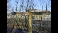
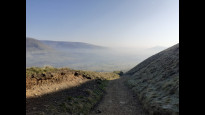
27 Mar 2022I walked this route from Edale to Chapel en le Frith. It was both a beautiful walk (especially the views back into Edale and the thrill of being on the top). There route is well signed between Edale and Barber Booth, and uses bridleway for much of the route. There's a fiddly bit of route finding nearer Chapel, but otherwise a simple walk. The benefit of going over a hill is that you have a good view of where you're going!.
-
Share your thoughts
Share your views about this route, give it a star rating, indicate whether it should be verified or not.
Include information that will be useful to others considering to walk or wheel it.
You can add up to 15 photos.
There are no other routes for Chapel-en-le-Frith — Edale
If you know a better way, then please let us know.
Review this better route and help establish a trusted network of walking routes.
Suggest a better route if it better meets our methodology.
Share your thoughts