Ashbourne — Wirksworth
Ashwir four

Slow Way not verified yet. Verify Ashwir here.
Slow Way not verified yet. Verify Ashwir here.
By Ken on 11 Feb 2024
Description
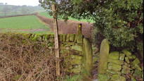
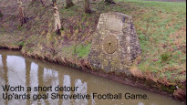
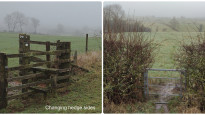
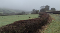
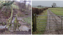
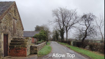
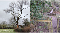
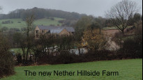
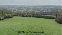
This takes a high level route above the Henmoor Brook to find dryer ground. Best avoid this Slow Way on Shrove Tuesday and Ash Wednesday. A couple of hedge side changes which I’ve tried to highlight in the plot
This takes a high level route above the Henmoor Brook to find dryer ground. Best avoid this Slow Way on Shrove Tuesday and Ash Wednesday. A couple of hedge side changes which I’ve tried to highlight in the plot
Status
This route has been reviewed by 1 person.
There are no issues flagged.
Photos for Ashwir four


Photos of this route will appear when they are added to a review. You can review this route here.
Information
Route status - Live
Reviews - 1
Average rating -
Is this route good enough? - Yes (1)
There are currently no problems reported with this route.
Downloads - 0
Surveys
We are working to build-up a picture of what routes look like. To do that we are asking volunteers to survey routes so that we can communicate features, obstacles and challenges that may make a route desirable or not.
Slow Ways surveyors are asked to complete some basic online training, but they are not vetted. If you are dependent on the survey information being correct in order to complete a route, we recommend that you think critically about the information provided. You may also wish to wait until more than one survey has been completed.
Help people know more about this route by volunteering to submit a survey.
- Complete the survey training.
- Submit a survey for this route.
Geography information system (GIS) data
Total length
Maximum elevation
Minimum elevation
Start and end points
Ashbourne
Grid Ref
SK1806646458
Lat / Lon
53.01514° / -1.73216°
Easting / Northing
418,066E / 346,458N
What3Words
reefs.compacts.single
Wirksworth
Grid Ref
SK2864053981
Lat / Lon
53.08231° / -1.57389°
Easting / Northing
428,640E / 353,981N
What3Words
tastings.limes.buckling
| Ashbourne | |
|---|---|
| Grid Ref | SK1806646458 |
| Lat / Lon | 53.01514° / -1.73216° |
| Easting / Northing | 418,066E / 346,458N |
| What3Words | reefs.compacts.single |
| Wirksworth | |
|---|---|
| Grid Ref | SK2864053981 |
| Lat / Lon | 53.08231° / -1.57389° |
| Easting / Northing | 428,640E / 353,981N |
| What3Words | tastings.limes.buckling |
Sorry Land Cover data is not currently available for this route. Please check back later.
Other Routes for Ashbourne—Wirksworth See all Slow Ways
Review this better route and help establish a trusted network of walking routes.
Suggest a better route if it better meets our methodology.