Description
This is a good route between Abercarn and Risca.
It follows a similar route to Aberis Two, but goes via Crosskeys Station and shops and includes more walking alongside roads as a result
This is a good route between Abercarn and Risca.
It follows a similar route to Aberis Two, but goes via Crosskeys Station and shops and includes more walking alongside roads as a result
Status
This route has been reviewed by 2 people.
There are no issues flagged.
Photos for Aberis three

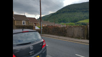
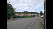
Photos of this route will appear when they are added to a review. You can review this route here.
Information

Route status - Live
Reviews - 2
Average rating -
Is this route good enough? - Yes (2)
There are currently no problems reported with this route.
Downloads - 1
Surveys
We are working to build-up a picture of what routes look like. To do that we are asking volunteers to survey routes so that we can communicate features, obstacles and challenges that may make a route desirable or not.
Slow Ways surveyors are asked to complete some basic online training, but they are not vetted. If you are dependent on the survey information being correct in order to complete a route, we recommend that you think critically about the information provided. You may also wish to wait until more than one survey has been completed.
Help people know more about this route by volunteering to submit a survey.
- Complete the survey training.
- Submit a survey for this route.
Geography information system (GIS) data
Total length
Maximum elevation
Minimum elevation
Start and end points
Abercarn
Grid Ref
ST2157094840
Lat / Lon
51.64687° / -3.13495°
Easting / Northing
321,570E / 194,840N
What3Words
prank.fortnight.hitters
Risca
Grid Ref
ST2446890212
Lat / Lon
51.60566° / -3.09207°
Easting / Northing
324,468E / 190,212N
What3Words
takers.forest.crinkled
| Abercarn | |
|---|---|
| Grid Ref | ST2157094840 |
| Lat / Lon | 51.64687° / -3.13495° |
| Easting / Northing | 321,570E / 194,840N |
| What3Words | prank.fortnight.hitters |
| Risca | |
|---|---|
| Grid Ref | ST2446890212 |
| Lat / Lon | 51.60566° / -3.09207° |
| Easting / Northing | 324,468E / 190,212N |
| What3Words | takers.forest.crinkled |
Sorry Land Cover data is not currently available for this route. Please check back later.
Other Routes for Abercarn—Risca See all Slow Ways
Review this better route and help establish a trusted network of walking routes.
Suggest a better route if it better meets our methodology.