Abbey Wood — Erith
Abberi two

Slow Way not verified yet. Verify Abberi here.
Slow Way not verified yet. Verify Abberi here.
By Daisy C on 24 Feb 2024
Description
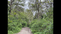
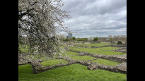
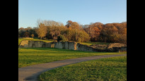
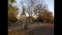
This is a pleasant and green route through Lenses Abbey Woods (ancient woodland and abbey ruins), Franks Park and along the Thames waterfront at Erith, linked by quieter residential streets. It's an improved version of AbbEri one which required a certain amount of winging it (or winged flight) around Abbey Wood station and through Lesnes Abbey Woods park and woodlands.
There's a nice kiosk and picnic tables by the LA Wds Lodge and a couple of small shops between LA Wds and F Pk. Around there you can also access a few bus routes, or take a short walk to Belvedere Station.
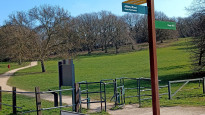
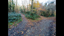
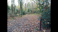
If starting from Abbey Wood Station entrance cross the road immediately outside and turn right along the flyover. This seems an unpromising start but at the bottom is a meadow which is the closest part of LA Woods to the station. Turn into it, keeping to the left then along a small lane to come out opposite the section of the woods with the Abbey ruins and the Lodge, kiosk and toilets. Head past these, keeping the bulk of the woodland on your right until the playground. This is where you turn into the woods proper although the paths roughly parallel the woodland edge. You will meet up with the Green Chain Walk (section 2) and from there it's very easy to follow the "G-C" markers and fingerposts all the way to Erith Station.
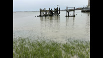
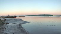
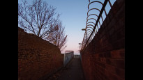
At Erith the path goes along the Thames waterfront. This was a highlight of my own walk but there are a few blind corners on the sometimes narrow path so you could follow the "Link to Erith Station" signs, basically using West St to cut out the river altogether.
As well as making the route feasible and easy to use in Abbey Wood there's a change in Franks Park to use the Green Chain Walk, which you would already be using either side. The path used in AbbEri one, nearer the bottom edge of the park is just as good bar the signage.
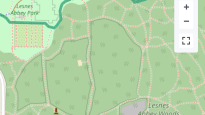
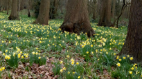
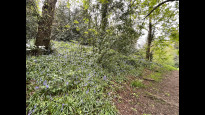
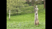
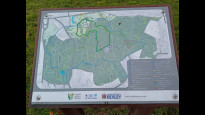
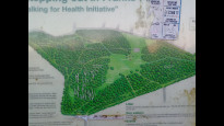
Edited to add: If you walk this route between mid February and early May it's well worth a detour to see the Lesnes Abbey spring flowers, particularly the unusual wild daffodils in Feb/Mar but as these fade sheets of wood anemones and then bluebells take over. There aren't that many actually on this route but some areas south of the Lodge and Abbey have been protected from trampling with spectacular results. The photo is from one of those areas, and on the little map you can see the thin black line marking the edges of the enclosures
This is a pleasant and green route through Lenses Abbey Woods (ancient woodland and abbey ruins), Franks Park and along the Thames waterfront at Erith, linked by quieter residential streets. It's an improved version of AbbEri one which required a certain amount of winging it (or winged flight) around Abbey Wood station and through Lesnes Abbey Woods park and woodlands.
There's a nice kiosk and picnic tables by the LA Wds Lodge and a couple of small shops between LA Wds and F Pk. Around there you can also access a few bus routes, or take a short walk to Belvedere Station.
If starting from Abbey Wood Station entrance cross the road immediately outside and turn right along the flyover. This seems an unpromising start but at the bottom is a meadow which is the closest part of LA Woods to the station. Turn into it, keeping to the left then along a small lane to come out opposite the section of the woods with the Abbey ruins and the Lodge, kiosk and toilets. Head past these, keeping the bulk of the woodland on your right until the playground. This is where you turn into the woods proper although the paths roughly parallel the woodland edge. You will meet up with the Green Chain Walk (section 2) and from there it's very easy to follow the "G-C" markers and fingerposts all the way to Erith Station.
At Erith the path goes along the Thames waterfront. This was a highlight of my own walk but there are a few blind corners on the sometimes narrow path so you could follow the "Link to Erith Station" signs, basically using West St to cut out the river altogether.
As well as making the route feasible and easy to use in Abbey Wood there's a change in Franks Park to use the Green Chain Walk, which you would already be using either side. The path used in AbbEri one, nearer the bottom edge of the park is just as good bar the signage.
Edited to add: If you walk this route between mid February and early May it's well worth a detour to see the Lesnes Abbey spring flowers, particularly the unusual wild daffodils in Feb/Mar but as these fade sheets of wood anemones and then bluebells take over. There aren't that many actually on this route but some areas south of the Lodge and Abbey have been protected from trampling with spectacular results. The photo is from one of those areas, and on the little map you can see the thin black line marking the edges of the enclosures
Status
This route has been reviewed by 2 people.
There are no issues flagged.
Photos for Abberi two


Photos of this route will appear when they are added to a review. You can review this route here.
Information
Route status - Live
Reviews - 2
Average rating -
Is this route good enough? - Yes (2)
There are currently no problems reported with this route.
Downloads - 1
Surveys
We are working to build-up a picture of what routes look like. To do that we are asking volunteers to survey routes so that we can communicate features, obstacles and challenges that may make a route desirable or not.
Slow Ways surveyors are asked to complete some basic online training, but they are not vetted. If you are dependent on the survey information being correct in order to complete a route, we recommend that you think critically about the information provided. You may also wish to wait until more than one survey has been completed.
Help people know more about this route by volunteering to submit a survey.
- Complete the survey training.
- Submit a survey for this route.
Geography information system (GIS) data
Total length
Maximum elevation
Minimum elevation
Start and end points
Abbey Wood
Grid Ref
TQ4738479026
Lat / Lon
51.49098° / 0.12157°
Easting / Northing
547,385E / 179,026N
What3Words
mixer.swift.palace
Erith
Grid Ref
TQ5113078110
Lat / Lon
51.48176° / 0.17509°
Easting / Northing
551,130E / 178,110N
What3Words
orchestra.strut.analogy
| Abbey Wood | |
|---|---|
| Grid Ref | TQ4738479026 |
| Lat / Lon | 51.49098° / 0.12157° |
| Easting / Northing | 547,385E / 179,026N |
| What3Words | mixer.swift.palace |
| Erith | |
|---|---|
| Grid Ref | TQ5113078110 |
| Lat / Lon | 51.48176° / 0.17509° |
| Easting / Northing | 551,130E / 178,110N |
| What3Words | orchestra.strut.analogy |
Sorry Land Cover data is not currently available for this route. Please check back later.
Other Routes for Abbey Wood—Erith See all Slow Ways
Review this better route and help establish a trusted network of walking routes.
Suggest a better route if it better meets our methodology.