Description
This is a Slow Ways route connecting Kimberley and Hucknall.
Know of a better route? Share it here.
This is a Slow Ways route connecting Kimberley and Hucknall.
Know of a better route? Share it here.
Status
This route has been reviewed by 4 people.
There are no issues flagged.
Photos for Kimhuc one


Photos of this route will appear when they are added to a review. You can review this route here.
Information
")
Route status - Live
Reviews - 4
Average rating -
Is this route good enough? - Yes (4)
There are currently no problems reported with this route.
Downloads - 4
Surveys
What is this route like?
Surveys are submitted by fellow users of this website and show what you might expect from this Slow Ways route. Scroll down the page to read more detailed surveys.
| Grade 2X based on 1 surveys | Sign up or log in to survey this route. | ||
|---|---|---|---|
| Description | Note | ||
| Grade 2: Mostly smooth and compacted surfaces, but there may be some loose gravel, muddy patches or cobbles. Access grade X: At least one stile, flight of steps or other obstacle that is highly likely to block access for wheelchair and scooter users. |
Grading is based on average scores by surveyors. This slow way has 1 surveys. | ||
| Full grading description | |||
Only people who have completed our training can become Slow Ways surveyors and submit a survey. We do not vet contributors, so we cannot guarantee the quality or completeness of the surveys they complete. If you are dependent on the information being correct we recommend reading and comparing surveys before setting off.
Survey Photos
Facilities
Facilities in the middle third of this route.
Challenges
Potential challenges reported on this route. Some challenges are seasonal.
Obstacles
Obstacles on this route.
Accessibility
Is this route step and stile free?
Measurements
Surveyors were asked to measure the narrowest and steepest parts of paths.
Narrowest part of path: no data
The steepest uphill gradient East: no data
The steepest uphill gradient West: no data
The steepest camber: no data
We don't have clear data on the waymarking (1)
Successfully completed
We asked route surveyors "Have you successfully completed this route with any of the following? If so, would you recommend it to someone with the same requirements?". Here is how they replied.
Recommended by an expert
We asked route surveyors "Are you a trained access professional, officer or expert? If so, is this route suitable for someone travelling with any of the following?" Here is how they replied.
Terrain
We asked route surveyors to estimate how much of the route goes through different kinds of terrain.
There is no data on how much of this route is on roads
There is no data on how much of this route is lit at night
Thereis no data on amount of route paved
There is no data on muddiness
There is no data on rough ground
There is no data on long grass
Report a problem with this data
1 surveys
Information from verified surveys.
Geography information system (GIS) data
Total length
Maximum elevation
Minimum elevation
Start and end points
Kimberley
Grid Ref
SK4994944748
Lat / Lon
52.99775° / -1.25722°
Easting / Northing
449,949E / 344,748N
What3Words
rotate.began.audit
Hucknall
Grid Ref
SK5400049330
Lat / Lon
53.03855° / -1.19610°
Easting / Northing
454,000E / 349,330N
What3Words
pushed.intent.acute
Kimhuc One's land is
| Kimberley | |
|---|---|
| Grid Ref | SK4994944748 |
| Lat / Lon | 52.99775° / -1.25722° |
| Easting / Northing | 449,949E / 344,748N |
| What3Words | rotate.began.audit |
| Hucknall | |
|---|---|
| Grid Ref | SK5400049330 |
| Lat / Lon | 53.03855° / -1.19610° |
| Easting / Northing | 454,000E / 349,330N |
| What3Words | pushed.intent.acute |
| Arable | 28.7% |
| Urban | 71.3% |
Data: Corine Land Cover (CLC) 2018
reviews
Hugh Hudson
28 Apr 2023 (edited 29 Apr 2023)Walked from Hucknall to Kimberley. A good and fairly direct route.
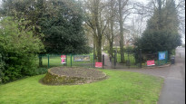
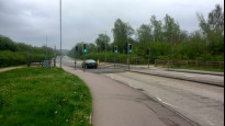
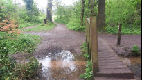
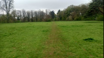
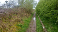
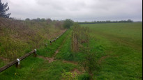
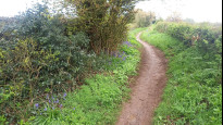
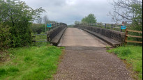
Leaving the meeting point at Hucknall station we go up the steps and turn left (if steps are a problem follow the ramped path through the car park). We follow Station Road then cross the pelican crossing to continue up Duke Street, then left and right onto Park Drive. It might be tempting to vary the route a little to stray into Titchfield Park, but we follow the roads out of Hucknall and take the signposted cycle track to the bypass. We emerge at the roundabout, where it is more sensible to use the pelican crossing to the left than to attempt the straight line crossing. We continue down the bridleway, passing the entrance to Merlin Park (which must have been created as part of the housing development, and although we pass both ends of the park the route through it is longer than the route we take). Crossing into Bulwell Hall Park, there is a footbridge accessed up a couple of half steps, and from here the trodden line across the field ahead is clear. We pass the golf course club house and go left/down slightly to pick up the Robin Hood Way path, which we follow out of the golf course and along the edge of the old Hucknall airfield.
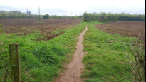
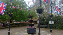
The right of way stays inside the fence, but there are now enough gaps in the fence to encourage people to walk on the field, and this has led to the old path becoming a little overgrown in places. We go straight on through the allotments then turn right up the Blenheim Lane, passing another entrance to Merlin Park, a farm and a fishing lake then leaving the Robin Hood way on the unsignposted path right that leads along the edge of the wood and continues along a hedgerow between fields. This path gets a little wet and muddy in places. We take the path right through the field that leads to the M1 bridge, then follow the lane past industrial buildings to emerge on Main Road. We cross and go a short distance left, then turn right up Newdigate Street which we follow into the centre of Kimberley and the meeting point.
John Hay
25 Mar 2022Finding the start was a little tricky, but interesting as it was an old railway.
-
Share your thoughts
StephenWalker
23 Jan 2022Walked from Hucknall. Crossing the by-pass head to the left (Nottingham) side of the roundabout, where there is a pedestrian/horse crossing leading onto the new footpath. Approaching Bulwell Hall Park on the good path head straight ahead to the bridge and then straight ahead up the worn grass trod to reach the car parking and club house.
The section around the former airfield fence and boundary of the golf course has been hemmed in by an earth and rubble bank, and the path was muddy on the day I walked it (January),
Route finding was straight forward.
-
Share your thoughts
Ken
24 Nov 2021Hucknall to Kimberley, no stiles or even gates as I recall. No cattle. Pavements on all road sections and generally good path surfaces. Cafe about half way in Bulwell Hall Park at the Golf Club.
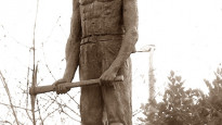
Hucknall more recently was a mining town which is recorded along with being the burial place of Byron. Look out along the route for the home of Eric Coates, who I may hear you ask, until I tell you he composed the Dambusters March which we still hum as we weave around the room with arms outstretched.
The exit from Hucknall is not through but alongside Titchfield Park and perhaps the posh area of the town before crossing the bypass road. Here I nearly went wrong so follow the plot to arrive in Bulwell Hall Park where the golf club has an open to all cafe.
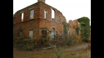
You will not find the hall built in 1770, it was demolished in 1958 after ravages of war time requisition and mining subsidence. All that remains today is the large derelict Grade II stable block for which after years of neglect Nottingham City Council, the owner, seek a grant to refurbish.
The path next follows the boundary between the city and county where a large area of mown grass appears to be in limbo. Is it a recreation area or land awaiting more development? The path network is a mess here with a newly laid wide track and original rights of way but no direct link between them.
This section of the route is also used by Kimarn one which I have also reviewed so I was pleased when this route turned off to use a different bridge over the motorway. Not much more to be said, pavement walking to arrive at the meeting point in Kimberley.
-
Share your thoughts
Share your views about this route, give it a star rating, indicate whether it should be verified or not.
Include information that will be useful to others considering to walk or wheel it.
You can add up to 15 photos.
There are no other routes for Kimberley — Hucknall
If you know a better way, then please let us know.
Review this better route and help establish a trusted network of walking routes.
Suggest a better route if it better meets our methodology.
Share your thoughts