Bexleyheath — Erith
Bexeri two

Slow Way not verified yet. Verify Bexeri here.
Slow Way not verified yet. Verify Bexeri here.
By Daisy C on 25 Feb 2023
Description
This is a short and quiet route through residential streets plus two medium sized parks, Martens Grove and Barnehurst Open Space. Although it is about 1km longer than BexEri 1 it avoids the main roads and the local road layout means there is relatively little cut through traffic.
There are some bus stops near the Parkside Avenue / Manor Way junction which is also less than half a mile walk from Barnehurst Station. Might be useful as there is no station in Bexleyheath town centre, the start/end of the route, although it is a bus route hub. No midway shops or eateries, but plenty at either end
This is a short and quiet route through residential streets plus two medium sized parks, Martens Grove and Barnehurst Open Space. Although it is about 1km longer than BexEri 1 it avoids the main roads and the local road layout means there is relatively little cut through traffic.
There are some bus stops near the Parkside Avenue / Manor Way junction which is also less than half a mile walk from Barnehurst Station. Might be useful as there is no station in Bexleyheath town centre, the start/end of the route, although it is a bus route hub. No midway shops or eateries, but plenty at either end
Status
This route has been reviewed by 1 person.
There are no issues flagged.
Photos for Bexeri two


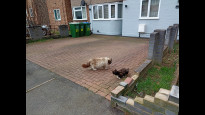


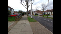
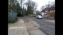
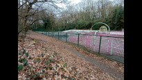

Photos of this route will appear when they are added to a review. You can review this route here.
Information
Route status - Live
Reviews - 1
Average rating -
Is this route good enough? - Yes (1)
There are currently no problems reported with this route.
Downloads - 6
Surveys
We are working to build-up a picture of what routes look like. To do that we are asking volunteers to survey routes so that we can communicate features, obstacles and challenges that may make a route desirable or not.
Slow Ways surveyors are asked to complete some basic online training, but they are not vetted. If you are dependent on the survey information being correct in order to complete a route, we recommend that you think critically about the information provided. You may also wish to wait until more than one survey has been completed.
Help people know more about this route by volunteering to submit a survey.
- Complete the survey training.
- Submit a survey for this route.
Geography information system (GIS) data
Total length
Maximum elevation
Minimum elevation
Start and end points
Bexleyheath
Grid Ref
TQ4905175146
Lat / Lon
51.45568° / 0.14392°
Easting / Northing
549,051E / 175,147N
What3Words
water.navy.with
Erith
Grid Ref
TQ5113078110
Lat / Lon
51.48176° / 0.17509°
Easting / Northing
551,130E / 178,110N
What3Words
orchestra.strut.analogy
| Bexleyheath | |
|---|---|
| Grid Ref | TQ4905175146 |
| Lat / Lon | 51.45568° / 0.14392° |
| Easting / Northing | 549,051E / 175,147N |
| What3Words | water.navy.with |
| Erith | |
|---|---|
| Grid Ref | TQ5113078110 |
| Lat / Lon | 51.48176° / 0.17509° |
| Easting / Northing | 551,130E / 178,110N |
| What3Words | orchestra.strut.analogy |
Sorry Land Cover data is not currently available for this route. Please check back later.
review
Daisy C
25 Feb 2023I walked from Erith to Bexleyheath on a wintry afternoon. I had created the route to avoid walking along the A220, I'm not a fan of busy urban roads. Even so I was a bit surprised how pleasant and quiet I found it. Easy to follow (maybe I'm biased though) even in the parks. It was clear which route to take through Martens Grove and although there was no trodden path in Barnehurst Op Sp, you just follow the scrub along the side of the park.
This route is probably accessible on wheels, although I ran the route and so may not have registered things e.g. kerb drops or narrow pavements. The only non paved part is the grassy slope in Barnehurst Open Space, but Manor Way runs parallel and just outside the park and it would be a very simple diversion. There are a couple of slightly steep but short sections.
Share your views about this route, give it a star rating, indicate whether it should be verified or not.
Include information that will be useful to others considering to walk or wheel it.
You can add up to 15 photos.
Other Routes for Bexleyheath—Erith See all Slow Ways
Review this better route and help establish a trusted network of walking routes.
Suggest a better route if it better meets our methodology.
Share your thoughts