YorkStamford Bridge

Yorsta one
Verified route

Verified Slow Way

Verified by 75.00% of reviewers

By a Slow Ways Volunteer on 07 Apr 2021


Distance

15km/9mi

Ascent

71m

Descent

67m

Download this route

Are you sure you want to download this route?

Using a GPX file for the first time?

No, back to route

Give a hike

Pledge to walk this route and help firm up its place in the network - every walk helps.

So far it has been reviewed by four people and surveyed by three people and there is one issue flagged with this route.

Three people have pledged to review this route.

Your pledged routes will show up in your pledges Waylist.

Every review and survey pledged and then walked will help make the Slow Ways network better, thank you for your help!

Sign up or log in to pledge to walk this route.

Back to route

Save to Waylist

Sign up or log in to save this route so you can find it more easily or plan a longer journey.

More options

Save to my account

Sign up or log in to save this route so you can find it more easily or plan a longer journey.

Print (via Inkatlas)

Survey this route

Review this route

Suggest a better route

Report a problem

Description

This is a Slow Ways route connecting York and Stamford Bridge.

Know of a better route? Share it here.

This is a Slow Ways route connecting York and Stamford Bridge.

Know of a better route? Share it here.

Status

This route has been reviewed by 4 people.

This route has been flagged (1 times) for reasons relating to access.

Photos for Yorsta one

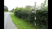
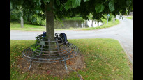
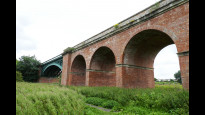
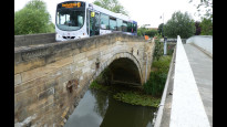
Photos of this route will appear when they are added to a review. You can review this route here.


Information

Verified route

Route status - Live

Reviews - 4

Average rating -

Is this route good enough? -  Yes (3) Maybe (1)

Problems reported -  Access (1)

Downloads - 29

Surveys

What is this route like?

Surveys are submitted by fellow users of this website and show what you might expect from this Slow Ways route. Scroll down the page to read more detailed surveys.

Grade 4X based on 3 surveys Sign up or log in to survey this route.
Description Note
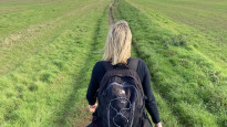
Grade 3: Route includes rough surfaces that may include small boulders, potholes, shallow ruts, loose gravel, short muddy sections.
Access grade X: At least one stile, flight of steps or other obstacle that is highly likely to block access for wheelchair and scooter users.
Grading is based on average scores by surveyors. This slow way has 3 surveys.
Full grading description

Only people who have completed our training can become Slow Ways surveyors and submit a survey. We do not vet contributors, so we cannot guarantee the quality or completeness of the surveys they complete. If you are dependent on the information being correct we recommend reading and comparing surveys before setting off.

Survey Photos

Photo by


Facilities

Facilities in the middle third of this route.

Not present at time of survey Public toilet (3)
Not present at time of survey Wheelchair accessible toilet (3)
Supermarket (0)
Restaurant (0)
Vegan restaurant (0)
Maybe present Accommodation (2)
Maybe present Accommodation < £50 (2)
Maybe present Campsite (1)
Maybe present Bothy (1)
Maybe present Free wifi (1)
Not present at time of survey Public phone (3)
Mobile phone coverage (0)
Not present at time of survey Train station (3)
Present at time of survey Bench (3)
Not present at time of survey Picnic table (3)
Bus stop (0)
Not present at time of survey Ferry (3)

Challenges

Potential challenges reported on this route. Some challenges are seasonal.
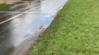
Not present at time of survey Scrambling (3)
Not present at time of survey Wading (3)
Not present at time of survey Swimming (3)
Not present at time of survey Climbing (3)
Not present at time of survey Stepping stones (3)
Maybe present Very slippery (3)
Very muddy (0)
Maybe present Very icy (3)
Maybe present Likely to flood (2)
Present at time of survey Long grass sections (3)
Present at time of survey Crops encroaching on path (3)
Present at time of survey Diverted path (3)

Obstacles

Obstacles on this route.

Present at time of survey Stiles (3)
Step and kerbs (0)
Possible to avoid steps, if applicable (0)
Not present at time of survey Flights of steps (3)
Present at time of survey Gates (3)
Present at time of survey Kissing gates (3)
Maybe present Locked gates (1)
Maybe present Disables access gates (1)
Cycle barriers (0)
Not present at time of survey Ladders (3)
Cattle grids (0)
Fords (0)
Narrow bridges (0)
Not present at time of survey Ferry required (3)
Present at time of survey Acceptable road walking (3)
Not present at time of survey Unacceptable road walking (3)
Dangerous road crossings (0)
Present at time of survey Walking on paths beside roads (3)
Walking on verges beside roads (0)
Not present at time of survey Railway crossings (3)
Not present at time of survey River crossings (3)
Present at time of survey Cattle possible (3)
Present at time of survey Horses possible (3)
Maybe present Tidal area (1)
Potential falls (0)
Exposed to elements (0)
Maybe present Remote area (1)
Not present at time of survey Mountainous area (3)
Not present at time of survey Military training area (3)
No visible path (0)
Seasonal nesting birds (0)
Maybe present Other hazards (1)

Accessibility

Is this route step and stile free?

Not present at time of survey Free of stiles (3)
Maybe present Free of single steps/kerbs (1)
Present at time of survey Free of flights of steps (3)
Not present at time of survey Free of other obstacles (3)

Measurements

Surveyors were asked to measure the narrowest and steepest parts of paths.

The narrowest part of the path is 40.0cm (3)

The steepest uphill gradient walking East 10.0% (3)

The steepest uphill gradient walking West 10.0% (3)

The steepest camber gradient across the path 10.0% (3)

How clear is the waymarking on the route: Unclear in places (3)

Successfully completed

We asked route surveyors "Have you successfully completed this route with any of the following? If so, would you recommend it to someone with the same requirements?". Here is how they replied.

Not present at time of survey Small Pug-sized dog (1)
Maybe present Small Labrador-sized dog (1)
Maybe present Large St. Bernard-sized dog (1)
Not present at time of survey Standard pram (1)
Not present at time of survey Off-road rugged pram (1)
Not present at time of survey Standard wheelchair (1)
Not present at time of survey Off-road rugged wheelchair (1)
Not present at time of survey Standard mobility scooter (1)
Not present at time of survey Off-road rugged mobility scooter (1)

Recommended by an expert

We asked route surveyors "Are you a trained access professional, officer or expert? If so, is this route suitable for someone travelling with any of the following?" Here is how they replied.

Not present at time of survey Small Pug-sized dog (1)
Maybe present Small Labrador-sized dog (1)
Maybe present Large St. Bernard-sized dog (1)
Not present at time of survey Standard pram (1)
Not present at time of survey Off-road rugged pram (1)
Not present at time of survey Standard wheelchair (1)
Not present at time of survey Off-road rugged wheelchair (1)
Not present at time of survey Standard mobility scooter (1)
Not present at time of survey Off-road rugged mobility scooter (1)

Terrain

We asked route surveyors to estimate how much of the route goes through different kinds of terrain.

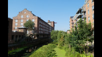
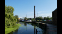
17.5% of the route is on roads (3)

There is no data on how much of this route is lit at night

80.0% of the route is paved (3)

20.0% of the route is muddy (3)

20.0% of the route is over rough ground (3)

15.0% of the route is through long grass (3)

Report a problem with this data

3 surveys

Information from verified surveys.

3X August 2021 by Yorkie Christine
Read survey
4X May 2023 by Stewart Thom
Read survey
4X May 2023 by Kwok Koo
Read survey

Sign up or log in to get the link to survey this route for Yorsta.

Geography information system (GIS) data

Total length

Maximum elevation

Minimum elevation

Start and end points

York
Grid Ref SE5965051750
Lat / Lon 53.95843° / -1.09242°
Easting / Northing 459,650E / 451,750N
What3Words actual.again.sorters
Stamford Bridge
Grid Ref SE7125655562
Lat / Lon 53.99122° / -0.91468°
Easting / Northing 471,256E / 455,562N
What3Words primary.arrow.quote

Yorsta One's land is

Arable 56.3%
Pasture 8.2%
Urban 35.5%

Data: Corine Land Cover (CLC) 2018

reviews


Sign up or log in to review this route for Yorsta.

Overall ratings

4 reviews


0 reviews

4 reviews

0 reviews

0 reviews

0 reviews

Show all


Other Routes for York—Stamford Bridge See all Slow Ways

York—Stamford Bridge

Yorsta two

Distance

0km/0mi

Ascent

-

Descent

-

Review this better route and help establish a trusted network of walking routes.

Suggest a better route if it better meets our methodology.

See all routes from York.

See all routes from Stamford Bridge.