Description
Rochester Rail Station to Chatham Rail Station via greenspace and roads
Rochester Rail Station to Chatham Rail Station via greenspace and roads
Status
This route has been reviewed by 4 people.
There are no issues flagged.
Photos for Roccha one

Photos of this route will appear when they are added to a review. You can review this route here.
Information
")
Route status - Live
Reviews - 4
Average rating -
Is this route good enough? - Yes (4)
There are currently no problems reported with this route.
Downloads - 16
Surveys
We are working to build-up a picture of what routes look like. To do that we are asking volunteers to survey routes so that we can communicate features, obstacles and challenges that may make a route desirable or not.
Slow Ways surveyors are asked to complete some basic online training, but they are not vetted. If you are dependent on the survey information being correct in order to complete a route, we recommend that you think critically about the information provided. You may also wish to wait until more than one survey has been completed.
Help people know more about this route by volunteering to submit a survey.
- Complete the survey training.
- Submit a survey for this route.
Geography information system (GIS) data
Total length
Maximum elevation
Minimum elevation
Start and end points
Rochester
Grid Ref
TQ7447568576
Lat / Lon
51.38940° / 0.50627°
Easting / Northing
574,475E / 168,576N
What3Words
stem.bossy.puzzle
Chatham
Grid Ref
TQ7554067607
Lat / Lon
51.38037° / 0.52108°
Easting / Northing
575,540E / 167,607N
What3Words
moved.fired.dining
| Rochester | |
|---|---|
| Grid Ref | TQ7447568576 |
| Lat / Lon | 51.38940° / 0.50627° |
| Easting / Northing | 574,475E / 168,576N |
| What3Words | stem.bossy.puzzle |
| Chatham | |
|---|---|
| Grid Ref | TQ7554067607 |
| Lat / Lon | 51.38037° / 0.52108° |
| Easting / Northing | 575,540E / 167,607N |
| What3Words | moved.fired.dining |
Sorry Land Cover data is not currently available for this route. Please check back later.
reviews
Jaitch
04 Nov 2023This is a good route that attempts to avoid main roads where possible however it could be improved.
A couple of notes in route order.
1) Instead of following the A2 and going through the Alleyway up George lane to Rochester High Street alongside The George Vaults I would suggest turning up the turning before which is North Street and carrying on directly over the High Street up towards Boley hill to rejoin the existing route in front of Rochester Cathedral. This will give 3 benefits, a) You will get to see more of the high street this way, b) it will take you off the main busy A2 road quicker and c) george lane on the existing route can often have garbage overspill on it and not be too nice to walk on. also on the existing route where the path crosses the high street and then goes through Two Post Alley, the path past the posts at the start is quite narrow and might not suit a wide buggy or wheelchair. If you follow the existing route and its an issue then 30 yards down the high street there is a better solution.
2) At the section where the existing route crosses over The Delce and then through a small cut through up to Star Hill I would suggest instead turn right up the Delce for about 50 yards and use the pedestrian crossing to the use the path up The Cut to rejoin the existing route at the pedestrian crossing across City Way to Jacksons Fields. This has the following benefits a) the cut through to Star Hill has a couple of steps up to it which might be manageable for a buggy, slightly less so for a wheelchair. b) further up Star Hill as it becomes City Way, the pedestrian path is not very wide and it would be easier to walk in the road (even though its the no through road part and very little traffic, this is not ideal) c) the road up the Delce and the Cut is slightly quieter, although only slightly.
3) At the point that the route switches from Jacksons Fields to Fort Pitt Gardens there is no easy short route step free access. you will need to follow the route out of Jacksons Fields as plotted but then before joining Fort Pitt Gardens, turn left down RRX20 about 15 yards and easier access into Fort Pitt Gardens is on the right hand side.
4) As you come to near the end of Fort Pitt Gardens, the route turns right up the hill, apparently following the train tracks which is in a tunnel underneath, this is an error in the routing software and you should continue straight ahead and crossing Fort Pitt Hill road at the end and into Victoria Gardens park at the visible entrance. walk along that path 30 yards or so and then turn right up the paved path go 50 yards or so until it then turns left to run alongside Fort Pitt Hill Road and joins back on the existing route.
Daisy C
30 Aug 2023 (edited 06 Sep 2023)This is a great route and it deserves a Slow Ways download which gives you a trouble free walk. As RocCha Slow Way has a verified route now I'm going to upload a new improved version that future walkers should find very easy to follow and perhaps enjoy a little more too. I tested out the small changes while I walked the original route
.
Rochester old town centre is gorgeous but this route misses a lovely part of the High Street to walk beside the A2 instead. Later the mapped line doesn't follow the paths through some parks, and where that happens on a very steep hillside then trying to follow the closest fit path can result in a needless drop and climb and also less of the great view. Not serious problems but it took the shine off, so it’s a high 4 star route instead of 5 stars.
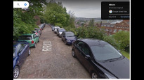
Almost all the surfaces are paved. There are cobbles in Rochester (see G St View screenshot) and either 4 steps or a short cambered slope up from Delce Rd to Star Hill. It's hard to describe the conditions for the loosely mapped section in Fort Pitt Gardens / Victoria Gardens because it depends greatly how you choose to navigate it. It may be steep grass slopes, tarmac paths or a roughly surfaced road (see screenshot) or a mix. It may be a dozen or more steps (up the side of the Uni building) or 3 steps or none.
Now I've walked the route I'm sure the small issues are down to oddities with the map systems used to design them. On the OS maps at Fort Pitt Hill the underground tunnel symbols look just like a path and to further muddy the waters the Saxon Shore Way line follows that "path" too. There is definitely no path. And from my own attempts to make routes through Rochester using OSM based apps I know it doesn't recognise the crossing right outside the station, which is about 3 or 4 years old. The old one is quite far north and not ideal as it has no lights now, but just depends on traffic gaps.
-
Jaitch
04 Nov 2023I have just walked this route and found exactly the same issues you described in Rochester and traversing Fort Pitt/Victoria Gardens.
-
Share your thoughts
Bobmatt3
27 Jun 2022Hilly through the parks but not too difficult. Changed the route to get through Victoria Gardens instead of doing what it said on the map but it wasn't a big detour.
-
Share your thoughts
Karsco
27 Apr 2021Easy route round beautiful historical buildings and across green spaces with great views of cityscape and of river.
-
Share your thoughts
Share your views about this route, give it a star rating, indicate whether it should be verified or not.
Include information that will be useful to others considering to walk or wheel it.
You can add up to 15 photos.
Other Routes for Rochester—Chatham See all Slow Ways
Review this better route and help establish a trusted network of walking routes.
Suggest a better route if it better meets our methodology.
Share your thoughts