Description
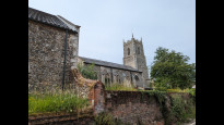
This is a Slow Ways route connecting Reepham and Aylsham.
Know of a better route? Share it here.
This is a Slow Ways route connecting Reepham and Aylsham.
Know of a better route? Share it here.
Status
This route has been reviewed by 3 people.
There are no issues flagged.
Photos for Reeayl one


Photos of this route will appear when they are added to a review. You can review this route here.
Information
")
Route status - Live
Reviews - 3
Average rating -
Is this route good enough? - Yes (3)
There are currently no problems reported with this route.
Downloads - 9
Surveys
We are working to build-up a picture of what routes look like. To do that we are asking volunteers to survey routes so that we can communicate features, obstacles and challenges that may make a route desirable or not.
Slow Ways surveyors are asked to complete some basic online training, but they are not vetted. If you are dependent on the survey information being correct in order to complete a route, we recommend that you think critically about the information provided. You may also wish to wait until more than one survey has been completed.
Help people know more about this route by volunteering to submit a survey.
- Complete the survey training.
- Submit a survey for this route.
Geography information system (GIS) data
Total length
Maximum elevation
Minimum elevation
Start and end points
Reepham
Grid Ref
TG1001722847
Lat / Lon
52.76240° / 1.11127°
Easting / Northing
610,017E / 322,847N
What3Words
mainframe.womb.tracking
Aylsham
Grid Ref
TG1931226911
Lat / Lon
52.79519° / 1.25151°
Easting / Northing
619,312E / 326,911N
What3Words
plug.cyber.addicted
Reeayl One's land is
| Reepham | |
|---|---|
| Grid Ref | TG1001722847 |
| Lat / Lon | 52.76240° / 1.11127° |
| Easting / Northing | 610,017E / 322,847N |
| What3Words | mainframe.womb.tracking |
| Aylsham | |
|---|---|
| Grid Ref | TG1931226911 |
| Lat / Lon | 52.79519° / 1.25151° |
| Easting / Northing | 619,312E / 326,911N |
| What3Words | plug.cyber.addicted |
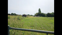
| Arable | 71.7% |
| Pasture | 3.4% |
| Urban | 24.2% |
| Woods | 0.7% |
Data: Corine Land Cover (CLC) 2018
reviews
Michael McClinton
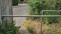
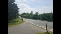
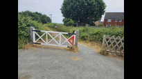
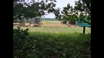
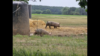
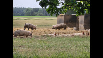
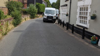
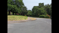
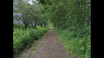
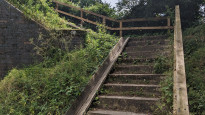
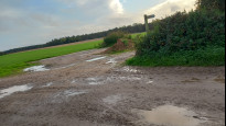
24 Jun 2023It was a nice walk. There were some parts where you had to walk on the road which wasn't ideal. Mostly it was dirt footpaths with the majority being an old disused train track. It is a nice way to walk from Reepham to Aylsham. Some parts would not be ideal for a pushchair and some parts might be to skinny for a cycle.
Tom B
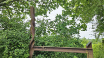
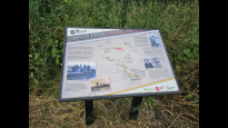
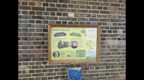
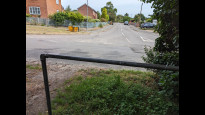
23 Jun 2023Walk is over even ground for the most of it with a few stoney lumpy sections. The start in Reepham is country roads with little path ways or walking on Road, until you hit Marriott's way which is then a nice old railway way turned into a cycle way / walking path with mile markers.
The walk is half shaded by trees and some areas have some no shade. Remember to bring hats and a drink..
This walk could be done with all terrain buggy if you are outdoors parent.
-
Share your thoughts
Marion Frankland
30 Oct 2022A lovely route, which quickly drops onto a disused railway line(Marriots Way). This is variously surfaced, with a nice surface at the Aylsham end, moving to a more muddy path as you get away from the town. Various widths in places. Suitable for a bike, but I wouldn't take a wheelchair! Diverts off the railway for a short while through the village, I was running so didn't stop anywhere!.
-
Share your thoughts
Share your views about this route, give it a star rating, indicate whether it should be verified or not.
Include information that will be useful to others considering to walk or wheel it.
You can add up to 15 photos.
There are no other routes for Reepham — Aylsham
If you know a better way, then please let us know.
Review this better route and help establish a trusted network of walking routes.
Suggest a better route if it better meets our methodology.
Share your thoughts