Description
Different route that follows the overground train line closer
Different route that follows the overground train line closer
Status
This route has been reviewed by 4 people.
There are no issues flagged.
Photos for Peccan two


Photos of this route will appear when they are added to a review. You can review this route here.
Information
")
Route status - Live
Reviews - 4
Average rating -
Is this route good enough? - Yes (4)
There are currently no problems reported with this route.
Downloads - 3
Surveys
What is this route like?
Surveys are submitted by fellow users of this website and show what you might expect from this Slow Ways route. Scroll down the page to read more detailed surveys.
| Grade 1X based on 1 surveys | Sign up or log in to survey this route. | ||
|---|---|---|---|
| Description | Note | ||
| Grade 1: Entirely smooth and compacted surfaces. Access grade X: At least one stile, flight of steps or other obstacle that is highly likely to block access for wheelchair and scooter users. |
Grading is based on average scores by surveyors. This slow way has 1 surveys. | ||
| Full grading description | |||
Only people who have completed our training can become Slow Ways surveyors and submit a survey. We do not vet contributors, so we cannot guarantee the quality or completeness of the surveys they complete. If you are dependent on the information being correct we recommend reading and comparing surveys before setting off.
Survey Photos
Facilities
Facilities in the middle third of this route.
Challenges
Potential challenges reported on this route. Some challenges are seasonal.
Obstacles
Obstacles on this route.
Accessibility
Is this route step and stile free?
Measurements
Surveyors were asked to measure the narrowest and steepest parts of paths.
The narrowest part of the path is 60.0cm (1)
The steepest uphill gradient walking East 9.0% (1)
The steepest uphill gradient walking West 9.0% (1)
The steepest camber gradient across the path 2.0% (1)
How clear is the waymarking on the route: Unsigned (1)
Successfully completed
We asked route surveyors "Have you successfully completed this route with any of the following? If so, would you recommend it to someone with the same requirements?". Here is how they replied.
Recommended by an expert
We asked route surveyors "Are you a trained access professional, officer or expert? If so, is this route suitable for someone travelling with any of the following?" Here is how they replied.
Terrain
We asked route surveyors to estimate how much of the route goes through different kinds of terrain.
80.0% of the route is on roads (1)
95.0% of the route is lit at night (1)
100.0% of the route is paved (1)
There is no data on muddiness
There is no data on rough ground
There is no data on long grass
Report a problem with this data
1 surveys
Information from verified surveys.
Geography information system (GIS) data
Total length
Maximum elevation
Minimum elevation
Start and end points
Peckham
Grid Ref
TQ3423776344
Lat / Lon
51.47015° / -0.06871°
Easting / Northing
534,237E / 176,344N
What3Words
rope.punks.gloves
Canada Water
Grid Ref
TQ3548579439
Lat / Lon
51.49766° / -0.04956°
Easting / Northing
535,485E / 179,439N
What3Words
oddly.storm.crush
| Peckham | |
|---|---|
| Grid Ref | TQ3423776344 |
| Lat / Lon | 51.47015° / -0.06871° |
| Easting / Northing | 534,237E / 176,344N |
| What3Words | rope.punks.gloves |
| Canada Water | |
|---|---|
| Grid Ref | TQ3548579439 |
| Lat / Lon | 51.49766° / -0.04956° |
| Easting / Northing | 535,485E / 179,439N |
| What3Words | oddly.storm.crush |
Sorry Land Cover data is not currently available for this route. Please check back later.
reviews
Loz Flowers
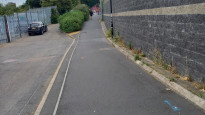
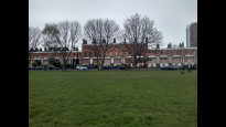
04 Jun 2023Several nice green spaces between various building sites at Peckham, Old Kent Road and Canada Water. It can be quiet between Surrey Canal Road and Oldfield Grove. There are no access issues.
Derick Rethans
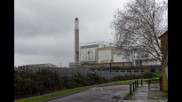
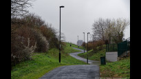
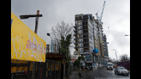
18 Mar 2023I walked this on a drizzly morning, from Canada Water to Peckham.
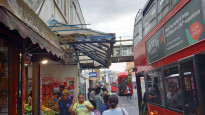
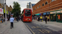
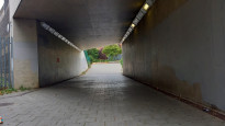
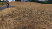
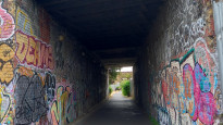
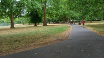
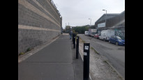
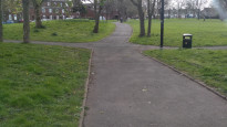
Starting at Canada Water it takes a little detour to get to Southwark Park (photo #1), which is although longer, a good idea as "Lower Road" is unpleasant. After the park, it follows quite back streets to end up on a path alongside a railway with a great view of the South East London Combined Heat & Power plant (photo #3), where it then soon goes past a football ground. It's a short section which is then followed by a stroll through the Bridgehouse Meadows (photo #4). There is quite some building work happening in the area (photo #5), with some tricky walking due to blocked pavements. Easy to go around though. After crossing Old Kent Road the route follows through Brimmington Park, with some interesting graffiti (photo #6). Then there is some walking along residential streets, before passing the Peckham Peace Wall (photo #7) and ending up at the finish at Peckham Rye station.
-
Share your thoughts
Strider
22 Jul 2022I walked from Peckham Rye to Canada Water.
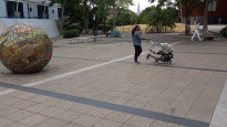
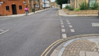
This is a series of busy streets, walkways and cycle paths joining three parks. A lovely walk with plenty to hold your attention or distract the eye; bustling highstreets, quiet roads, open fields; tarmac paths and lovely green spaces; markets and supermarkets. Places to pause or play. New and old architecture, some being built or re-built.
Brimmington Park has a working water fountain, although there are shops, pubs and cafes all along the route. Bridgehouse Meadows has a small moderate hill (9%) and views to Canary Warf.
Southwark Park has an art gallery (free) with a café and nearby playground.
Good for wheel chairs, although some pavements are narrow with cars parked on them, and some streets are packed with people. Lots of road crossing but most are light controlled or have zebras, most have dropped curbs.
-
Share your thoughts
Intrepid Rabbit
10 Apr 2022Straight forward route involving foot paths, parks and quiet roads. There is one section that goes past an industrial estate and Millwall football stadium which may not be safe to walk at night because it feels quite isolated. Otherwise, no obvious problems.
-
Share your thoughts
Share your views about this route, give it a star rating, indicate whether it should be verified or not.
Include information that will be useful to others considering to walk or wheel it.
You can add up to 15 photos.
Other Routes for Peckham—Canada Water See all Slow Ways
Review this better route and help establish a trusted network of walking routes.
Suggest a better route if it better meets our methodology.
Share your thoughts