Description
This is a Slow Ways route connecting Mulbarton and Norwich.
Know of a better route? Share it here.
This is a Slow Ways route connecting Mulbarton and Norwich.
Know of a better route? Share it here.
Status
This route has been reviewed by 12 people.
There are no issues flagged.
Photos for Mulnor one


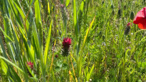
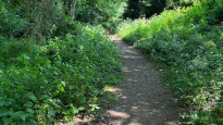
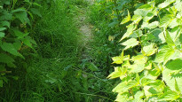


Photos of this route will appear when they are added to a review. You can review this route here.
Information
")
Route status - Live
Reviews - 12
Average rating -
Is this route good enough? - Yes (12)
There are currently no problems reported with this route.
Downloads - 31
Surveys
What is this route like?
Surveys are submitted by fellow users of this website and show what you might expect from this Slow Ways route. Scroll down the page to read more detailed surveys.
| Grade 3X based on 1 surveys | Sign up or log in to survey this route. | ||
|---|---|---|---|
| Description | Note | ||
| Grade 3: Route includes rough surfaces that may include small boulders, potholes, shallow ruts, loose gravel, short muddy sections. Access grade X: At least one stile, flight of steps or other obstacle that is highly likely to block access for wheelchair and scooter users. |
Grading is based on average scores by surveyors. This slow way has 1 surveys. | ||
| Full grading description | |||
Only people who have completed our training can become Slow Ways surveyors and submit a survey. We do not vet contributors, so we cannot guarantee the quality or completeness of the surveys they complete. If you are dependent on the information being correct we recommend reading and comparing surveys before setting off.
Survey Photos
Facilities
Facilities in the middle third of this route.
Challenges
Potential challenges reported on this route. Some challenges are seasonal.
Obstacles
Obstacles on this route.
Accessibility
Is this route step and stile free?
Measurements
Surveyors were asked to measure the narrowest and steepest parts of paths.
Narrowest part of path: no data
The steepest uphill gradient East: no data
The steepest uphill gradient West: no data
The steepest camber: no data
How clear is the waymarking on the route: Unclear (1)
Successfully completed
We asked route surveyors "Have you successfully completed this route with any of the following? If so, would you recommend it to someone with the same requirements?". Here is how they replied.
Recommended by an expert
We asked route surveyors "Are you a trained access professional, officer or expert? If so, is this route suitable for someone travelling with any of the following?" Here is how they replied.
Terrain
We asked route surveyors to estimate how much of the route goes through different kinds of terrain.
50.0% of the route is on roads (1)
There is no data on how much of this route is lit at night
50.0% of the route is paved (1)
30.0% of the route is muddy (1)
30.0% of the route is over rough ground (1)
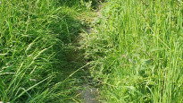
20.0% of the route is through long grass (1)
Report a problem with this data
1 surveys
Information from verified surveys.
Geography information system (GIS) data
Total length
Maximum elevation
Minimum elevation
Start and end points
Mulbarton
Grid Ref
TG1929900230
Lat / Lon
52.55572° / 1.23357°
Easting / Northing
619,299E / 300,230N
What3Words
dragon.scribble.extreme
Norwich
Grid Ref
TG2387908389
Lat / Lon
52.62709° / 1.30653°
Easting / Northing
623,879E / 308,389N
What3Words
ended.feeds.plants
Mulnor One's land is
| Mulbarton | |
|---|---|
| Grid Ref | TG1929900230 |
| Lat / Lon | 52.55572° / 1.23357° |
| Easting / Northing | 619,299E / 300,230N |
| What3Words | dragon.scribble.extreme |
| Norwich | |
|---|---|
| Grid Ref | TG2387908389 |
| Lat / Lon | 52.62709° / 1.30653° |
| Easting / Northing | 623,879E / 308,389N |
| What3Words | ended.feeds.plants |
| Arable | 26.3% |
| Natural grass | 1.0% |
| Pasture | 37.5% |
| Urban | 35.2% |
Data: Corine Land Cover (CLC) 2018
reviews
Pandora
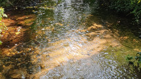
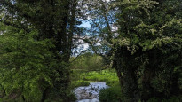
01 Apr 2024Great walk into Norwich. The first stretch through lovely woodland beside the water is beautiful.
As you come down the hill and approach the Southern Bypass where you meat the All Saints Church, take extra care as very fast cars approach the small junction with little awareness of walkers.
After you cross the bypass over the bridge you will walk alongside the loud bypass for a while - this stretch had some pretty major flooding issues that we had to divert up alongside the road to pass this. Once past this we encountered no other issues to reach our destination.
Tiril Sofie Berg
31 Mar 2024The route takes you through a varied landscape of field-side footpaths as well as parts of the alongside high roads. Please be mindful of the former reviewer’s recommendations when hiking in wet weather.
-
Share your thoughts
Thom Brisco
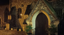
29 Mar 2024Leaving Mulbarton we walked for several kilometres along field-side footpaths across easy going landscape with pretty woodland stretches to the west of Swadeston. Approaching the Norwich Southern Bypass we encountered All Saints Church on Intwood Lane, which has a fascinating tower with its round body built in the 13thC but with a high-level faceted section added later in the 15thC.
Shortly after this, we crossed over the bypass on a road bridge before doubling back to walk parallel to the A47 on a low-level path. It was on this approx 700-metre-long stretch that we encountered significant flooding across the path, forcing us to climb a portion of the road embankment to circumnavigate. There is no obvious alternative route that doesn’t add significantly to the distances involved so it is worth being mindful of this on wet days.
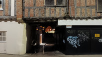
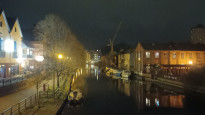
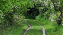
Passing Keswick Hall, the route follows lanes and narrow roads but these have adequate verges and seemed only lightly used by vehicles. Soon we met the Ipswich Road, which took us on into the city centre. Just before meeting the route’s end point, we passed the richly storied St Julian's Church and the jettied timber-framed buildings of King Street. Outside Norwich Station we completed our 91 mile walk.
-
Share your thoughts
Christie Williamson
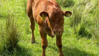
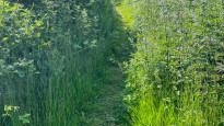
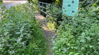
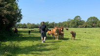
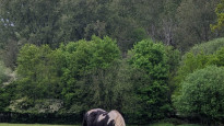
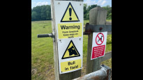
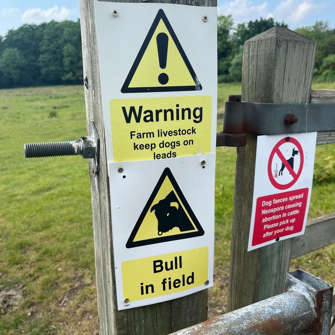
22 Jun 2023We did this walk as a group of five and set off just after lunch. The first few miles of the route took us through the city on nice wide, flat pathways with plenty of safe crossing points. The first field that we cut into was a bit uneven on the ground bur felt fairly safe. There was a stretch that ran alongside a 60mph road with no path and some overgrown areas. The stinging nettles came up quite high. We got to the field with the 'warning Bull' signs and saw no sign of any livestock but as we neared a narrow corner, about 30 cows/calves and the bull all came around. We patiently waited for them all to come into the field and then carried on, they didn't seem too bothered by us being there. We got lost a couple of times as the signs we needed to follow were covered in a lot of grass so ended up having to double back a few times and added about a mile to the route. If you wanted somewhere to stop it would have been a bit tricky during the second half of the walk. Overall it wasn't too bad, not much shade if you are doing this on a hot day and probably not very accessible to a wheelchair due to parts of the route being quite overgrown but some nice scenery to take in.
-
Share your thoughts
Steven Gowing
09 Jun 2023There are multiple pro's and con's with this walk. From beautiful scenery and surroundings, to busy 60mph road and well overgrown tracks ready to sting your legs on.
Once you're out of the city, it's where things get trickier, with the map not 100% accurate in telling you exactly where to go, instead leaving you to take an educated guess.
For the first... hour or so you're on fairly open track with no concerns, until you edge closer to the A47 path that runs alongside it, this is then very overgrown in places with nettles ready to get the unaware.
Multiple lumps and bumps so make sure you're wearing suitable footwear.
From here you're then forced along a stretch of 60mph road with no path, heading in to oncoming traffic.
Multiple occasions for the next few miles where you have to be very alert for cars from either side.
Once you eventually reach Swardeston, if you slightly diverge away you can rest at the cricket ground and then make your way onwards through the cows field.
Long as you're slow and cautious, they will leave you alone.
From here there's Multiple levels, obsticals and bushes to tackle before finally reaching Mulbarton.
-
Share your thoughts
Rachel L
07 Jun 2023We walked this route on a sunny day in June. It took around 4 hours to complete the route at a steady pace.
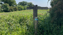
The route was waymarked well, picking up Norfolk Trails signposting for part of the way, with one exception. When nearing the sewage works near Swardeston, we reached a gate which held a private property, no public right of way sign. Looking back it looks like we may have missed a change in which side of the hedge line the path was running, albeit there was no clear indication this was necessary.
The route did go through the gated field, however as it also contained some eager cows and a bull who were keen to see us and blocked the way, we opted for a detour up to Swardeston cricket ground, and rejoined the route at the common.
The latter part of the route wasn't especially scenic as followed the main road into Norwich.
Key observations:
- Route not suitable for pushchairs or wheelchairs
- A few uneven/hazardous areas (look out for the goalpost holes when crossing the common)
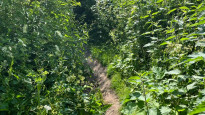
- Some narrow paths through shrubbery which may be more overgrown at certain times in the year (covered legs may be wise)
- Some of the paths may become muddy after any wet weather
- High traffic noise when walking alongside A47
- One part of the route required walking allow a narrow country road with no footpath, which had cars frequently passing by
- The latter part of the walk was alongside a main road
- No public toilets en-route until Norwich city centre.
-
Share your thoughts
Jack Purllant
24 May 2023Really nice walk, especially once you get out of Norwich and into the countryside!
Some sections along country roads, however very quiet with good room for allowing cars to get past, and only one small section on a larger road near the southern bypass.
Definitely would recommend - but check the weather before you go!!.
-
Share your thoughts
Ben Slater
15 May 2023Agree with other reviews that leaving Norwich could be nicer rather than being stuck on a main road for an hour. The other not so enjoyable bit was the 10 mins being next to the A47. But other than this it is hard to fault the walk. We had the pleasure of thunderstorms everyday leading up to our walk (also stormy on the day). Highly recommend walking boots when it has been rainy, although the walk was still safe, there were quite a few muddy areas. I'd recommend stopping off at the Marsh Harrier pub as this will be the last toilet stop for rest of the walk! Also would recommend you checking in with the World's End pub towards the end of the walk as they were shut when we rocked up. Opening times may vary, but was 6pm for us. We started the walk around 11 and finished at 4:30. This was with a stop off at the pub to avoid a hail storm. There was also a field which had a sign of "Beware Bull", however we didn't come across the bull, but there was some "organic evidence" that he had been around. All in all, a great walk and would highly recommend.
-
Share your thoughts
Danny
13 May 2023Enjoyed this walk a lot. There was a little bit of city road walking at the start but to be expected if you start in city centre, and actually a massive benefit if you start the walk on a rainy day when hail hits you after 10 mins since you can then take cover with an unscheduled pub stop before you set out. The fields, paths and city roads were all very beautiful, passing animals to say hi to, pretty streams, and nice country houses to nose at on your way past. Recommend walking boots if it is a wet day due to the field and slightly muddy pathways, and also note the handy bus that stops at the end to take you back to the city to make it one way walk. Would thoroughly recommend (and already have done) this walk to others.
-
Share your thoughts
Katy Walters
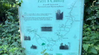
24 Sep 2022Agree with other reviewer about leaving Norwich via Lakenham Way / Hall Road being more attractive with less traffic. Keswick Mill and Hall (pretty, but part by the noisy A47) versus Eaton and Intwood Road (more urban, no pavement on part of Intwood Rd) is a tougher call. But the latter option does pass Waitrose with its cafe and toilets, and from just by Waitrose this route has recently received excellent new signage (pictured) as part of the Kett's Country Trail and its associated circular additions. The road section to Swardeston is unavoidable but quiet, and the first footpath out of Swardeston goes through a field of cattle, but after this it's a pleasant series of footpaths (with some kissing gates, stiles and plank bridges) to Mulbarton Common where you can find Blakey's Bus Cafe plus a pub and, at the official end of the route, a small supermarket.
A pleasant and easy walk with a lovely destination, and as a local I would certainly consider walking it again. Four stars reflects the lack of a perfect option out of Norwich.
-
Share your thoughts
Callum Rollo
30 Apr 2021+ Pleasant countryside
+ Interesting paths off the beaten track
+ Simple navigation
- Leaving Norwich on major road is unpleasant
- Not wheelchair accessible
- Difficult gates for bikes.
-
Pete Sturman
30 Apr 2021I would suggest the Lakenham Way and Hall Road instead of Ipswich Road to get to Marston Lane, as that stretch seemingly has the cycle provision Ipswich Road severely lacks. I would also avoid the Keswick Mill/Hall link to get to Intwood Road. Instead i would head to Eaton crossroads and pick up Intwood Road just the other side of Cringleford Bridge. As nice as Keswick Mill is it does avoid walking the stretch alongside the busy A47.
-
Share your thoughts
Share your views about this route, give it a star rating, indicate whether it should be verified or not.
Include information that will be useful to others considering to walk or wheel it.
You can add up to 15 photos.
There are no other routes for Mulbarton — Norwich
If you know a better way, then please let us know.
Review this better route and help establish a trusted network of walking routes.
Suggest a better route if it better meets our methodology.
Share your thoughts