Description
Slight changes to route to correct minor plotting errors and tracing it through quieter back streets and pedestrian routes within Liverpool city centre and the Grassendale area
Slight changes to route to correct minor plotting errors and tracing it through quieter back streets and pedestrian routes within Liverpool city centre and the Grassendale area
Status
This route has been reviewed by 2 people.
This route has been flagged (1 times) for reasons relating to accuracy.
Photos for Livgar two


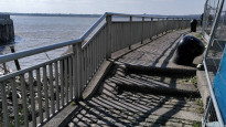
Photos of this route will appear when they are added to a review. You can review this route here.
Information

Route status - Live
Reviews - 2
Average rating -
Is this route good enough? - Yes (1) Maybe (1)
Problems reported - Accuracy (1)
Downloads - 1
Surveys
We are working to build-up a picture of what routes look like. To do that we are asking volunteers to survey routes so that we can communicate features, obstacles and challenges that may make a route desirable or not.
Slow Ways surveyors are asked to complete some basic online training, but they are not vetted. If you are dependent on the survey information being correct in order to complete a route, we recommend that you think critically about the information provided. You may also wish to wait until more than one survey has been completed.
Help people know more about this route by volunteering to submit a survey.
- Complete the survey training.
- Submit a survey for this route.
Geography information system (GIS) data
Total length
Maximum elevation
Minimum elevation
Start and end points
Liverpool
Grid Ref
SJ3502190540
Lat / Lon
53.40767° / -2.97892°
Easting / Northing
335,021E / 390,540N
What3Words
twice.email.bleak
Garston
Grid Ref
SJ4088784915
Lat / Lon
53.35781° / -2.88964°
Easting / Northing
340,887E / 384,915N
What3Words
shape.hooks.bring
| Liverpool | |
|---|---|
| Grid Ref | SJ3502190540 |
| Lat / Lon | 53.40767° / -2.97892° |
| Easting / Northing | 335,021E / 390,540N |
| What3Words | twice.email.bleak |
| Garston | |
|---|---|
| Grid Ref | SJ4088784915 |
| Lat / Lon | 53.35781° / -2.88964° |
| Easting / Northing | 340,887E / 384,915N |
| What3Words | shape.hooks.bring |
Sorry Land Cover data is not currently available for this route. Please check back later.
Other Routes for Liverpool—Garston See all Slow Ways
Review this better route and help establish a trusted network of walking routes.
Suggest a better route if it better meets our methodology.