Description
Avoids B road walking
Avoids B road walking
Status
This route has been reviewed by 3 people.
There are no issues flagged.
Photos for Lednew two
Photos of this route will appear when they are added to a review. You can review this route here.
Information

Route status - Live
Reviews - 3
Average rating -
Is this route good enough? - Yes (3)
There are currently no problems reported with this route.
Downloads - 7
Surveys
We are working to build-up a picture of what routes look like. To do that we are asking volunteers to survey routes so that we can communicate features, obstacles and challenges that may make a route desirable or not.
Slow Ways surveyors are asked to complete some basic online training, but they are not vetted. If you are dependent on the survey information being correct in order to complete a route, we recommend that you think critically about the information provided. You may also wish to wait until more than one survey has been completed.
Help people know more about this route by volunteering to submit a survey.
- Complete the survey training.
- Submit a survey for this route.
Geography information system (GIS) data
Total length
Maximum elevation
Minimum elevation
Start and end points
Ledbury
Grid Ref
SO7109737711
Lat / Lon
52.03705° / -2.42276°
Easting / Northing
371,097E / 237,711N
What3Words
cries.wool.eyelash
Newent
Grid Ref
SO7226125820
Lat / Lon
51.93020° / -2.40483°
Easting / Northing
372,261E / 225,820N
What3Words
clays.cone.lots
| Ledbury | |
|---|---|
| Grid Ref | SO7109737711 |
| Lat / Lon | 52.03705° / -2.42276° |
| Easting / Northing | 371,097E / 237,711N |
| What3Words | cries.wool.eyelash |
| Newent | |
|---|---|
| Grid Ref | SO7226125820 |
| Lat / Lon | 51.93020° / -2.40483° |
| Easting / Northing | 372,261E / 225,820N |
| What3Words | clays.cone.lots |
Sorry Land Cover data is not currently available for this route. Please check back later.
reviews
Hannah
20 Aug 2023Enjoyed this route through the orchards and hayfields of Herefordshire and Gloucestershire. Made use of bits of the Daffodil Way, Poets' Way, Geopark Way, along a disused canal, angling lakes, and not much in the way of road walking. In August there were a lot of ploughed or harvested fields to bash across, which at different stages of the growing cycle might be harder to traverse and mean along lumpy field-edge walk.
Rhys Jones
18 Aug 2023 (edited 20 Aug 2023)Generally pretty, interesting enough for the area, mostly fields, handful of quiet lanes, woodland and canal. If you a getting tired of walking through crop fields, at Dymock you can stay on the road past the pub (Ledbury side), East you can walk along the pavement and road past the cricket club. Six of one half dozen of the other there.
-
Nichowes
18 Aug 2023Thanks Rhys. Great to see that someone else walked this route and enjoyed it. What small change do you think is needed, please? Best wishes from Nic Howes.
-
Share your thoughts
Nichowes
22 Sep 2022 (edited 23 Sep 2022)Nic Howes' alternative to Lednew one, avoiding Three Shires Garden Centre and its associated walk alongside a busy road.
Lednew two departs from Lednew one after Hillend Green, turning right to pass Hill View Farm to reach Wisteria Villa on the left. Photo 1 shows a clear fingerpost aiming at a side gate to Wisteria Villa marked "Beware of the Dog"; the Geopark Way PROW definitely goes through the otherwise unmarked side gate and then leaves the curtilage of Wisteria Villa via a properly waymarked exit. I encountered no dogs here; some local authorities have online pages saying that putting up a "Beware of the Dog" sign like this is illegal if untrue, so it may be best to prepare yourself to "beware".
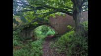
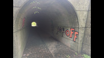
On leaving Wisteria Villa the Geopark Way crosses above the line of the Oxenhall canal tunnel and enters a large orchard (Photo 2). From the higher ground ahead there are fine views of the distinctive summit of May Hill (Photo 3), with its plantation of trees that are said to number "no more than 99"; a detailed analysis of the summit trees appears here: http://notabletrees.blogspot.com
Lednew two merges with Lednew one where the Geopark Way meets a surfaced lane on a sharp bend in the latter.
-
Share your thoughts
Share your views about this route, give it a star rating, indicate whether it should be verified or not.
Include information that will be useful to others considering to walk or wheel it.
You can add up to 15 photos.
Other Routes for Ledbury—Newent See all Slow Ways
Review this better route and help establish a trusted network of walking routes.
Suggest a better route if it better meets our methodology.


Share your thoughts