Description
This is a Slow Ways route connecting Kimpton and Stevenage.
Know of a better route? Share it here.
This is a Slow Ways route connecting Kimpton and Stevenage.
Know of a better route? Share it here.
Status
This route has been reviewed by 2 people.
There are no issues flagged.
Photos for Kimste one


Photos of this route will appear when they are added to a review. You can review this route here.
Information

Route status - Live
Reviews - 2
Average rating -
Is this route good enough? - Yes (2)
There are currently no problems reported with this route.
Downloads - 7
Surveys
What is this route like?
Surveys are submitted by fellow users of this website and show what you might expect from this Slow Ways route. Scroll down the page to read more detailed surveys.
| Grade 4X based on 1 surveys | Sign up or log in to survey this route. | ||
|---|---|---|---|
| Description | Note | ||
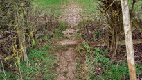
| Grade 4: Route includes very rough surfaces including deep ruts, steep loose gravel, unmade paths and deep muddy sections. Wheelchairs may experience traction/wheel spin issues. Access grade X: At least one stile, flight of steps or other obstacle that is highly likely to block access for wheelchair and scooter users. |
Grading is based on average scores by surveyors. This slow way has 1 surveys. | ||
| Full grading description | |||
Only people who have completed our training can become Slow Ways surveyors and submit a survey. We do not vet contributors, so we cannot guarantee the quality or completeness of the surveys they complete. If you are dependent on the information being correct we recommend reading and comparing surveys before setting off.
Survey Photos
Facilities
Facilities in the middle third of this route.
Challenges
Potential challenges reported on this route. Some challenges are seasonal.
Obstacles
Obstacles on this route.
Accessibility
Is this route step and stile free?
Measurements
Surveyors were asked to measure the narrowest and steepest parts of paths.
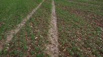
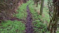
The narrowest part of the path is 45.0cm (1)
The steepest uphill gradient walking East 23.0% (1)
The steepest uphill gradient walking West 20.0% (1)
The steepest camber gradient across the path 6.0% (1)
How clear is the waymarking on the route: Unclear in places (1)
Successfully completed
We asked route surveyors "Have you successfully completed this route with any of the following? If so, would you recommend it to someone with the same requirements?". Here is how they replied.
Recommended by an expert
We asked route surveyors "Are you a trained access professional, officer or expert? If so, is this route suitable for someone travelling with any of the following?" Here is how they replied.
Terrain
We asked route surveyors to estimate how much of the route goes through different kinds of terrain.
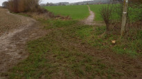
20.0% of the route is on roads (1)
15.0% of the route is lit at night (1)
25.0% of the route is paved (1)
70.0% of the route is muddy (1)
10.0% of the route is over rough ground (1)
10.0% of the route is through long grass (1)
Report a problem with this data
1 surveys
Information from verified surveys.
Geography information system (GIS) data
Total length
Maximum elevation
Minimum elevation
Start and end points
Kimpton
Grid Ref
TL1743818310
Lat / Lon
51.85105° / -0.29636°
Easting / Northing
517,438E / 218,310N
What3Words
dart.outer.prop
Stevenage
Grid Ref
TL2348324087
Lat / Lon
51.90166° / -0.20658°
Easting / Northing
523,483E / 224,087N
What3Words
faded.pushed.behind
Kimste One's land is
| Kimpton | |
|---|---|
| Grid Ref | TL1743818310 |
| Lat / Lon | 51.85105° / -0.29636° |
| Easting / Northing | 517,438E / 218,310N |
| What3Words | dart.outer.prop |
| Stevenage | |
|---|---|
| Grid Ref | TL2348324087 |
| Lat / Lon | 51.90166° / -0.20658° |
| Easting / Northing | 523,483E / 224,087N |
| What3Words | faded.pushed.behind |
| Arable | 58.8% |
| Pasture | 20.9% |
| Urban | 20.2% |
| Woods | 0.1% |
Data: Corine Land Cover (CLC) 2018
reviews
Heather S.
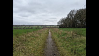
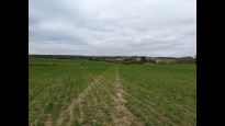
26 Mar 2023Walked from Stevenage to Kimpton. Starting out you quickly leave Stevenage, unfortunately the start of Dyes lane is mostly a tip. Mostly goes through farmland, mud is pretty slippy so hard work, with a few stretches of road walking in the middle.
The last stretch heading into Kimpton is a bit hard to navigate, as it's hard to tell what is the path and what is farm tracks.
Not my favourite slow way in the area, but good mostly nice enough.
Strider
17 Jan 2023I walked from Kimpton to Stevenage.
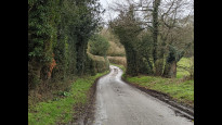
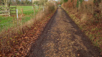
From 'The Boot' you pass through a residential area, I chose to walk on the tarmac paths rather than across the lawns as shown on the map, only 4m to the side. Then up onto large open fields. The path across the field is clear but does not quite match the route here, or as shown on the OS map, but it is not far off. There are good views across the Hertfordshire countryside as you cross big open fields, then down to the River Mimram in Whitwell (pub). Then up again through farmland to St Paul's Walden (pub). There is a permissive path onto the Estate, a notice said it would be closed on the last Wednesday of the month (see photo) which would be 26/1/23. Is it every month? From here you have to walk in the road for a while, but I only encountered a couple of cars (no through way on one part) and being quite open the visibility is good. Having been wet it made a nice change from all the mud! Then through some woods and fields again. As you approach the motorway the noise increases and so does dumped rubbish, mercifully a very short section. The path in Stevenage is alongside cycle paths through open lit underpasses so avoids the roads and road crossings. This takes you to a cinema and restaurant complex where the station is.
A lovely walk despite the mud rain hail and snow, it will be superb in summer. There is some verge and in-road walking but I felt safe at all times. Steep in places but rewarded with big skies and views.
Kissing gates, narrow paths, mud and verges make this unsuitable for wheels.
-
Share your thoughts
Share your views about this route, give it a star rating, indicate whether it should be verified or not.
Include information that will be useful to others considering to walk or wheel it.
You can add up to 15 photos.
There are no other routes for Kimpton — Stevenage
If you know a better way, then please let us know.
Review this better route and help establish a trusted network of walking routes.
Suggest a better route if it better meets our methodology.
Share your thoughts