Description
This is a Slow Ways route connecting Holt and Aylsham.
Know of a better route? Share it here.
This is a Slow Ways route connecting Holt and Aylsham.
Know of a better route? Share it here.
Status
This route has been reviewed by 3 people.
This route has been flagged (1 times) for reasons relating to access.
Photos for Holayl one

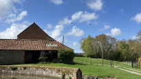
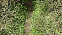
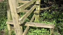


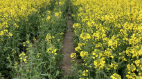

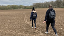

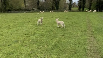


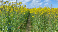
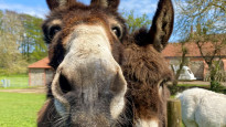
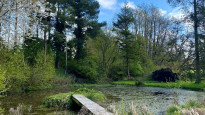
Photos of this route will appear when they are added to a review. You can review this route here.
Information

Route status - Live
Reviews - 3
Average rating -
Is this route good enough? - Yes (2) Maybe (1)
Problems reported - Access (1)
Downloads - 12
Surveys
We are working to build-up a picture of what routes look like. To do that we are asking volunteers to survey routes so that we can communicate features, obstacles and challenges that may make a route desirable or not.
Slow Ways surveyors are asked to complete some basic online training, but they are not vetted. If you are dependent on the survey information being correct in order to complete a route, we recommend that you think critically about the information provided. You may also wish to wait until more than one survey has been completed.
Help people know more about this route by volunteering to submit a survey.
- Complete the survey training.
- Submit a survey for this route.
Geography information system (GIS) data
Total length
Maximum elevation
Minimum elevation
Start and end points
Holt
Grid Ref
TG0794538748
Lat / Lon
52.90594° / 1.09072°
Easting / Northing
607,945E / 338,748N
What3Words
deferring.tasks.commander
Aylsham
Grid Ref
TG1931226911
Lat / Lon
52.79519° / 1.25151°
Easting / Northing
619,312E / 326,911N
What3Words
plug.cyber.addicted
Holayl One's land is
| Holt | |
|---|---|
| Grid Ref | TG0794538748 |
| Lat / Lon | 52.90594° / 1.09072° |
| Easting / Northing | 607,945E / 338,748N |
| What3Words | deferring.tasks.commander |
| Aylsham | |
|---|---|
| Grid Ref | TG1931226911 |
| Lat / Lon | 52.79519° / 1.25151° |
| Easting / Northing | 619,312E / 326,911N |
| What3Words | plug.cyber.addicted |
| Arable | 57.9% |
| Pasture | 15.5% |
| Urban | 14.4% |
| Woods | 12.1% |
Data: Corine Land Cover (CLC) 2018
Other Routes for Holt—Aylsham See all Slow Ways
Review this better route and help establish a trusted network of walking routes.
Suggest a better route if it better meets our methodology.