Hammersmith — Shepherds Bush
Hamshe one

Verified Slow Way
Verified by 100.00% of reviewers
Verified Slow Way
Verified by 100.00% of reviewers
By a Slow Ways Volunteer on 07 Apr 2021
Description
This is a Slow Ways route connecting Hammersmith and Shepherds Bush.
Know of a better route? Share it here.
This is a Slow Ways route connecting Hammersmith and Shepherds Bush.
Know of a better route? Share it here.
Status
This route has been reviewed by 3 people.
There are no issues flagged.
Photos for Hamshe one


Photos of this route will appear when they are added to a review. You can review this route here.
Information
Route status - Live
Reviews - 3
Average rating -
Is this route good enough? - Yes (3)
There are currently no problems reported with this route.
Downloads - 3
Surveys
What is this route like?
Surveys are submitted by fellow users of this website and show what you might expect from this Slow Ways route. Scroll down the page to read more detailed surveys.
| Grade 1X based on 2 surveys | Sign up or log in to survey this route. | ||
|---|---|---|---|
| Description | Note | ||
| Grade 1: Entirely smooth and compacted surfaces. Access grade X: At least one stile, flight of steps or other obstacle that is highly likely to block access for wheelchair and scooter users. |
Grading is based on average scores by surveyors. This slow way has 2 surveys. | ||
| Full grading description | |||
Only people who have completed our training can become Slow Ways surveyors and submit a survey. We do not vet contributors, so we cannot guarantee the quality or completeness of the surveys they complete. If you are dependent on the information being correct we recommend reading and comparing surveys before setting off.
Survey Photos
Facilities
Facilities in the middle third of this route.
Challenges
Potential challenges reported on this route. Some challenges are seasonal.
Obstacles
Obstacles on this route.
Accessibility
Is this route step and stile free?
Measurements
Surveyors were asked to measure the narrowest and steepest parts of paths.
The narrowest part of the path is 125.0cm (2)
The steepest uphill gradient walking East 18.0% (2)
The steepest uphill gradient West: no data
The steepest camber: no data
How clear is the waymarking on the route: Unclear in places (2)
Successfully completed
We asked route surveyors "Have you successfully completed this route with any of the following? If so, would you recommend it to someone with the same requirements?". Here is how they replied.
Recommended by an expert
We asked route surveyors "Are you a trained access professional, officer or expert? If so, is this route suitable for someone travelling with any of the following?" Here is how they replied.
Terrain
We asked route surveyors to estimate how much of the route goes through different kinds of terrain.
100.0% of the route is on roads (2)
100.0% of the route is lit at night (2)
100.0% of the route is paved (2)
There is no data on muddiness
1.0% of the route is over rough ground (2)
There is no data on long grass
Report a problem with this data
2 surveys
Information from verified surveys.
Geography information system (GIS) data
Total length
Maximum elevation
Minimum elevation
Start and end points
Hammersmith
Grid Ref
TQ2337678607
Lat / Lon
51.49296° / -0.22421°
Easting / Northing
523,376E / 178,607N
What3Words
dime.submit.trips
Shepherds Bush
Grid Ref
TQ2372179902
Lat / Lon
51.50452° / -0.21878°
Easting / Northing
523,721E / 179,902N
What3Words
closed.powers.puppy
Hamshe One's land is
| Hammersmith | |
|---|---|
| Grid Ref | TQ2337678607 |
| Lat / Lon | 51.49296° / -0.22421° |
| Easting / Northing | 523,376E / 178,607N |
| What3Words | dime.submit.trips |
| Shepherds Bush | |
|---|---|
| Grid Ref | TQ2372179902 |
| Lat / Lon | 51.50452° / -0.21878° |
| Easting / Northing | 523,721E / 179,902N |
| What3Words | closed.powers.puppy |
| Urban | 100.0% |
Data: Corine Land Cover (CLC) 2018
reviews
Martin McGovern
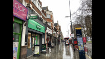
25 Sep 2023As others have noted, this is direct and wheel friendly. Nothing wrong with it, though Hamshe Two uses back-streets and is therefore likely to be quieter. But for those who like watching the shops change, from shabby to chic (or the reverse, depending on the direction), this is a good one.
Mtormey
04 Jan 2022I walked this route from Hammersmith to Shepherds Bush.
The route was, as other reviewers have noted, flat, direct, and on consistent smooth pavements. There were shops and interesting buildings, and the route is nice and short, delivering you to the Shepherds Bush area surprisingly quickly.
The downside is that the main road is quite noisy and less pleasant to walk along. I might look to try another route that sticks to quieter and less polluted streets!.
-
Share your thoughts
Custardtart
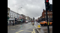
30 Sep 2021This route takes you north from Hammersmith Broadway, up Shepherd's Bush Road passing alongside Brook Green, before cutting diagonally across Shepherd's Bush Green and then joining Uxbridge Road to end Shepherd's Bush Underground/Overground stations.
The route is almost completely flat and is step free, with dropped kerbs at every road junction crossed. The majority is on the pavement of the fairly busy Shepherd's Bush Road. The path across Shepherd's Bush Green is smooth bonded gravel.
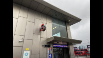
TfL bus route 295 follows pretty much the same route albeit on road and goes round Shepherd's Bush Green rather than across it. This walking route connects with five London Underground lines (Piccadilly, District, Circle, Hammersmith & City, Central), the Overground at Shepherd's Bush and numerous bus routes.
-
Share your thoughts
Share your views about this route, give it a star rating, indicate whether it should be verified or not.
Include information that will be useful to others considering to walk or wheel it.
You can add up to 15 photos.
Other Routes for Hammersmith—Shepherds Bush See all Slow Ways
Review this better route and help establish a trusted network of walking routes.
Suggest a better route if it better meets our methodology.
Share your thoughts