Gerrards Cross — Iver
Gerive one

Slow Way not verified yet. Verify Gerive here.
Slow Way not verified yet. Verify Gerive here.
By Hevver on 21 Apr 2021
Description
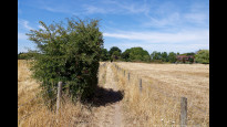
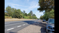
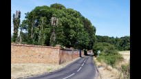
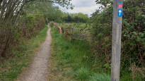
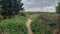
Goes through Bulstrode Park, Black Park and Langley Park. Crosses major dual carriageway with fast traffic but good visibility and the opportunity to pause in the middle. Could avoid this by a 500m diversion to a roundabout if preferred
Goes through Bulstrode Park, Black Park and Langley Park. Crosses major dual carriageway with fast traffic but good visibility and the opportunity to pause in the middle. Could avoid this by a 500m diversion to a roundabout if preferred
Status
This route has been reviewed by 2 people.
There are no issues flagged.
Photos for Gerive one


Photos of this route will appear when they are added to a review. You can review this route here.
Information
Route status - Live
Reviews - 2
Average rating -
Is this route good enough? - Yes (2)
There are currently no problems reported with this route.
Downloads - 6
Surveys
What is this route like?
Surveys are submitted by fellow users of this website and show what you might expect from this Slow Ways route. Scroll down the page to read more detailed surveys.
| Grade 3X based on 1 surveys | Sign up or log in to survey this route. | ||
|---|---|---|---|
| Description | Note | ||
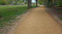
| Grade 3: Route includes rough surfaces that may include small boulders, potholes, shallow ruts, loose gravel, short muddy sections. Access grade X: At least one stile, flight of steps or other obstacle that is highly likely to block access for wheelchair and scooter users. |
Grading is based on average scores by surveyors. This slow way has 1 surveys. | ||
| Full grading description | |||
Only people who have completed our training can become Slow Ways surveyors and submit a survey. We do not vet contributors, so we cannot guarantee the quality or completeness of the surveys they complete. If you are dependent on the information being correct we recommend reading and comparing surveys before setting off.
Survey Photos
Facilities
Facilities in the middle third of this route.
Challenges
Potential challenges reported on this route. Some challenges are seasonal.
Obstacles
Obstacles on this route.
Accessibility
Is this route step and stile free?
Measurements
Surveyors were asked to measure the narrowest and steepest parts of paths.
The narrowest part of the path is 40.0cm (1)
The steepest uphill gradient walking East 10.0% (1)
The steepest uphill gradient walking West 10.0% (1)
The steepest camber gradient across the path 4.0% (1)
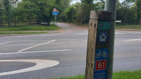
How clear is the waymarking on the route: Clear (1)
Successfully completed
We asked route surveyors "Have you successfully completed this route with any of the following? If so, would you recommend it to someone with the same requirements?". Here is how they replied.
Recommended by an expert
We asked route surveyors "Are you a trained access professional, officer or expert? If so, is this route suitable for someone travelling with any of the following?" Here is how they replied.
Terrain
We asked route surveyors to estimate how much of the route goes through different kinds of terrain.
15.0% of the route is on roads (1)
10.0% of the route is lit at night (1)
30.0% of the route is paved (1)
5.0% of the route is muddy (1)
15.0% of the route is over rough ground (1)
15.0% of the route is through long grass (1)
Report a problem with this data
1 surveys
Information from verified surveys.
Geography information system (GIS) data
Total length
Maximum elevation
Minimum elevation
Start and end points
Gerrards Cross
Grid Ref
TQ0032388686
Lat / Lon
51.58811° / -0.55328°
Easting / Northing
500,323E / 188,686N
What3Words
dine.bill.secret
Iver
Grid Ref
TQ0385081192
Lat / Lon
51.52011° / -0.50461°
Easting / Northing
503,850E / 181,192N
What3Words
drums.sage.noon
| Gerrards Cross | |
|---|---|
| Grid Ref | TQ0032388686 |
| Lat / Lon | 51.58811° / -0.55328° |
| Easting / Northing | 500,323E / 188,686N |
| What3Words | dine.bill.secret |
| Iver | |
|---|---|
| Grid Ref | TQ0385081192 |
| Lat / Lon | 51.52011° / -0.50461° |
| Easting / Northing | 503,850E / 181,192N |
| What3Words | drums.sage.noon |
Sorry Land Cover data is not currently available for this route. Please check back later.
reviews
Derick Rethans
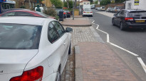
07 Aug 2022I walked this on a warm Saturday afternoon from Iver to Gerrards Cross.
It starts in busy Iver, where there are more cars on the pavement, then on the road. On the road, they go (too) fast. Luckily, this section is short and you end up going along (or among) some public foot paths soon enough. Bells Wood lane is fairly narrow, but had virtually no traffic.
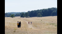
It continues through Langley Country park with lovely wide lanes. The route has some access issues, but as long as you know how to read a compass and a map, you should be able to find your way to the north eastern corner to cross the busy and fast A412. Cross with care!
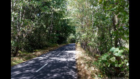
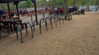
Black Park is lovely again, has a lake, toilets and a cafe.
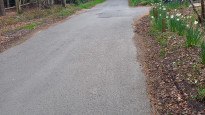
When you come out of the park there is a little road walking, with light traffic, although they can go a little fast. It's not a very long section, before you start following the Beeches Way for a while. A land owner has cut off the signs of the Beeches Way through a field, and although they have made a foot path zigzagging around it with fences on each way, I recommend you follow the actual public way that diagonally crosses it.
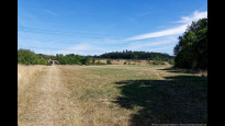
After you pass through Fulmer, there are fields and sheep. Once you cross Windsor Road, there are public foot paths which you follow in a big V, but you can also walk along the third leg of the triangle to shorten the route a little. A little road walking follows with a big wall on the other side, take a little caution here.
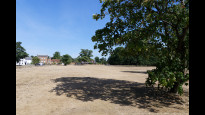
After this, the route crosses a nice wide field, with lots of other walkers. It goes up a fairly steep hill. After another road walking section up a hill, you end up on (the very dry) Gerrards Cross Common, and soon at your destination at the station.
It's a pretty good route, with some annoying road walking, and some tricky crossing points.
Strider
24 Apr 2022I walked from Iver to Gerrards Cross.
Iver is dominated by vehicles on the roads and on the pavements, but the section is short and there is an almost hidden path out of the town into the countryside. Beware these paths pop out onto lanes with fast traffic, some have crossing points.
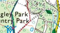
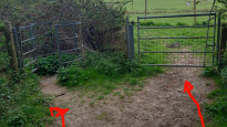
Langley Park is beautiful, but the path marked on the OS map is unwalkable, partly blocked by dead-hedge to preserve the woods, and partly non-existent. See map below for alternatives (red lines), the best (easy to navigate and away from road) shown by the red arrow. The park exit is in the NW corner where there is a busy dual carriage way to cross, patience needed for gaps.
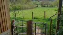
Then into Black Park along good paths to the lake where there is a café and toilets. Through the car park and head North past the tree houses along another good path through the woods. Cutting left through a new plantation to a road. You have to walk along the road, the first of many roads to walk on. Just past the junction is a gate to a rhododendron lined driveway, access
for expensive houses. Then out across and around grass fields to Fulmer. More countryside paths then the route goes along a footpath, but the bridleway slightly to the North is correct. Another walk in the road to fields and under the M25, another road then Bulstrode Park. Bear right across the grass into open parkland to a gate, up a road to the common and Gerrards Cross Highstreet.
This walk is mostly beautiful woods and countryside with lots to see and do, but is marred by some navigation issues and some uncomfortable road walking/crossing. Probably worth it though.
-
Share your thoughts
Share your views about this route, give it a star rating, indicate whether it should be verified or not.
Include information that will be useful to others considering to walk or wheel it.
You can add up to 15 photos.
There are no other routes for Gerrards Cross — Iver
If you know a better way, then please let us know.
Review this better route and help establish a trusted network of walking routes.
Suggest a better route if it better meets our methodology.
Share your thoughts