Description
This is a Slow Ways route connecting Cliviger and Todmorden.
Know of a better route? Share it here.
This is a Slow Ways route connecting Cliviger and Todmorden.
Know of a better route? Share it here.
Status
This route has been reviewed by 1 person.
This route has been flagged (1 times) for reasons relating to access.
Photos for Clivtod one


Photos of this route will appear when they are added to a review. You can review this route here.
Information

Route status - Live
Reviews - 1
Average rating -
Is this route good enough? - No (1)
Problems reported - Access (1)
Downloads - 2
Surveys
We are working to build-up a picture of what routes look like. To do that we are asking volunteers to survey routes so that we can communicate features, obstacles and challenges that may make a route desirable or not.
Slow Ways surveyors are asked to complete some basic online training, but they are not vetted. If you are dependent on the survey information being correct in order to complete a route, we recommend that you think critically about the information provided. You may also wish to wait until more than one survey has been completed.
Help people know more about this route by volunteering to submit a survey.
- Complete the survey training.
- Submit a survey for this route.
Geography information system (GIS) data
Total length
Maximum elevation
Minimum elevation
Start and end points
Cliviger
Grid Ref
SD8651629963
Lat / Lon
53.76585° / -2.20603°
Easting / Northing
386,516E / 429,963N
What3Words
crust.hits.fees
Todmorden
Grid Ref
SD9356224176
Lat / Lon
53.71398° / -2.09902°
Easting / Northing
393,562E / 424,176N
What3Words
garden.allowable.bloodshot
Clivtod One's land is
| Cliviger | |
|---|---|
| Grid Ref | SD8651629963 |
| Lat / Lon | 53.76585° / -2.20603° |
| Easting / Northing | 386,516E / 429,963N |
| What3Words | crust.hits.fees |
| Todmorden | |
|---|---|
| Grid Ref | SD9356224176 |
| Lat / Lon | 53.71398° / -2.09902° |
| Easting / Northing | 393,562E / 424,176N |
| What3Words | garden.allowable.bloodshot |
| Moors | 16.9% |
| Natural grass | 18.9% |
| Pasture | 48.8% |
| Urban | 8.6% |
| Woods | 6.8% |
Data: Corine Land Cover (CLC) 2018
review
Mary Oz
09 Jul 2023We walked about 60% of this route, starting from Todmorden, before giving up, partly due to the extreme heat that day, but also because we were encountering difficulties in the track by this stage.
We headed up the very steep but quiet road from Todmorden Station, with a couple of diversions through fields which were pleasant and didn’t add distance. The views behind us were excellent, including of the monument on Stoodley Pike. The entrance to the second field crossing (just below Todmorden Edge) was a ridiculously narrow stone gap stile with a metal pole in the middle of it. There followed a long section along Parkin Lane/Tower Causeway, which was quiet, with great views, but rather wearing on the feet!
Some hairpin bends took us down to the village of Portsmouth, where we stopped for a refreshing drink at a strange old pub. We left Portsmouth over a level crossing. I got excited because I was allowed to press the button to lower the traffic barriers after a local resident had driven through!
The walk through fields to the fishing pond was reasonably straightforward, but where the public right of way was due to leave the north-west corner of the pond, it was completely fenced off with no indication of where the footpath was. Unfortunately I forgot to take a picture here. We ended up backtracking and climbing over a gate into a field where we followed what looked like a fairly well-used bit of footpath nearer to the railway line, until we rejoined the plotted route soon after.
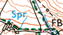
After this is was very difficult to see our route on the ground. It was all a bit vague. We found a human size gate, but it was jammed closed, so we climbed over it. We clambered uphill near to the wall (to avoid cows) from FB towards the base of Riddle Scout. It was at this point, with the prospect of more steep, rough climbing, in the extreme heat, that we called it a day.
I have plotted an alternative, using the other side of the A646 through the Cliviger Gorge, but I’m not going to upload it until I’ve tested it!.
Share your views about this route, give it a star rating, indicate whether it should be verified or not.
Include information that will be useful to others considering to walk or wheel it.
You can add up to 15 photos.
There are no other routes for Cliviger — Todmorden
If you know a better way, then please let us know.
Review this better route and help establish a trusted network of walking routes.
Suggest a better route if it better meets our methodology.
Share your thoughts