Description
This route was trialled on the ground on Tuesday 18th April, 2023 by Nic Howes as an alternative to the original route (now Broled One) because that route was plotted along several private paths and drives. Broled Two follows PROWs and public roads
This route was trialled on the ground on Tuesday 18th April, 2023 by Nic Howes as an alternative to the original route (now Broled One) because that route was plotted along several private paths and drives. Broled Two follows PROWs and public roads
Status
This route has been reviewed by 1 person.
There are no issues flagged.
Photos for Broled two

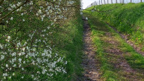


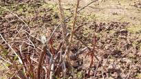
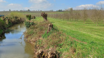


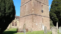
Photos of this route will appear when they are added to a review. You can review this route here.
Information

Route status - Live
Reviews - 1
Average rating -
Is this route good enough? - Yes (1)
There are currently no problems reported with this route.
Downloads - 2
Surveys
We are working to build-up a picture of what routes look like. To do that we are asking volunteers to survey routes so that we can communicate features, obstacles and challenges that may make a route desirable or not.
Slow Ways surveyors are asked to complete some basic online training, but they are not vetted. If you are dependent on the survey information being correct in order to complete a route, we recommend that you think critically about the information provided. You may also wish to wait until more than one survey has been completed.
Help people know more about this route by volunteering to submit a survey.
- Complete the survey training.
- Submit a survey for this route.
Geography information system (GIS) data
Total length
Maximum elevation
Minimum elevation
Start and end points
Bromyard
Grid Ref
SO6543354774
Lat / Lon
52.19013° / -2.50707°
Easting / Northing
365,433E / 254,774N
What3Words
targeted.operating.clutter
Ledbury
Grid Ref
SO7109737711
Lat / Lon
52.03705° / -2.42276°
Easting / Northing
371,097E / 237,711N
What3Words
cries.wool.eyelash
| Bromyard | |
|---|---|
| Grid Ref | SO6543354774 |
| Lat / Lon | 52.19013° / -2.50707° |
| Easting / Northing | 365,433E / 254,774N |
| What3Words | targeted.operating.clutter |
| Ledbury | |
|---|---|
| Grid Ref | SO7109737711 |
| Lat / Lon | 52.03705° / -2.42276° |
| Easting / Northing | 371,097E / 237,711N |
| What3Words | cries.wool.eyelash |
Sorry Land Cover data is not currently available for this route. Please check back later.
Other Routes for Bromyard—Ledbury See all Slow Ways
Review this better route and help establish a trusted network of walking routes.
Suggest a better route if it better meets our methodology.