Description
This is a Slow Ways route connecting Bratton and Devizes.
Know of a better route? Share it here.
This is a Slow Ways route connecting Bratton and Devizes.
Know of a better route? Share it here.
Status
This route has been reviewed by 1 person.
There are no issues flagged.
Photos for Bradev one


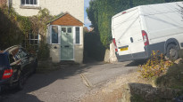
Photos of this route will appear when they are added to a review. You can review this route here.
Information

Route status - Live
Reviews - 1
Average rating -
Is this route good enough? - Yes (1)
There are currently no problems reported with this route.
Downloads - 6
Surveys
What is this route like?
Surveys are submitted by fellow users of this website and show what you might expect from this Slow Ways route. Scroll down the page to read more detailed surveys.
| Grade 4X based on 1 surveys | Sign up or log in to survey this route. | ||
|---|---|---|---|
| Description | Note | ||
| Grade 4: Route includes very rough surfaces including deep ruts, steep loose gravel, unmade paths and deep muddy sections. Wheelchairs may experience traction/wheel spin issues. Access grade X: At least one stile, flight of steps or other obstacle that is highly likely to block access for wheelchair and scooter users. |
Grading is based on average scores by surveyors. This slow way has 1 surveys. | ||
| Full grading description | |||
Only people who have completed our training can become Slow Ways surveyors and submit a survey. We do not vet contributors, so we cannot guarantee the quality or completeness of the surveys they complete. If you are dependent on the information being correct we recommend reading and comparing surveys before setting off.
Survey Photos

Facilities
Facilities in the middle third of this route.
Challenges
Potential challenges reported on this route. Some challenges are seasonal.
Obstacles
Obstacles on this route.
Accessibility
Is this route step and stile free?
Measurements
Surveyors were asked to measure the narrowest and steepest parts of paths.
The narrowest part of the path is 40.0cm (1)
The steepest uphill gradient walking East 48.0% (1)
The steepest uphill gradient walking West 36.0% (1)
The steepest camber gradient across the path 10.0% (1)
How clear is the waymarking on the route: Unclear in places (1)
Successfully completed
We asked route surveyors "Have you successfully completed this route with any of the following? If so, would you recommend it to someone with the same requirements?". Here is how they replied.
Recommended by an expert
We asked route surveyors "Are you a trained access professional, officer or expert? If so, is this route suitable for someone travelling with any of the following?" Here is how they replied.
Terrain
We asked route surveyors to estimate how much of the route goes through different kinds of terrain.
23.0% of the route is on roads (1)
20.0% of the route is lit at night (1)
44.0% of the route is paved (1)
5.0% of the route is muddy (1)
5.0% of the route is over rough ground (1)
2.0% of the route is through long grass (1)
Report a problem with this data
1 surveys
Information from verified surveys.
Geography information system (GIS) data
Total length
Maximum elevation
Minimum elevation
Start and end points
Bratton
Grid Ref
ST9145952374
Lat / Lon
51.27045° / -2.12381°
Easting / Northing
391,459E / 152,374N
What3Words
atlas.plant.chitchat
Devizes
Grid Ref
SU0040261483
Lat / Lon
51.35242° / -1.99561°
Easting / Northing
400,402E / 161,483N
What3Words
barbarian.stop.likely
Bradev One's land is
| Bratton | |
|---|---|
| Grid Ref | ST9145952374 |
| Lat / Lon | 51.27045° / -2.12381° |
| Easting / Northing | 391,459E / 152,374N |
| What3Words | atlas.plant.chitchat |
| Devizes | |
|---|---|
| Grid Ref | SU0040261483 |
| Lat / Lon | 51.35242° / -1.99561° |
| Easting / Northing | 400,402E / 161,483N |
| What3Words | barbarian.stop.likely |
| Arable | 30.4% |
| Pasture | 38.1% |
| Urban | 31.5% |
Data: Corine Land Cover (CLC) 2018
review
Brian
18 Oct 2022Undertook this route yesterday, and the first section was fine, generally being green lanes and quiet roads, thereafter the route took paths across fields towards Marston ( rather than green lanes ) which involved cows and stiles. Again from Worton the route goes to Potterne across fields again with cows and multiple stiles. In total there were 20+ stiles. I acknowledge that the route I created included more quiet roads, and green lanes ( zero stiles ), but it is less stressful to undertake.
Some of the stiles are broken, and many overgrown. Perhaps a mix of the two, using the route to Marston on Bradev one, then transferring to Bradev two from Worton. I will consider creating a third route incorporating the two.
The upside of this route is that there is a pub in Potterne
I recorded this route as 10.80 mi.
Share your views about this route, give it a star rating, indicate whether it should be verified or not.
Include information that will be useful to others considering to walk or wheel it.
You can add up to 15 photos.
Other Routes for Bratton—Devizes See all Slow Ways
Review this better route and help establish a trusted network of walking routes.
Suggest a better route if it better meets our methodology.
Share your thoughts