Bovey Tracey — Kingsteignton
Bovkin one

Verified Slow Way
Verified by 100.00% of reviewers
Verified Slow Way
Verified by 100.00% of reviewers
By a Slow Ways Volunteer on 07 Apr 2021
Description
This is a Slow Ways route connecting Bovey Tracey and Kingsteignton.
Know of a better route? Share it here.
This is a Slow Ways route connecting Bovey Tracey and Kingsteignton.
Know of a better route? Share it here.
Status
This route has been reviewed by 3 people.
There are no issues flagged.
Photos for Bovkin one


Photos of this route will appear when they are added to a review. You can review this route here.
Information
Route status - Live
Reviews - 3
Average rating -
Is this route good enough? - Yes (3)
There are currently no problems reported with this route.
Downloads - 7
Surveys
We are working to build-up a picture of what routes look like. To do that we are asking volunteers to survey routes so that we can communicate features, obstacles and challenges that may make a route desirable or not.
Slow Ways surveyors are asked to complete some basic online training, but they are not vetted. If you are dependent on the survey information being correct in order to complete a route, we recommend that you think critically about the information provided. You may also wish to wait until more than one survey has been completed.
Help people know more about this route by volunteering to submit a survey.
- Complete the survey training.
- Submit a survey for this route.
Geography information system (GIS) data
Total length
Maximum elevation
Minimum elevation
Start and end points
Bovey Tracey
Grid Ref
SX8154878455
Lat / Lon
50.59376° / -3.67488°
Easting / Northing
281,548E / 78,455N
What3Words
regard.hunk.reckoned
Kingsteignton
Grid Ref
SX8696572982
Lat / Lon
50.54563° / -3.59672°
Easting / Northing
286,965E / 72,982N
What3Words
refilled.trousers.emails
Bovkin One's land is
| Bovey Tracey | |
|---|---|
| Grid Ref | SX8154878455 |
| Lat / Lon | 50.59376° / -3.67488° |
| Easting / Northing | 281,548E / 78,455N |
| What3Words | regard.hunk.reckoned |
| Kingsteignton | |
|---|---|
| Grid Ref | SX8696572982 |
| Lat / Lon | 50.54563° / -3.59672° |
| Easting / Northing | 286,965E / 72,982N |
| What3Words | refilled.trousers.emails |
| Arable | 26.2% |
| Moors | 11.7% |
| Other | 5.6% |
| Pasture | 14.6% |
| Urban | 33.8% |
| Woods | 8.2% |
Data: Corine Land Cover (CLC) 2018
reviews
Claire
11 Aug 2023This route is mainly flat, mostly tarmac and a nice walk. Easy to navigate as it follows the Templer Way with no stiles.
Starting from Bovey the route heads out of town following pavements and leads you to a tarmac path through woodland. The path crosses a quiet junction and later over the top of the A38, via a sloped bridge with a slight incline. After two quiet lanes you reach Teigngrace Cross where you join a busier but a still relatively quiet road and you only walk on it for a short stretch.
At Ventiford Basin you can either take the tarmac path or the uneven woodland path, both suitable routes depending on your interest/ need. Option to stop at Locks Bridge Tea Garden.
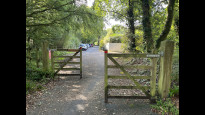
Reaching Exeter Road the route crosses into a more densely green environment (in summer) with an uneven path, there is gravel in places and a couple of tree roots poking into the path. It is narrower than the path you've just walked but still enough room. A couple of small bridges to cross but suitable. This type of path continues through Jetty Marsh until you reach a small gate. Then a pavement walk all the way back to Kingsteignton.
Depending on the wheel user, going down Exeter Road to Broadway Road could be an alternative route to avoid the uneven path as it is all tarmac, however on a road.
In wet weather there would be a couple of muddy and flooded areas but still a doable route. A couple of benches here and there, some history about the Stover Canal and sometimes cows in the field (next to route). Very enjoyable!.
Helen C
10 Mar 2023This is a good, relatively easy level route from Bovey Tracey to Kingsteignton, largely following off-road trails. Both towns have good public transport links. It’s a nice way to get up to Dartmoor.
It’s pretty accessible, being mostly level with no steps or stiles. It follows the Stover Trail out of Bovey Tracey, an off-road (small section quiet road) multi-use route which crosses the A38 by an impressive ramped bridge.
From Teigngrace the trail follows the disused Stover Canal. There are options to follow pedestrian only sections along the canal bank (the Templer Way) or stay on the sealed multi-use path.
After crossing the old Exeter road the route diverges from the multi use route & follows the Templer Way beside the canal. The surface is rougher but still level & it’s very peaceful. It continues through a nature reserve to the main road then follows pavement into Kingsteignton.
There is a seasonal café at Teigngrace and also a café if you turn right & over the humpback bridge on reaching the Exeter Road.
-
Share your thoughts
Dstansby
29 Jul 2021Very nice route, mostly off road. After going out of Bovey Tracey follows an excellent and recently created tarmac path through to Teigngrace. After that the path is a bit rougher, but still a relatively good surface, and the walk finishes along the pavement in to Kingsteignton.
-
Share your thoughts
Share your views about this route, give it a star rating, indicate whether it should be verified or not.
Include information that will be useful to others considering to walk or wheel it.
You can add up to 15 photos.
There are no other routes for Bovey Tracey — Kingsteignton
If you know a better way, then please let us know.
Review this better route and help establish a trusted network of walking routes.
Suggest a better route if it better meets our methodology.
Share your thoughts