Ashby Folville — Melton Mowbray
Ashbmel two

Slow Way not verified yet. Verify Ashbmel here.
Slow Way not verified yet. Verify Ashbmel here.
By Hugh Hudson on 09 Apr 2023
Description
Having attempted to walk ASHBMEL1 yesterday, I found a few problems. The most important is that a large new housing development is blocking the footpath that goes south from Redbrook Crescent in south Melton, and since the final layout is not yet available I have chosen a route that works now and avoids the site completely. I have also amended the route to shorten the route through the park in Melton and to use the new diverted bridleway route around Old Guadaloupe Farm
Having attempted to walk ASHBMEL1 yesterday, I found a few problems. The most important is that a large new housing development is blocking the footpath that goes south from Redbrook Crescent in south Melton, and since the final layout is not yet available I have chosen a route that works now and avoids the site completely. I have also amended the route to shorten the route through the park in Melton and to use the new diverted bridleway route around Old Guadaloupe Farm
Status
This route has been reviewed by 1 person.
There are no issues flagged.
Photos for Ashbmel two


Photos of this route will appear when they are added to a review. You can review this route here.
Information
Route status - Live
Reviews - 1
Average rating -
Is this route good enough? - Yes (1)
There are currently no problems reported with this route.
Downloads - 0
Surveys
What is this route like?
Surveys are submitted by fellow users of this website and show what you might expect from this Slow Ways route. Scroll down the page to read more detailed surveys.
| Grade 3X based on 1 surveys | Sign up or log in to survey this route. | ||
|---|---|---|---|
| Description | Note | ||
| Grade 3: Route includes rough surfaces that may include small boulders, potholes, shallow ruts, loose gravel, short muddy sections. Access grade X: At least one stile, flight of steps or other obstacle that is highly likely to block access for wheelchair and scooter users. |
Grading is based on average scores by surveyors. This slow way has 1 surveys. | ||
| Full grading description | |||
Only people who have completed our training can become Slow Ways surveyors and submit a survey. We do not vet contributors, so we cannot guarantee the quality or completeness of the surveys they complete. If you are dependent on the information being correct we recommend reading and comparing surveys before setting off.
Survey Photos
Facilities
Facilities in the middle third of this route.
Challenges
Potential challenges reported on this route. Some challenges are seasonal.
Obstacles
Obstacles on this route.
Accessibility
Is this route step and stile free?
Measurements
Surveyors were asked to measure the narrowest and steepest parts of paths.
The narrowest part of the path is 50.0cm (1)
The steepest uphill gradient East: no data
The steepest uphill gradient West: no data
The steepest camber: no data
How clear is the waymarking on the route: Unclear in places (1)
Successfully completed
We asked route surveyors "Have you successfully completed this route with any of the following? If so, would you recommend it to someone with the same requirements?". Here is how they replied.
Recommended by an expert
We asked route surveyors "Are you a trained access professional, officer or expert? If so, is this route suitable for someone travelling with any of the following?" Here is how they replied.
Terrain
We asked route surveyors to estimate how much of the route goes through different kinds of terrain.
20.0% of the route is on roads (1)
15.0% of the route is lit at night (1)
30.0% of the route is paved (1)
10.0% of the route is muddy (1)
There is no data on rough ground
10.0% of the route is through long grass (1)
Report a problem with this data
1 surveys
Information from verified surveys.
Geography information system (GIS) data
Total length
Maximum elevation
Minimum elevation
Start and end points
Ashby Folville
Grid Ref
SK7063812123
Lat / Lon
52.70220° / -0.95606°
Easting / Northing
470,638E / 312,123N
What3Words
slouched.super.camps
Melton Mowbray
Grid Ref
SK7527519116
Lat / Lon
52.76443° / -0.88585°
Easting / Northing
475,275E / 319,116N
What3Words
liner.pulse.libraries
| Ashby Folville | |
|---|---|
| Grid Ref | SK7063812123 |
| Lat / Lon | 52.70220° / -0.95606° |
| Easting / Northing | 470,638E / 312,123N |
| What3Words | slouched.super.camps |
| Melton Mowbray | |
|---|---|
| Grid Ref | SK7527519116 |
| Lat / Lon | 52.76443° / -0.88585° |
| Easting / Northing | 475,275E / 319,116N |
| What3Words | liner.pulse.libraries |
Sorry Land Cover data is not currently available for this route. Please check back later.
review
Hugh Hudson
09 Apr 2023This route is mostly the route I walked while trying to follow ASHBMEL 1 from Melton Mowbray to Ashby Folville, but I have tidied and straightened it a little. It is a good direct route, though some of the footpaths are little used and there was one stile that was a little awkward due to an overgrown hedge. There are no facilities between the edge of Melton and Ashby, but Melton has plenty of pubs and shops and Ashby has a pub.
From the Market Place in Melton, we head down Park Lane and follow the paved path around the park and over the footbridge to the junction of Leicester Road and Dalby Road. We then follow Leicester Road over the railway then turn left onto Edendale Road, right onto Heather Crescent at the roundabout and right onto Cowslip Drive, then follow the path out through the park to Kirby Lane. We turn left then right along the lane that leads to Old Guadaloupe Farm, where we follow the signposted diversion around the farm (which is now the right of way on the latest OS map). We stay on the bridleway as it passes the Eye Kettleby cabins and their lakes, and heads out along the edge of a wood. We then cross a large field diagonally to join a farm lane that takes us onto Kirby Lane.
The path beyond is not signposted but is obvious as far as the bridge under the old railway. Beyond it follows the edge of a large open pasture (diagonal shortcuts are possible) to join another old lane that takes us to Ashby Folville Road. The path forward is slightly to the left, and starts through the awkward stile I mentioned earlier. There is little evidence of a trodden path, but fortunately Leicestershire's footpath posts are visible from a distance - just head for the far left corner of the field. We cross another path then turn right to reach a lane, where we go right a short distance then take the field path sharp left that takes us out to Pasture Lane.
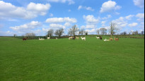
Here we go left a few yards and take the lane right towards Grange Farm, leaving it to cross the field towards the right of the buildings. We cross a little wood and another couple of fields then turn right to skirt Ashby Grange on the right (where I saw an impressively varied herd of alpacas). More field paths take us to the edge of Ashby Folville, where we turn right onto the Leicestershire Round, then left down Highfield End to reach the Ashby Folville meeting point opposite the Carington Arms (sic) pub.
Share your views about this route, give it a star rating, indicate whether it should be verified or not.
Include information that will be useful to others considering to walk or wheel it.
You can add up to 15 photos.
Other Routes for Ashby Folville—Melton Mowbray See all Slow Ways
Review this better route and help establish a trusted network of walking routes.
Suggest a better route if it better meets our methodology.
Share your thoughts