
1. Wood Green Station to Dalston. (Woodal One) This is the start outside Wood Green underground station. 0 km from start — 13 May 2021

2. Head south along the high street. Could be busy 0 km from start — 13 May 2021

3. Turn right onto residential streets. 0.2 km from start — 13 May 2021

4. Residential Street Path Quality 0.25 km from start — 13 May 2021

5. Turn left onto Alleyway 0.5 km from start — 13 May 2021

6. Turn right onto residential street. 0.6 km from start — 13 May 2021

7. Some part of the residential street sidewalk is blocked by bushes. However walking on the other side of the road should be fine. 0.7 km from start — 13 May 2021

8. Tree could be potential obstacle. Probably the narrowest part of the path. Walking on the other side of the road should be ok 0.7 km from start — 13 May 2021

9. The route shows going straight into this alleyway. However the road is busy. There is a light crossing 50m to the right. 0.9 km from start — 13 May 2021

10. Location of where to cross the road (where the red traffic light is). 0.9 km from start — 13 May 2021

11. After crossing the road, there are shops so there might be loading and unloading and stuff on the street. 0.9 km from start — 13 May 2021

12. Alleyway. It feels uncomfortable going in at first, but it is fairly well used and also lit. 0.9 km from start — 13 May 2021

13. There are step free crossing between the alleyway. At least 10 will be crossed. This is a residential area. 1 km from start — 13 May 2021

14. Each alleyway has these pole but baby car should fit through it. 1 km from start — 13 May 2021

15. 2.2 km from start — 13 May 2021

16. After walking through multiple alleyway, turn left onto a residential road leading to a main road. 2.3 km from start — 13 May 2021

17. When you reach the main road, it is the overground station. A McDonald and a retail park is nearby. Sainsbury supermarket is also nearby. 2.4 km from start — 13 May 2021

18. Follow the main road for the next 2km. 2.6 km from start — 13 May 2021

19. Manor House underground station, on the main road. 3.2 km from start — 13 May 2021

20. Gate entry onto Cissold Park. The park will be closed after dark. Alternative route available following the roads when it is closed. 4.2 km from start — 13 May 2021

21. Temporary roadworks near Manour House underground station. Can be avoided be walking on the other side of the road. 3.4 km from start — 13 May 2021
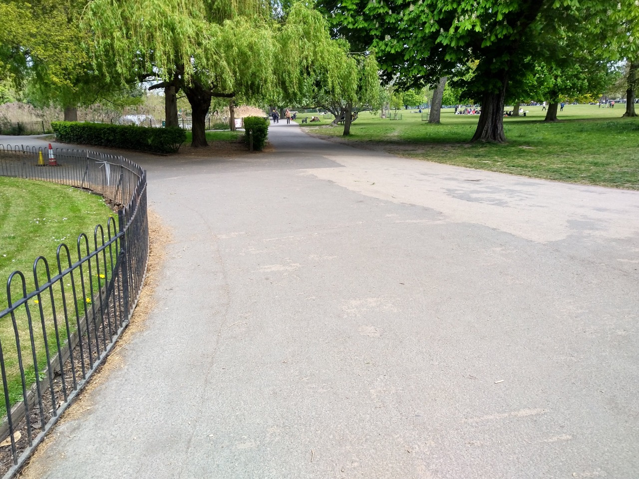
22. Follow the path that takes you to the right of a lake with a fountain. 4.2 km from start — 13 May 2021

23. When the lake ends, turn right. The official route is through some grass, but the detour following the path is less than 20 metres. 4.4 km from start — 13 May 2021

24. Route to take if you want to cut through the grass. 4.4 km from start — 13 May 2021

25. Park exit. If the park is closed, you will walk around the park and rejoin here. 4.8 km from start — 13 May 2021

26. Walk through a small high street (Stoke Newington). Could be busy and narrow in some part but baby trolleys and wheelchair can stay on the path with no issues. 5.1 km from start — 13 May 2021

27. Turn right onto this short alleyway leading to a residential street. 5.27 km from start — 13 May 2021

28. Residential Road 5.4 km from start — 13 May 2021

29. There is a short section of cobblestone. Can be avoided by walking on the other side of the residential street. 5.8 km from start — 13 May 2021

30. The route merges onto another residential street. Part of Cycle Superhighway 1 which you can follow the signs all the way to Dalston. This picture shows wheelie bins potentially narrowing and blocking the path. 5.8 km from start — 13 May 2021

31. Turn left at the junction. 6.5 km from start — 13 May 2021

32. As you get closed to Dalston, it might get bussier. 6.5 km from start — 13 May 2021

33. You will see a bridge as Cycle superhighway 1 turn right. This is the steepest part of the walk. 6.7 km from start — 13 May 2021

34. Dalston High Street. Could be busy. 7 km from start — 13 May 2021

35. Endpoint, Dalston Junction overground station. Next to a crossroad with traffic lights. 7.1 km from start — 13 May 2021